- Doab
-
A Doab (Hindi: दो आब, Urdu: دو آب dō, "two" + āb, "water" or "river") is a term used in India and Pakistan for a "tongue" or tract of land lying between two confluent rivers.[1] - see Ap (water)
Contents
Uttar Pradesh
 A map of the Doab, shows the sub-regions, "Upper Doab," "Central or Middle Doab," and "Lower Doab."
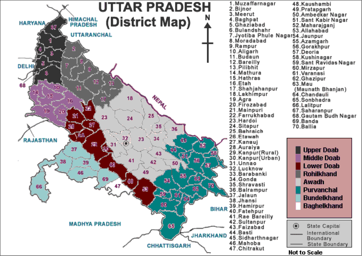
 Regions of Uttar Pradesh
The Doab, unqualified by the names of any rivers, designates the flat alluvial tract between the Ganges and Yamuna rivers in western and southwestern Uttar Pradesh and Uttarakhand state in India, extending from the Shiwalik range to the two rivers' confluence at Allahabad. The region has an area of about 23,360 square miles (60,500 square km); it is approximately 500 miles (805 km) in length and 60 miles (97 km) in width.
Doab figures prominently in history and myths of Vedic period; the epic Mahabharata, for example, is set in the Doab, around the city of Hastinapur.
The following districts/states form part of the Doab:
- Upper Doab
Dehradun, Rishikesh, Muzaffarnagar, Saharanpur, Meerut, Ghaziabad, Gautam Buddha Nagar, Baghpat and Bulandshahar[2]
- Central or Middle Doab
Etah, Aligarh, Agra, Hathras , Firozabad, Mathura and Agra (Mathura are in trans-Yamuna region of Braj).[2]
- Lower Doab
Farrukhabad, Mainpuri, Etawah, Kannauj, Auraiya, Kanpur Urban, Kanpur Rural, Fatehpur, Kaushambi and Allahabad.[2]
The Punjab Doabs
 A map of the Punjab region ca. 1947 showing the different doabs.
Each of the tracts of land lying between the confluent rivers of the Punjab region of Pakistan and India (the Indus basin) has a distinct name, said to have been coined by Raja Todar Mal, a minister of the Mughal emperor Akbar. The names (except for 'Sindh Sagar') are a combination of the first letters, in the Persian alphabet, of the names of the rivers that bound the Doab. For example, Jech = 'Je'(Jhelum) + 'Ch'(Chenab). The names are (from west to east):
- Sind Sagar Doab - lies between the Indus and Jhelum River rivers.
- Jech Doab (also Chaj) Doab - between the Jhelum and the Chenab River.
- Rechna Doab - between the Chenab and the Ravi River.
- Bari Doab or Majha - between the Ravi and the Beas River.
- Bist Doab (also Jullundur Doab or Doaba) - between the Beas and the Sutlej River.
In addition, the tract of land lying between the Sutlej and the Yamuna river is sometimes called the Delhi doab, although, strictly speaking, it is not a doab, since its two bounding rivers, the Yamuna and Sutlej, are not confluent. Recently it is the proposed name of the former Eastern Punjab for Land of two Rivers not five, because they are now situated in Pakistan.
Raichur
The Raichur Doab is the triangular region of Andhra Pradesh and Karnataka states which lies between the Krishna River and its tributary the Tungabhadra River, named for the town of Raichur.
References
- ^ Oxford English Dictionary. 2nd Edition. 1989.
- ^ a b c http://www.websters-online-dictionary.org/definitions/Doab?cx=partner-pub-0939450753529744%3Av0qd01-tdlq&cof=FORID%3A9&ie=UTF-8&q=Doab&sa=Search#922
Hydrology of Uttar Pradesh Rivers Main riversNorth flowingSouth flowingLakes Dams/ Barrages Canals Ganges Canal • Agra CanalBridges Malviya Bridge • Shahi Bridge, JaunpurRelated topics Hydrology of
surrounding areasUttarakhand • Nepal • Bihar • Jharkhand • Madhya PradeshMountains and Plateaus Himalayas · Western Ghats · Eastern Ghats · Aravalli Range · The Nilgiris · Vindhya Range · Satpura Range · Garo Hills · Shivalik Hills · Mahabharat Range · Khasi Hills · Annamalai Hills · Cardamom Hills · Sulaiman Mountains · Toba Kakar Range · Karakoram · Hindu Kush · Chittagong Hill Tracts · Deccan Plateau · Thar Desert · Makran · Chota Nagpur · Naga Hills · Mysore Plateau · Ladakh Plateau · Gandhamardan HillsLowlands and Islands Indo-Gangetic plain · Indus River Delta · Ganges Basin · Ganges Delta · Terai · Atolls of Maldives · Coromandel Coast · Konkan · Lakshadweep · Andaman and Nicobar Islands · Sundarbans · Greater Rann of Kutch · Little Rann of Kutch · Protected areas in Tamil NaduCountries Categories:- Geography of Uttar Pradesh
- Punjab
- Regions of India
- India geography stubs
- Pakistan geography stubs


Wikimedia Foundation. 2010.