- Colyford
-
Coordinates: 50°43′37″N 3°03′52″W / 50.72695°N 3.06443°W
Colyford 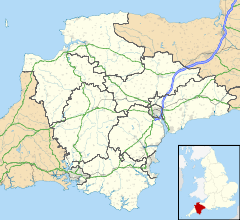
 Colyford
Colyford shown within DevonOS grid reference SY249924 Shire county Devon Region South West Country England Sovereign state United Kingdom Post town COLYTON Postcode district EX24 Police Devon and Cornwall Fire Devon and Somerset Ambulance South Western EU Parliament South West England UK Parliament East Devon List of places: UK • England • Devon Colyford is a village in East Devon, England. It is adjacent to the town of Colyton to the north and lies within its civil parish boundaries.
Features
Colyford is a village on the A3052 Lyme Regis to Exeter road, situated mid-way between Lyme Regis and Sidmouth. Seaton is 2 km. away on the coast and Colyton 1 km. further inland. Colyford was formerly an Ancient Borough of long-standing and still elects a Mayor.
There is a strong sense of community within the village[citation needed] and the social scene is centred on the Memorial Hall. Much village effort is put into the annual Michaelmas Goose Fayre, held on Springfields on the south side of the village. Villagers and friends dress in medieval costume, with mummers and medieval music, as they follow the Mayor and his Lady, in a horse-drawn cart, as they process along the main road to the fayre ground.
Colyford has a chapel-of-ease, dedicated to St. Michael and All Angels, also a village Post Office, a Butcher, and two Pubs, the Wheelwright and the White Hart. In recent years the village has lost the service of its village Filling Station which is now a museum of motoring memorabilia.
Another of the attractions of the village is the Seaton Tramway that runs along the discontinued railway branch line from Seaton to Colyton from Spring to Autumn.
Colyton Grammar School dates from 1545[citation needed] and made headlines in recent years as the first school to 'opt out' of local authority control and gain grant-maintained status and for achieving very high rankings in national examination league tables. It is located on a narrow lane and is not visible from the main road.
External links
- colyfordvillage.co.uk - City Colyford's website
Towns, villages and hamlets in the East Devon District of Devon, England 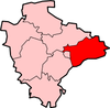 Alfington · Axminster · Beacon · Beer · Bowd · Branscombe · Broadhembury · Buckerell · Budleigh Salterton · Church Green · Colyford · Colyton · Combpyne · Exmouth · Farway · Feniton · Honiton · Kilmington · Marsh Green · Membury · Musbury · Northleigh · Offwell · Ottery St Mary · Pinhay · Rousdon · Salcombe Regis · Seaton · Shute · Sidford · Sidmouth · Smallridge · Southleigh · Stockland · Street · Uplyme · Ware · West Hill · Weston · WhitfordCategories:
- Villages in Devon
- Devon geography stubs


Wikimedia Foundation. 2010.