- Navi Mumbai
-
"New Bombay" redirects here. For other uses, see Bombay (disambiguation).
Navi Mumbai
नवी मुंबईCity of the 21st Century — city — View of the Palm Beach Road and surrounding area of Nerul and Belapur from Parsik Hill
Coordinates 19°02′N 73°01′E / 19.03°N 73.01°ECoordinates: 19°02′N 73°01′E / 19.03°N 73.01°E Country India State Maharashtra District(s) Thane district, Raigad District Municipal commissioner Vijay Nahata Mayor Sagar Naik Population
• Density
2,600,000 est. (2008[update])
• 4,332 /km2 (11,220 /sq mi)
Time zone IST (UTC+05:30) Area
343.7 km2 (133 sq mi)
• 10 metres (33 ft)
Website www.nmmconline.com Seal of the Navi Mumbai Municipal Corporation
Navi Mumbai (Marathi: नवी मुंबई, IAST: Navi Muṃbaī) is a Planned Satellite City on the west coast of the Indian state of Maharashtra. It was developed in 1972 as a twin city of Mumbai, and is the largest planned city on the planet, with 163 square kilometres (63 sq mi) under the jurisdiction of the Navi Mumbai Municipal Corporation (NMMC) and a total area of 344 square kilometres (133 sq mi).[1] Navi Mumbai lies on the mainland on the eastern shore of Thane Creek. The city limits stretch from Airoli near Thane in the north, to Uran in the south. The length of the city is almost the same as that of Mumbai. The Vashi and the Airoli Bridges connect Navi Mumbai to Mumbai. A new link between Nerul and Uran is under construction. The costliest real estate and most highly developed areas of Navi Mumbai are Vashi and Nerul, while Kharghar and Panvel are experiencing major infrastructural developments due to their proximity to the proposed Navi Mumbai International Airport. Vashi is known as the king of Navi Mumbai while Nerul is called the queen of Navi Mumbai. Navi Mumbai has a population of 2,600,000 of which approximately 800,000 live in Nerul and about 700,000 in Vashi, with the remainder residing in Belapur, Kharghar, Sanpada, Airoli, Ghansoli, Kopar Khairane and surrounding areas.
Navi Mumbai Municipal Corporation, the public body that manages the city's affairs, is rated amongst the richest corporations in Asia.
Contents
History
Navi Mumbai is the world's largest planned city.[2][3] It was initially planned with a specific purpose: to decongest Mumbai and become an alternative haven for the multitudes that throng to Mumbai from all over India.
Planned city
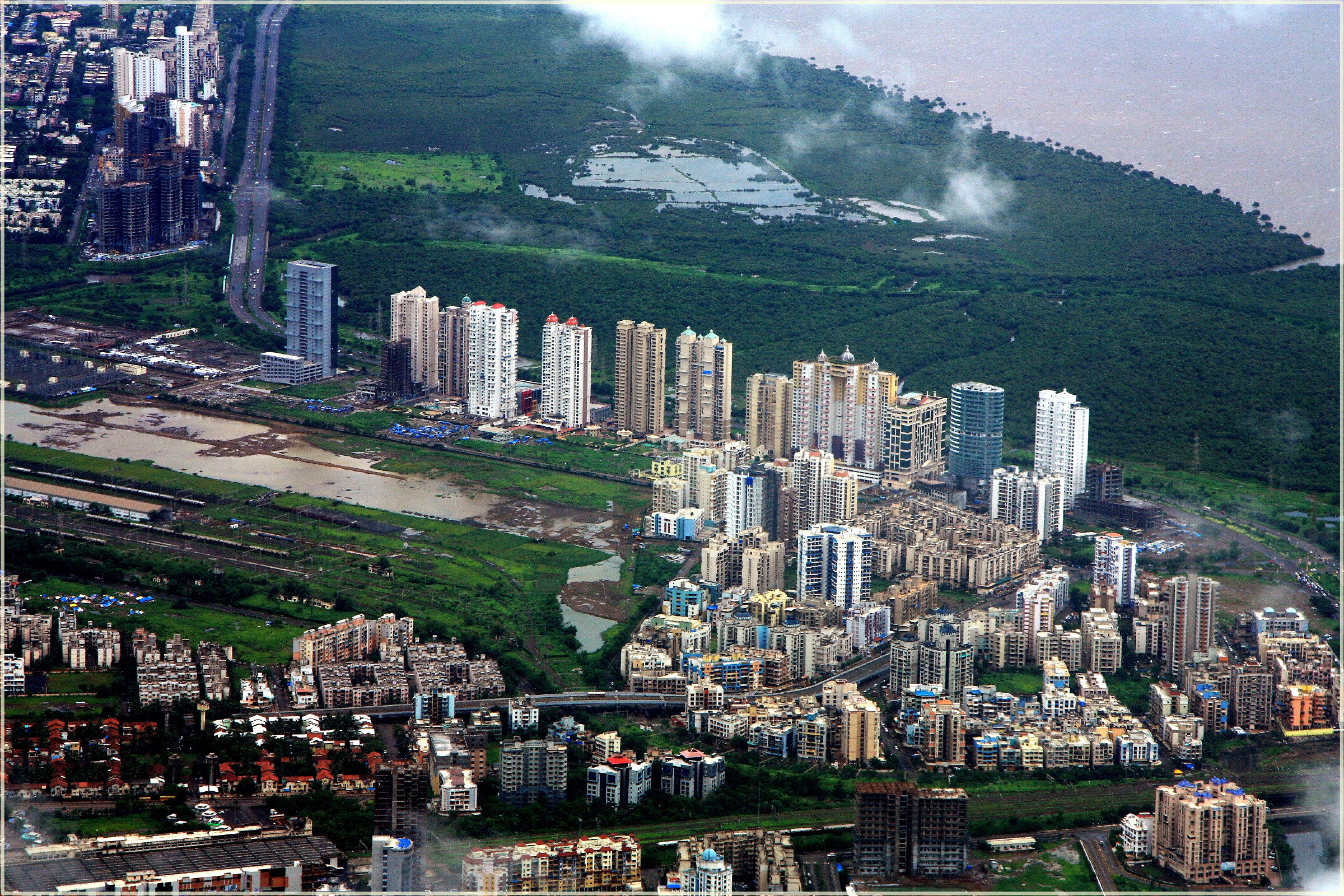
 Navi Mumbai Skyline
The first post-independence development plan for Mumbai, formulated by the Mayer-Modak Committee in 1948, suggested the development of satellite towns. In March 1958, the Study Group on Greater Mumbai was set up under the chairmanship of Mr. S.G. Barve. In February 1959, the committee suggested the formation of a township on the mainland across Thane Creek to relieve congestion in Mumbai. The study group recommended that a railroad bridge be built across Thane Creek to connect peninsular Mumbai with the mainland. The bridge accelerated development across the Creek, relieved pressure on the city's railways and roadways, and attracted industrial and residential concentrations eastward to the mainland.
South Navi Mumbai is being developed rapidly with its class infrastructure and modern nodes of Kharghar, Kamothe, New Panvel and Kalamboli.
The Barve Group's recommendations were accepted by the Government of Maharashtra in July 1964. In March 1965, a new committee chaired by Prof. D.R. Gadgil, then Director of the Gokhale Institute of Politics and Economics, was asked to form broad principles of regional planning. The Gadgil Committee strongly recommended a new town be constructed across the harbour.[4]
In March 1966, the Gadgil Committee recommended regional planning legislation and regional planning boards. In January 1967, the Maharashtra Regional and Town Planning Act 1966 was passed. July 1967 saw the constitution of Mumbai Metropolitan and Regional Planning Board under the chairmanship of ICS officer L.G. Rajwade. The committee published the Draft Plan with recommendations to set up a new metro centre of Navi Mumbai across the creek. This proposal was accepted by the Brihanmumbai Municipal Corporation as a new twin city designed within the Mumbai Metropolitan region to facilitate the decongestion of Mumbai.
CIDCO development
 Palm Beach Marg between Vashi and Belapur, Navi Mumbai. A major portion of the road passes through Nerul.
 Utsav Chowk at Kharghar
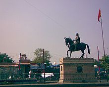 Shivaji Chowk
The City and Industrial Development Corporation (CIDCO) was formed on 17 March 1971, under the Indian Companies Act, 1956.[citation needed] It was given the mandate of converting about 344 square kilometres (133 sq mi) of marshy land lying between the village of Dighe in Thane district and the village of Kalundre of Raigad district into a new city. The area covered 150 kilometres (93 mi) of the total 720 kilometres (450 mi) of the Konkan coast. The villagers of the area lived a calm life much different from the life in the neighbouring city of Mumbai. Privately owned land conisisting of 86 villages covering 15,954 hectares (39,420 acres) within the present limits of Navi Mumbai and further villages measuring an additional 2,870 hectares (7,100 acres) were acquired by the government of Maharashtra.
CIDCO carved out 14 nodes—small townships—with a view towards facilitating comprehensive development. These nodes are named Airoli, Ghansoli, Kopar Khairane, Vashi, Sanpada, Nerul, CBD Belapur, Kharghar, Kamothe, New Panvel, Kalamboli, Ulwe, Pushpak, and Dronagiri. CIDCO acquired 193.94 square kilometres (74.88 sq mi) of land, of which 141.05 square kilometres (54.46 sq mi) was private land, 22.92 square kilometres (8.85 sq mi) salt-pan land and 52.89 square kilometres (20.42 sq mi) government land. By 2000 CIDCO had developed about 117.60 square kilometres (45.41 sq mi) of land. Of this land, 54.45 square kilometres (21.02 sq mi) is saleable under various land uses. CIDCO has sold about 21.90 square kilometres (8.46 sq mi) leaving a balance land for sale about 32.58 square kilometres (12.58 sq mi) under various land uses.
CIDCO planned and constructed all the railway stations in Navi Mumbai and developed nearby areas commercially.
 Vashi Bridge across Thane creek.
In 1973 the Thane Creek Road Bridge, Vashi Bridge, was opened to the public for residents of Vashi, Belapur and Nerul.[citation needed] The Sion Panvel Expressway was built to reduce the time taken to travel from Sion to Panvel. Initially there was not much response to the new city. Major changes took place only after 1990, with the commissioning of a wholesale agricultural produce market at Vashi and the construction of a commuter railway line from Mankhurd to Vashi in May 1992. These developments caused a sudden growth in economic activities and population in Navi Mumbai.[citation needed]
Recent developments
By the end of the 1990s, the planning authority of Navi Mumbai initiated private participation in the developmental activity of Navi Mumbai.
Some of the older and more populated nodes are Vashi, Nerul and Belapur. Some of the more recently developed nodes include Kharghar, Kamothe, Koperkhairane and New Panvel.
The 2.4 kilometres (1.5 mi) long Airoli Bridge was built over the Thane Creek between Airoli and Mulund, an eastern suburb of Mumbai.
Administration
CIDCO
When Navi Mumbai was created in 1970s, CIDCO was the only authority that looked after the development and maintenance of the city. CIDCO prepared a developmental plan for Navi Mumbai covering 95 villages from Thane and Raigad district. For the first ten years of the project CIDCO acted as the planning and administrative body, as well as the developer and builder for the project. Taxes on property, land, commercial, and water were payable to CIDCO. The 14 nodes which CIDCO created were named Airoli, Ghansoli, Kopar Khairane, Vashi, Sanpada, Nerul, CBD Belapur, Kharghar, Kamothe, New Panvel, Kalamboli, Ulwe, Pushpak and Dronagiri. Each of the nodes is divided into smaller groups called sectors, which are numbered.
Initially only Vashi, Nerul, CBD Belapur, and Airoli were developed by CIDCO with housing, schools, and community centre roads. But after the arrival of the Harbour Line extension in 1990s, there was an increase in population. CIDCO shifted its development plan to nodes like Kharghar, Kamothe, New Panvel and Kopar Khairane. In its new development plan, CIDCO land was allocated to builders for housing. CIDCO only provided basic infrastructure like roads, water, and electricity; these nodes were developed mostly by private builders according to the CIDCO plan.
NMMC
In 17 December 1991 Navi Mumbai Municipal Corporation (NMMC) was constituted by the State Government for maintaining some of the developed nodes of Navi Mumbai.
Local self-government started on 1 January 1992. NMMC was handed nine of the 25 nodes of the Navi Mumbai project area for its jurisdiction. However, CIDCO, as a Planning Authority, has rights on the open plots in these five nodes.[5]
The nine nodes maintained by NMMC are Belapur, Nerul, Vashi, Turbhe, Koparkhairane, Ghansoli, Airoli, Digha, and Sanpada as of 1 January 1998, with the physical and social infrastructure already in place.[6]
The municipal corporation is headed by a municipal commissioner and an elected mayor. There are 64 electoral wards in Navi Mumbai. A corporator is elected in each of the wards. All the nodes under the municipal corporation come under Thane District.
The newly developed nodes of Navi Mumbai on the south side like Kharghar, Kamothe, New Panvel, and Kalamboli are still maintained by CIDCO. These nodes, which are all beyond Belapur, come under the Raigad District and are under the jurisdiction of the Panvel Municipal Council.
Navi Mumbai Municipal Transport Undertaking or NMMT Undertaking is the local transport service operated by the Navi Mumbai Municipal Corporation in the city of Navi Mumbai and adjoining areas of Dombivli, Badlapur, Uran, Panvel, Thane, Kalyan and Mulund.
Nodes
- Digha
- Airoli
- Ghansoli
- Kopar Khairane
- Turbhe
- Sanpada
- Vashi
- Nerul
- CBD Belapur
- Taloja
- Kamothe
- Kharghar
- Kalamboli
- New Panvel
- Pushpak
- Ulwe
- Dronagiri (Uran)
Seawoods
Politics
The city has one Member of Parliament seat, two Member of legislature seats, and 89 Corporation seats. The Navi Mumbai Municipal Corporation is ruled by the Nationalist Congress Party (NCP). The NCP holds 55 seats in the NMMC and holds all of the MP and MLA seats. The Shiv Sena-BJP holds the second largest position in the corporation with a combined total of 17 seats. The Indian National Congress party has 13 seats in the corporation. Other parties like the Maharashtra Navnirman Sena, Samajwadi Party, Bahujan Samaj Party, Republican Party of India (Athvale), Janata Dal (Secular), and other parties contest elections but presently hold no seats.
Organisations like Rashtriya Swayamsevak Sangh and Bajrang Dal are also present here but are not active in politics.
Some of the major politicians from Navi Mumbai are Excise Minister Ganesh Naik, MP Sanjeev Naik, MLA Sandeep Naik, BJP Leader Suresh Haware, Shiv Sena Chief Vijay Chougule and first lady mayor shiv sena women's chief sushma dande.
Physical characteristics
 A view of Belapur Creek
Navi Mumbai spreads over parts of two districts of Maharashtra: Thane and Raigad. The region is hilly in some parts, and certain areas of the region are protected wetlands. Unlike its bigger neighbour, the city is sparsely populated.
Its coordinates are between Latitude 19.5’ and 19.15’, Longitude 72.55’ and 73.5’.
Geography and geology
To the east, there are small hills running in a north-south direction. The land is situated in the Konkan Region. The narrow belt of land starts at Dighe in the north and ends at Kalundre in the south. It is 25.6 square kilometres (9.9 sq mi) in area, 20 kilometres (12 mi) long and about 2 kilometres (1.2 mi) wide.
To part of Western Konkan coast is a narrow coastal strip along the western part of Sahyadris. It is bound on the East side by hillocks of 50 to 200 m height and on the west side by Thane creek.
The rock formations in the region are derived mainly from Deccan Basalt and from granites, gneiss and laterite. The gently sloping coastal low lands are observed in patches and are covered with moderately shallow to deep soils, mostly lateritic in nature, sometimes oxidised to yellow marrum.
The soils of the region are high in saline in the vicinity of creeks with lower saline at other places. They are calcareous, neutral to alkaline in reaction (pH 7.5 to 8.5), often contain clay, with a high amount of bases and high water holding capacity (200–250 mm/m). The soils located on moderately sloping residual hills are lateritic in nature and show intensively leached surfaces. They are loamy and slight to moderately acidic (pH 5-6.5) with moderate base status (< 75%).
Land use
The land was used to produce rice during the rainy season. Some mango and coconut orchards and limited vegetable cultivation was also practised by locals. Those with good irrigation facilities would choose to cultivate legumes like Tur and beans. With urbanisation, almost all agricultural activities in Navi Mumbai have ceased to exist, except in the easternmost part.
Fish, crabs, and prawns were common products from the creek, though the quantities of each were not significant. Surplus from domestic consumption was sold in Thane and Belapur markets. With the advent of industries in the region, and with consequent deterioration of water quality, these markets were lost.
Climate
The Indian Meteorological Department (IMD) has a station in Thane on the Belapur Industry Association (TBIA) premises which collects meteorological data daily.[7] Under the Koppen climate classification, the city has a tropical monsoon climate that borders on a tropical wet and dry climate. Overall climate is equable with high rainfall days and very few days of extreme temperatures.
 Rain on the Palm Beach Junction, Nerul. Though slightly wetter than its near namesake, Navi Mumbai shares rainfall patterns with Mumbai
Navi Mumbai temperature varies from 22°C to 36°C. In winter temperature is between 12°C to 20°C while summer temperature ranges from 36°C to 41°C. Out of total rainfall, 80% rainfall is experienced during June to October. Average annual rainfall is 2000–2500 mm and humidity is 61-86 %, making it a humid-perhumid zone. The driest days are in winter while the wettest days are experienced in July.
According to the IMD, the predominant wind direction is southwest in monsoon and north-east during rest of the year.[7]
Climate data for Mumbai Month Jan Feb Mar Apr May Jun Jul Aug Sep Oct Nov Dec Year Average high °C (°F) 30.6
(87.1)31.3
(88.3)32.7
(90.9)33.1
(91.6)33.3
(91.9)31.9
(89.4)29.8
(85.6)29.3
(84.7)30.1
(86.2)32.9
(91.2)33.4
(92.1)32.0
(89.6)31.7 Average low °C (°F) 16.4
(61.5)17.3
(63.1)20.6
(69.1)23.7
(74.7)26.1
(79.0)25.8
(78.4)24.8
(76.6)24.5
(76.1)24.0
(75.2)23.1
(73.6)20.5
(68.9)18.2
(64.8)22.1 Rainfall mm (inches) 0.6
(0.024)1.5
(0.059)0.1
(0.004)0.6
(0.024)13.2
(0.52)574.1
(22.602)868.3
(34.185)553.0
(21.772)306.4
(12.063)62.9
(2.476)14.9
(0.587)5.6
(0.22)2,401.2
(94.535)Avg. rainy days 0.1 0.1 0 0.1 1.0 14.9 24.0 22.0 13.7 3.2 1.1 0.4 80.6 Sunshine hours 269.7 259.9 272.8 285.0 297.6 150.0 74.4 74.4 165.0 238.7 246.0 254.2 2,587.7 Source no. 1: WMO [8] Source no. 2: HKO (sun only, 1971–1990) [9] Demographics
As of the 2001 India census,[10] Navi Mumbai had a population of 703,947. Males constitute 56% of the population and females 44%. Navi Mumbai has an average literacy rate of 74%, higher than the national average of 59.5%: male literacy is 79%, and female literacy is 67%. In Navi Mumbai, 14% of the population is under 6 years of age, with 28% in the age group of up to 15 years, 55% in the age group of 15-44 year bracket and 13% aged 45–59. Average family size is 4.05 persons, compared to Mumbai's average of 4.85.
67% of families living in Navi Mumbai own their homes and of the working population, 63.5% are employed within the city.[11]
A 2000 survey done by the Tata Institute of Social Sciences revealed that 43% of the families currently settled in Navi Mumbai migrated from Mumbai. This percentage has gone up since then. The survey found that the literacy rate in the city was 96%, that 32% of the total population was working, 67% own their houses and 46% own vehicles. As of 2008 the estimated population is 2,600,000, and Nerul and Vashi are the most populated nodes of the city.[12]
Nerul is the most populated area of Navi Mumbai, with an estimated population of 800,000, followed by Vashi, which has an estimated population of 700,000. Kharghar Node in Navi Mumbai has witnessed the highest population growth in 2010 census compared to 2001 census, which is little more than 1000% The average monthly family income in Navi Mumbai is
 9549/month, compared to 5000/month in Mumbai. Vashi has the highest monthly income at 12,349/month, followed by Nerul, at 11,998/month.[13]
Religion
 A view of Nerul Balaji Temple Rajagopuram, Nerul
Navi Mumbai is a cosmopolitan city and people of different religions live together amicably. The majority of the population is Hindu (86%), followed by Muslims (10%) having praying Mosque in every node, and there are Christian and Sikh populations. The best example of this is in Brahmagiri, where CIDCO had in a planned way allotted plots to religious activities atop a hill near the west side of the Nerul Railway Station. This area houses a Balaji Temple, a Swaminarayan Temple Complex, a Mata Amirtandamayi Temple Complex, a Narayanaguru Temple Complex, the Little Flower Church and the Epworth Methodist Tamil Church. All these religious institutions are well patronised by people not only from Navi Mumbai but also from Mumbai.
Inside the South Indian Education Society complex at Nerul, close to Mumbai-Pune Expressway, there is a Anjaneyar (Lord Hanuman) Temple, a Kamakshi Amman Temple and an Adhisankarar Mandap Temple. The Anjaneyar idol is 10 metres in height and is installed on a pedestal that is 3.6 metres high. It is made of a single granite stone.
In line with the fast growing population of the Navi Mumbai, the city has now a vast number of religious place for worship, fellowship, and service. Various temples have been built in Kharghar. Churches of various denominations has started regular services at various nodes. List of churches in Navi Mumbai has been undertaken in wikipedia. Various cultural events are being organised by the respective associations and religions to commemorate festivals and events.
Language
Navi Mumbai has an Agri and Koli population. Marathi is extensively spoken in most of Navi Mumbai. Business in the municipal corporation is also transacted in Marathi. A common language spoken on the city streets is Mumbaiya Hindi or Bambaiya Hindi—a blend of Hindi, Urdu, and Marathi, with some invented colloquial words. English is extensively spoken and is the working language of the city's white collar workforce.
Education
Main article: Education in Navi MumbaiThere are 11 Engineering Colleges, two Medical Colleges, three Architectural colleges and a National Institute of Fashion Technology(NIFT). There are 128 primary schools, 80 secondary schools, and 25 colleges in the NMMC area.[7] Navi Mumbai has become self sufficient in higher education facilities—only 4% students go to Mumbai for higher studies.
Transportation
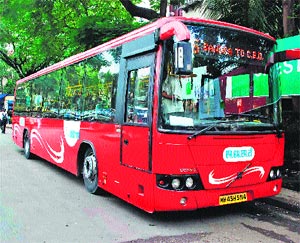
Main article: Navi Mumbai Municipal Transport (NMMT) A NMMT Volvo A/C Bus in Vashi Bus Station leaving for CBD Belapur
 A BEST Bus in Navi Mumbai
 Nerul Railway Station, west side
The most common forms of transportation in Navi Mumbai are the red NMMT buses and suburban trains. NMMT buses are similar to the Brihanmumbai Electric Supply and Transport buses except that they are operated by NMMC. Auto rickshaws and Taxis are popular modes of transport. With the Mulund-Airoli link, currently the fastest route to central is via NMMT or the BEST buses to Mulund.
Within each node, the auto rickshaw is the preferred mode of transportation. Yellow and Black taxicabs operating from designated taxi stands provide the means to travel further to destinations such as Mumbai and Thane. Taxis charge a fixed rate approved by the Regional Transport Office.
The Mumbai Suburban Railway network covers most of the populated region of the city. The most important external railway stations are Vashi, Belapur and Panvel. Nerul will be an important external railway station when the Thane-Nerul-Uran link starts. The stations are planned as a major railway junction. Most trains plying on the Konkan Railway stop at Panvel so that those passengers destined to reach Mumbai may get the local trains. These trains bypass the island city altogether. Future plans include linking the station to Pune via Karjat to cut travel time between Mumbai and Pune.
The Thane-Vashi corridor on the Harbour Line of the Central Railway was commissioned on 9 November 2004. The trains ply along an 18.5 km route through Vashi, Sanpada, Turbhe, Kopar Khairane, Ghansoli, Rabale and Airoli, to Thane. Work is underway to lay an additional pair of tracks between Thane and Kurla - the 5th and 6th corridor for a ring railway route: Thane-Kurla-Vashi-Thane. The new broad Gauge Harbour Line is functional between Karjat and Panvel.
BEST buses of the 500 series travel between Mumbai and Navi Mumbai. For example, BEST route 505 starts from the CBD of Navi Mumbai and ends at Bandra in Mumbai, and vice versa. Others routes such as 506, 507, 511, 512 take commuters from Nerul in Navi Mumbai to Mumbai and back. NMMT and BEST AC buses are both available to people of Navi Mumbai.
The 10 km long Palm Beach Marg (Marg translates to Road in Marathi) is a six-lane state-of-the-art road that connects Vashi to CBD-Belapur running parallel to the Thane creek. It is a twin of the Marine Drive.
There is growing demand for a new bridge over the Thane Creek from Kopar Khairane to Kannamwar Nagar in Vikroli, Mumbai off the eastern express highway so as to connect the eastern suburbs of Mumbai. This will establish a much desired third bridge linking Mumbai and Navi Mumbai.
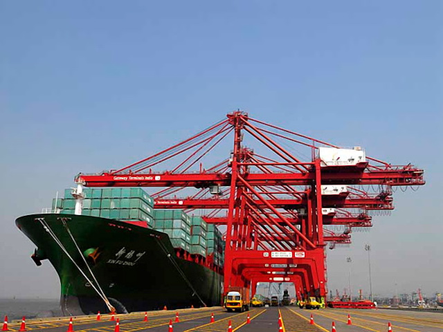
Navi Mumbai boasts the most advanced port in India, Jawaharlal Nehru Port, at Nhava Sheva near Uran. It is well connected with road and railways, and handles approximately 65% of India's container traffic.
Navi Mumbai is located 30 km away from Chatrapati Shivaji International Airport which currently acts as the International Airport for the city, but things will change up soon when the Navi Mumbai International Airport will be ready for use.
International Airport
Main article: Navi Mumbai International AirportThe new international airport for Navi Mumbai, destined for the Kopra-Panvel area, will be built through public-private partnership (PPP), with private sector partners having 74% equity and the Airports Authority of India (AAI) and Government of Maharashtra (through City and Industrial Development Corporation or CIDCO) each holding 13%.
The International Civil Aviation Organisation (ICAO) has already given techno-feasibility clearance to the airport. The central government provided cabinet approval for the construction on 31 May 2007.[14] Specialised consultants were appointed and the global tendering process is underway.[15] The government authorities are still planning the land acquisition.
Infrastructure
Basic infrastructure worth
4,000 crore (US$811.2 million) is already in place.[16] The city boasts a reliable supply of electricity from various sources, and excellent motoring conditions, with numerous flyovers, broad roads, and parking lots. The main problem facing the residents is poor connectivity with Mumbai, with only two road links between the two cities and a single rail line. A hovercraft service from Vashi to Colaba and the CBD to Colaba did not succeed due to the high cost of tickets and maintenance. Cidco is planning to relaunch its hovercraft service from Vashi, Belapur, Nerul, and Airoli to Gateway of India.Services
 Raghuleela Mall, Vashi
There are adequate utility services, banks, restaurants, malls, multiplexes and other shops in Navi Mumbai. Vashi boasts several shopping malls such as Center One, Palm Beach Galleria, Citi Center, Raghuleela Mall and Inorbit Mall. Palm Beach Road, Nerul, and Kharghar are also witnessing the construction of malls and multiplexes. Throughout Navi Mumbai supermarkets and malls like Apnaa Bazaar, More, Spencer's, Reliance Fresh, Spinach and Fairprice cater to the shopping needs of the residents. DMart has launched five hypermalls in Navi Mumbai.
Leading banks such as the State Bank of India, Union Bank, Saraswat Bank, Bank of Baroda, Bank of Maharashtra, Bank of Hyderabad, Citibank India, ICICI Bank, and HDFC Bank have their branches and ATMs around Navi Mumbai. The Reserve Bank of India has served the people of Navi Mumbai since 2001.
Navi Mumbai has very few three- and five-star hotels. However, with the completion of the Navi Mumbai International Airport by 2012, nodes like Nerul, Panvel, Kharghar, and CBD Belapur are expected to get several five-star luxury hotels.
Commerce
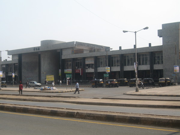
 Vashi station complex
 Jawaharlal Nehru Port Trust is the busiest port in India
 Belapur Railway Station
Most of the software companies in Maharashtra have their offices in Navi Mumbai. The government of Maharashtra has set up software parks to cater to the growing demand. Many large institutions have their offices here. Since 2005, The Reliance group of industries have had a major presence, and DAKC in Kopar Khairane and Mahape. Other prominent companies include CORE Projects & Technologies Ltd, Hexaware Technologies, Mastek, Enser Communications, Patni Computer Systems, Intellenet, Hewitt Associates, TCS, Digit magazine, V2Solutions, IRIS Business Services Private Limited, Indiagames, and Carwale. Most of them are located in an area called the Millenium Business Park in Mahape. As a part of long-term planning, major commodity markets have begun moving from the heart of Mumbai city to Navi Mumbai. Kalamboli (a node in Navi Mumbai) is home to a major steel market.
Vashi has the fresh fruits and vegetables market. One of the important business landmarks is the shipping port of Jawaharlal Nehru Port in the Nhava Sheva - Dronagiri nodes. The major business hubs in the City are CBD Belapur, Vashi, Nerul and Mahape.
The International Infotech Park at Vashi and Belapur railway station complex houses many international IT companies. The New Millennium City near Mahape forms a major part of the Knowledge Corridor that spans Mumbai and Pune.[17] The head office of Reliance Infocom - Dhirubhai Ambani Knowledge City is situated opposite the Koparkhairane station. Other IT companies in Navi Mumbai include L&T Infotech, Wipro Ltd, CMC, Tata Consultancy Services, Aptech, Track Mail, ICICI Infotech and PCS, whose offices are on Thane Belapur Road.
The Navi Mumbai Special Economic Zone (SEZ) located in the nodes of Dronagiri and Kalamboli are planned to provide commercial growth and employment to the city. Positioned enroute the proposed Navi Mumbai Airport, this mega project has attracted investments of close to 40,000 crores.[citation needed]
Marathon Group has launched the development of its mini SEZ called NexZone near the site of the proposed airport. This mini SEZ will be specially for the IT/ITES industry and will be an integrated township of residential and commercial buildings, entertainment mall and education institutes. Honda SEIL's Headquarters is located in Nerul MIDC.
Law and order
As the population and prosperity of the city rose through the years, it began to attract more criminal activity. Navi Mumbai's crime count jumped up from 2,763 in 2003 to 3,571 in 2004. One of the main reasons for the spurt in crime is continuous political meddling in police investigations and the grossly under-staffed police force.
There are very few police chowkies throughout Navi Mumbai with virtually non existent beat chowkies and traffic police. Criminal activities in Navi Mumbai include chain snatching, pickpocketing, cellphone snatching. These crimes are mainly confined to sparsely populated areas. Navi Mumbai has witnessed several vehicle thefts and burglaries involving unoccupied houses. Murder and armed robbery take place in significant numbers.[18] Riots and community feuds take place, especially in the Ghansoli area. There have been several instances where mobs of frustrated native villagers have beaten innocent law abiding residents. Nerul is especially plagued by robbery.[19] The number of accidents on the Palm Beach Road caused by are growing at an alarming pace due to non existent traffic police or security cameras. The absence of street lights on the highway between Belapur and Kharghar poses a continued danger to motorists.
Shops and housing colonies often hire private security guards, as the police force is often overstretched.[20] Businesses are expected to shut shop by 10pm. The Mumbai underworld has begun to take notice of the city,[21] targeting the increasingly thriving businesses of cable operators, builders and real estate developers for extortion. On the whole, crime in Navi Mumbai is much less than in Mumbai.
Sports
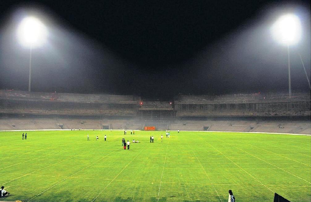
Cricket is the prevalent sport in the city. Navi Mumbai has its own International Cricket Ground in Nerul called the DY Patil Stadium which hosted 3 IPL T-20 matches and the IPL T-20 Cricket Final. It is said that this stadium is one of the best in India. Football is the second most popular sport with the city clubs playing during the monsoons, when other outdoor sports cannot be played. The FIFA World Cup is one of the most widely watched television events in Mumbai. India's national sport, field hockey, has gone into a sharp decline in the recent years, losing out in terms of popularity to cricket, though many Mumbai players play on the national team.
Navi Mumbai has an olympic size swimming pool at Nerul. CIDCO has proposed two 18 hole golf course academies at Nerul and Kharghar. There are plans to have sports facilities in the proposed 80 hectare Central park being developed in Kharghar. The park is expected to open in mid 2010.
The Navi Mumbai Olympics is held every year. The 2008 Olympics had 12 sports and more than 3500 participants. It was won by Vashi Vikings while the runners up were the Nerul Ninjas. The other teams which take part in these Olympics are the KoparKhairane Kings, the Airoli Aces, the Panvel Patriots, the Belapur Blazers, the Kalamboli Knockouts and the Kharghar Knights.


Panorama of CBD Belapur Sister cities
Navi Mumbai has many sister cities:
References
- ^ nmmconline.com: "Land Usage"
- ^ Navi Mumbai
- ^ "New Delhi News : A peek into emerging India on the small screen". The Hindu. 2006-08-11. http://www.hindu.com/2006/08/11/stories/2006081109950200.htm. Retrieved 2010-08-11.
- ^ Thesis titled - The Urban Social Pattern of Navi Mumbai, India by Malathi Ananthakrishnan, April, 1998, Blacksburg, Virginia
- ^ Formation of Civic Body
- ^ Zones under NMMC
- ^ a b c "About Navi Mumbai". http://www.nmmconline.com/english/aboutUs/climateShow.php. Retrieved 2008-07-28.
- ^ "World Weather Information Service - Mumbai". World Meteorological Organisation. http://worldweather.wmo.int/066/c00226.htm. Retrieved 2010-09-14.
- ^ "Climatological Normals of Mumbai, India". Hong Kong Observatory. http://www.weather.gov.hk/wxinfo/climat/world/eng/asia/india/mumbai_e.htm. Retrieved 2010-09-14.
- ^ "Census of India 2001: Data from the 2001 Census, including cities, villages and towns (Provisional)". Census Commission of India. Archived from the original on 2004-06-16. http://web.archive.org/web/20040616075334/http://www.censusindia.net/results/town.php?stad=A&state5=999. Retrieved 2008-11-01.
- ^ Navi Mumbai — pulsating with business activities
- ^ The maker of modern cities
- ^ http://www.cidcoindia.com/UserFiles/File/EXECUTIVE%20SUMMARY-2000.doc
- ^ . http://www.financialexpress.com/news/Navi-Mumbai-Airport-gets-Cabinet-approval/200643/title=Navi Mumbai Airport gets Cabinet approval. Retrieved 2007-06-01.
- ^ "Cidco". Cidcoindia.com. http://cidcoindia.com/cidco/Globalrfp.aspx. Retrieved 2010-07-26.
- ^ Maharashtra IT parks The Recommended New Address For 21st Century Corporate India
- ^ Cidco plans for Navi Mumbai
- ^ [1][dead link]
- ^ [2][dead link]
- ^ [3][dead link]
- ^ [4][dead link]
External links
- Navi Mumbai travel guide from Wikitravel
- Navi Mumbai Municipal Corporation
- NMMT Official Website
- CIDCO - City and Industrial Development Corporation
Articles Related to Navi Mumbai Navi Mumbai Geography Temples Balaji · Shaneshawara · Murgan · Sai Baba · Swami Narayan · Amirtandamayi · Narayan Guru · Ayyapa · JhulelalSports associations Navi Mumbai Sports Association, Vashi · Nerul Gymkhaana, Nerul · Vazirani Sports Club, Nerul · Merchants Gym Club, Vashi · DY Patil Sports Club · YMCA, BelapurEntertainment Megharj, Vashi · Meghdut Vashi · Adlabs · Cinemax · Fame · Oracle Fun Square · Vishnudas BhaveUpcomingInox, Nerul · PVR, VashiMajor roads Palm Beach Road · Thane Belapur · Sion-Panvel Highway · Uran-Nerul link road (URAN Phata) · Rajiv Gandhi Bridge, Nerul · London Pilsner, NerulBusiness districts Shopping Center One, Vashi · Palm Beach Galleria, Vashi · Citi Center, Vashi · Raghuleela Mall, Vashi · Dmart, Nerul · Sahakar Bhandar, Nerul · DMart, Kopar Khairane · Fountain Square, Kharghar · Little World, Kharghar · InOrbit, VashiUnder construction mallsCenturion Mall & Multiplex, Nerul · Full Stop, Nerul · Fantasia, Vashi · Glomax, Kharghar · Bhoomi Mall, Belapur · Turning Point, Nerul · Infocity Mall, Nerul ·Buildings Commodity Exchange, APMC · Nerul Railway Station · Vashi Railway Station · CBD Belapur Station · BSEL Tech Park · Maithili IT park · Great Eastern Galleria, Nerul · Vishwaroop IT Park · Microtech Park · MK Shah IT Park, Nerul · ITC Fortune Hotel, Vashi · Hotel Sheraton, VashiLarge structures Under construction
or plannedNavi Mumbai International Airport · BSEL Golf Course, Nerul · Navi Mumbai SEZ · Seawood Railway Station, Nerul · · Central ParkEducation Fr. Conceicao Rodrigues Institute of Technology · Apeejay School Nerul · Bharati Vidyapeeth College of Engineering · Karmaveer Bhaurao Patil College · Ramrao Adik Institute of Technology · South Indian Education Society · M.G.M's College Of Engineering And TehnologyNodes CIDCOMumbai metropolitan area South Mumbai
NeigbourhoodsColaba · Parel · Elephanta Island · Fort · Dadar · Mahim · Mahalaxmi · Carmichael Road · Altamount Road · Kemps Corner · Marine Lines · Churchgate · Charni Road · Prabhadevi · Nariman Point · Navy Nagar · Tardeo · Girgaon · Kalbadevi · Worli · Cuffe Parade · Malabar Hill · Byculla · Chinchpokli · Wadala · Walkeshwar · Kala Ghoda · Kotachiwadi · Elphinstone Road · Sewri · Dadabhai Naoroji Road · Apollo Bunder · MazagaonEast Mumbai Suburban
NeighbourhoodsWest Mumbai Suburban
NeighbourhoodsAndheri · Bandra · Goregaon · Malad · Juhu · Kandivali · Borivali · Santacruz · Vile Parle · Dahisar · Versova · Kanheri Caves · Jogeshwari · Aarey Milk Colony · MarolNavi Mumbai
NeighbourhoodsVashi · Nerul-Seawoods · Ghansoli · Kopar Khairane · Sanpada · Turbhe · Belapur · Digha · Kharghar · Rabale · New Panvel · Airoli · Juinagar · Mansarovar (Navi Mumbai) · Kalamboli · Khandeshwar · KamotheThane City
NeighbourhoodsMira-Bhayandar Kalyan-Dombivali Vasai-Virar Bhiwandi-Nizampur Bhiwandi · NizampurUlhasnagar Municipal Councils  State of MaharashtraCapital: Mumbai
Topics Regions Districts Million-plus cities
in Maharashtra- Mumbai
- Pune
- Nagpur
- Thane
- Pimpri-Chinchwad
- Nashik
- Kalyan-Dombivali
- Navi Mumbai
- Aurangabad
Other cities with
municipal corporationsAiroli · CBD Belapur · Dronagiri · Ghansoli · Kalamboli · Khargar · Kopar Khairane · Nerul · New Panvel · Sanpada · Turbhe · Taloja · Ulwe · VashiMillion-plus agglomerations in India Agra · Ahmedabad · Allahabad · Amritsar · Asansol · Bangalore · Bhopal · Bhubaneswar · Chandigarh · Chennai · Coimbatore · Delhi · Dhanbad · Guwahati · Gwalior · Hyderabad · Indore · Jabalpur · Jaipur · Jamshedpur · Jodhpur · Kanpur · Kochi · Kolhapur · Kolkata · Kozhikode · Lucknow · Ludhiana · Madurai · Meerut · Mumbai · Navi Mumbai · Nagpur · Nashik · Patna · Pune · Rajkot · Ranchi · Sagar · Solapur · Srinagar · Surat · Thrissur · Thiruvananthapuram · Tiruchirappalli · Ujjain · Vadodara · Varanasi · Vijayawada · Visakhapatnam
Categories:- 1970s establishments
- Cities and towns in Thane district
- Mumbai
- Navi Mumbai
- Planned cities in India


Wikimedia Foundation. 2010.