- Tropic of Cancer
-
For the novel by Henry Miller, see Tropic of Cancer (novel). For the BBC TV series, see Tropic of Cancer (BBC TV series).
Coordinates: 23°26′16″N 0°0′0″W / 23.43778°N 0°E
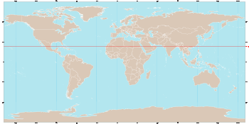 World map showing the Tropic of Cancer
The Tropic of Cancer, also referred to as the Northern tropic, is the circle of latitude on the Earth that marks the most northerly position at which the Sun may appear directly overhead at its zenith. This event occurs once per year, at the time of the June solstice, when the Northern Hemisphere is tilted toward the Sun to its maximum extent.
Its Southern Hemisphere counterpart, marking the most southerly position at which the Sun may appear directly overhead, is the Tropic of Capricorn. These tropics are two of the five major degree measures or major circles of latitude that mark maps of the Earth, besides the Arctic and Antarctic Circles and the Equator. The positions of these circles of latitude (other than the Equator) are dictated by the tilt of the Earth's axis of rotation relative to the plane of its orbit.
Contents
Name
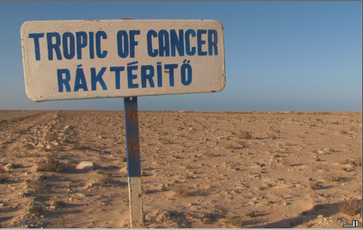
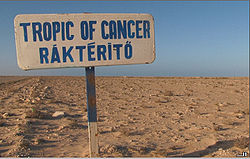 Road sign South of Dakhla, Western Sahara (claimed by Morocco) marking the Tropic of Cancer. The sign was placed by the Budapest-Bamako rally participants, thus the non-English inscription is in Hungarian.
The imaginary line is called the Tropic of Cancer because when it was named, the Sun was in the direction of the constellation Cancer (Latin for crab) at the June solstice. However, this is no longer true due to the precession of the equinoxes. According to International Astronomical Union boundaries, the Sun now is in Taurus at the June solstice. According to sidereal astrology, which divides the zodiac into 12 equal parts, the Sun is in Gemini at that time. The word "tropic" itself comes from the Greek τροπή (tropi), meaning turn, referring to the fact that the Sun appears to "turn back" at the solstices.
Geography
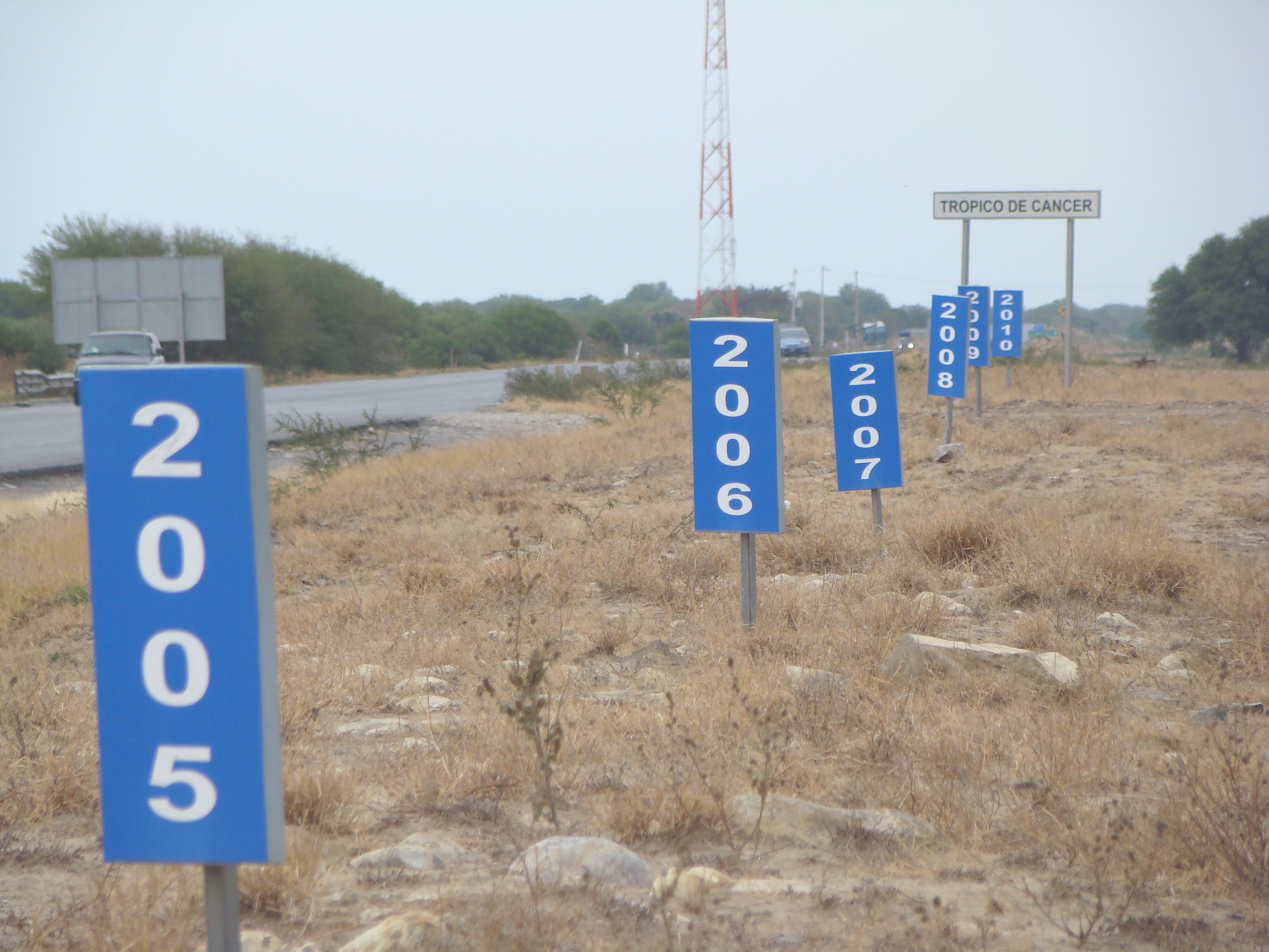
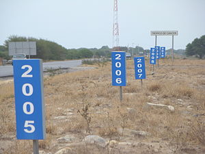 Carretera 83 (Vía Corta) Zaragoza-Victoria, Km 27+800. In all crossings of the Tropic of Cancer with Mexican federal highways, this is the only place where the latitude is marked with absolute precision and where the annual drift between 2005 and 2010 can be appreciated.
The Tropic of Cancer currently (Epoch 2011) lies 23° 26′ 16″ north of the Equator.[1] Its position is not fixed, but varies in a complicated manner over time. It is presently drifting south at the rate of almost half a second (0.47″) of latitude per year (it was at exactly 23º 27' in year 1917).[2] See circles of latitude for further information.
North of Tropic of Cancer are the subtropics and the North Temperate Zone. The equivalent line of latitude south of the Equator is called the Tropic of Capricorn, and the region between the two, centered on the Equator, is the tropics.
Starting at the Prime Meridian and heading eastwards, the Tropic of Cancer passes through:
Climate
Excluding cooler highland regions in Mexico and China, the climate at the Tropic of Cancer is generally hot and dry except for easterly coastal areas where orographic rainfall can be very heavy, in some places reaching 4 metres (160 in). Most regions on the Tropic of Cancer experience two distinct season: an extremely hot summer with temperatures often reaching 45 °C (113 °F) and a warm winter with maxima around 22 °C (72 °F). Most land on or near the Tropic of Cancer is part of the Sahara Desert, whilst to the east the climate is torrid monsoonal with a short wet season from June to September and very little rainfall for the rest of the year.
The highest mountain on or adjacent to the Tropic of Cancer is Yushan in Taiwan; though it had glaciers descending as low as 2,800 metres (9,190 ft) during the Last Glacial Maximum, none survive and at present no glaciers exist within 350 kilometres (220 mi); the nearest currently surviving are in the Himalayas to the north and Iztaccíhuatl to the south.
According to the Fédération Aéronautique Internationale's rules, for a flight to compete for a round-the-world speed record, it must cover a distance no less than the length of the Tropic of Cancer, as well as cross all of the meridians, and end on the same airfield where it started.
To calculate the length of the Tropic:
- At present (2011) the radius of the circle will be 6 378 x cos(23º 26′ 16″) which results in 5 851.77 km
- Then,
 = 3.1416 x 2 x 5851.77 which amounts to 36 767.8413
 - Therefore, assuming the Earth to be a perfect sphere, the length of the circumference at the parallel of the Tropics would be 36 768 km
For an ordinary circumnavigation the rules are somewhat relaxed and the distance is set to a rounded value of at least 37,000 kilometers.
External links
- Article on the Tropic of Cancer in Oman
- Temporal Epoch Calculations
- Useful constants" See: Obliquity of the ecliptic
See also
- 23rd parallel north
- 24th parallel north
- Tropic of Capricorn
- Antarctic Circle
- Arctic Circle
- Axial tilt
- Equator
- Milankovitch cycles
- Ducking and shaving
Notes
Circles of latitude / Meridians  Tropic of CancerTropic of CancerTropic of Cancer145°145°65°75°Categories:
- Lines of latitude
- Tropics

Wikimedia Foundation. 2010.