- M'Sila Province
-
M'Sila Province
ولاية المسيلة— Province — Map of Algeria highlighting M'Sila
Coordinates: 35°42′N 4°33′E / 35.7°N 4.55°ECoordinates: 35°42′N 4°33′E / 35.7°N 4.55°E Country  Algeria
Capital M'Sila Government – PPA president – Wāli Area – Total 18,718 km2 (7,227.1 sq mi) Population (2008)[1] – Total 991,846 – Density 53/km2 (137.2/sq mi) Time zone CET (UTC+01) Area Code +213 (0) 35 ISO 3166 code DZ-28 Districts 15 Municipalities 47 M'Sila (also spelled Msila, M'sila or MSila) (Arabic: ولاية المسيلة) is a province (wilaya) of northern Algeria. It has a population of 1 million people and an area of 18,718 km², while its capital, also called M'sila, home to M'Sila University, has a population of about 100,000. Some localities in this wilaya are Bou Saada and Maadid. Chott El Hodna, a salt lake, crosses into M'Sila. However, most of the region is semi-arid and undeveloped.
M'Sila is primarily known for its farming.
Additionally, M'Sila was the location of the first village constructed as part of a government-run program to transition nomadic Algerians to sedentary life using local materials. The village, now complete, was dubbed Maader and consists of houses, public and trading areas, and a mosque.
Contents
Administrative divisions
The province is divided into 15 districts (daïras), which are further divided into 47 communes or municipalities.
Districts
- Aïn El Hadjel
- Aïn El Melh
- Ben S'Rour
- Bou Saâda
- Chellal
- Djebel Messaâd
- Hammam Dhalaâ
- Khoubana
- M'Sila
- Magra
- Medjedel
- Ouled Derradj
- Ouled Sidi Brahim
- Sidi Aïssa
- Sidi Ameur
Communes
1. Aïn El Hadjel
2. Aïn El Melh
3. Aïn Errich
4. Aïn Fares
5. Aïn Khadra
6. Belaïba
7. Ben Srour
8. Beni Ilmane
9. Benzouh
10. Berhoum
11. Bir Foda
12. Bou-Saâda13. Bouti Sayeh
14. Chellal
15. Dehahna
16. Djebel Messaad
17. El Hamel
18. El Houamed
19. Hammam Dhalaa
20. Khoubana
21. Khatouti Sed Eldjir
22. Maadid
23. Maarif
24. Magra25. M'Cif
26. Medjedel
27. M'Sila
28. M'Tarfa
29. Menaa
30. Mohamed Boudiaf
31. Ouanougha
32. Ouled Addi Guebala
33. Ouled Derraj
34. Ouled Madhi
35. Ouled Mansour
36. Ouled Sidi Brahim37. Ouled Slimane
38. Oultene
39. Sidi Aïssa
40. Sidi Ameur
41. Sidi Hadjeres
42. Sidi M'hamed
43. Slim
44. Souamaa
45. Tamsa
46. Tarmount
47. Zarzour The districts and communes of the province of M'Sila
References
- ^ Office National des Statistiques, Recensement General de la Population et de l’Habitat 2008 Preliminary results of the 2008 population census. Accessed on 2008-07-02.
External links
- Encycloepaedia of the Orient-a brief description of M'Sila, focusing on its capital
- BBC - a news article about some recent violence in M'Sila
- Archnet - focuses on the Maader village project
- Wetlands International - an in-depth description of M'Sila's wetland
Capital: M'SilaDistricts Aïn El Hadjel · Aïn El Melh · Ben S'Rour · Bou Saâda · Chellal · Djebel Messaâd · Hammam Dhalaâ · Khoubana · M'Sila · Magra · Medjedel · Ouled Derradj · Ouled Sidi Brahim · Sidi Aïssa · Sidi Ameur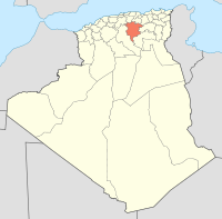
Communes Aïn El Hadjel · Aïn El Melh · Aïn Errich · Aïn Fares · Aïn Khadra · Belaiba · Ben Srour · Beni Ilmane · Benzouh · Berhoum · Bir Foda · Bou-Saâda · Bouti Sayah · Chellal · Dehahna · Djebel Messaad · El Hamel · El Houamed · Hammam Dhalaa · Khoubana · Maadid · Maarif · Magra · M'Cif · Medjedel · M'Sila · M'Tarfa · Ouanougha · Oued Chair · Ouled Addi Guebala · Ouled Atia · Ouled Derradj · Ouled Madhi · Ouled Mansour · Ouled Sidi Brahim · Ouled Slimane · Oultene · Sidi Aïssa · Sidi Ameur · Sidi Hadjeres · Sidi M'Hamed · Slim · Souamaa · Tamsa · Tarmount · Zarzour · ZerarkaProvinces of Algeria Adrar · Aïn Defla · Aïn Témouchent · Algiers · Annaba · Batna · Béchar · Béjaïa · Biskra · Blida · Bordj Bou Arréridj · Bouira · Boumerdès · Chlef · Constantine · Djelfa · El Bayadh · El Oued · El Taref · Ghardaïa · Guelma · Illizi · Jijel · Khenchela · Laghouat · Mascara · Médéa · Mila · Mostaganem · M'Sila · Naâma · Oran · Ouargla · Oum El Bouaghi · Relizane · Saïda · Sétif · Sidi Bel Abbes · Skikda · Souk Ahras · Tamanrasset · Tébessa · Tiaret · Tindouf · Tipaza · Tissemsilt · Tizi Ouzou · Tlemcen
 Categories:
- M'Sila Province
- Provinces of Algeria
- M'Sila Province geography stubs


Wikimedia Foundation. 2010.