- Chorazin
-
Chorazin Hebrew transcription(s) - Hebrew כורזים Ancient synagogue
 Chorazin
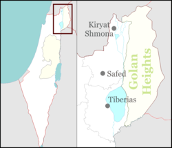
Coordinates: 32°54′41″N 35°33′50″E / 32.91139°N 35.56389°ECoordinates: 32°54′41″N 35°33′50″E / 32.91139°N 35.56389°E District Chorazin (pronounced /koʊˈreɪzɪn/; Korazim Karraza, Kh. Karazeh, Chorizim, Kerazeh, Korazin) was a village in northern Galilee, two and a half miles from Capernaum on a hill above the northern shore of the Sea of Galilee.
Contents
Biblical references
Chorazin, along with Bethsaida and Capernaum, was named in the New Testament gospels of Matthew and Luke as "cities" (more likely just villages) in which Jesus performed "mighty works". However, because these towns rejected his work ("they had not changed their ways" -Matt11:20SV), they were subsequently cursed (Matthew 11:20-24; Luke 10:13-15). Biblical scholars who accept the two-source hypothesis state that this story originally came from the Q document. Despite this textual evidence, archaeologists have not yet been successful in finding a settlement dating to the 1st century. Due to the condemnation of Jesus, some early Medieval writers believed that the Antichrist would be born in Chorazin.
The Babylonian Talmud (Menahot, 85a) mentions that Chorazin was a town known for its grain. In the 16th century, Jewish fishermen used to reside here.
Archaeology
 Olive oil press
Korazim is now the site of a National Archaeological Park. Extensive excavations and a survey were carried out at in 1962-1964. Excavations at the site were resumed in 1980-1987.
The site is an excavated ruin today, but was inhabited starting in the 1st century. It is associated with modern day Kerazeh.
The majority of the structures are made from black basalt, a volcanic rock found locally. The main settlement dates to the 3rd and 4th centuries. A mikvah, or ritual bath, was also found at the site. The handful of olive millstones used in olive oil extraction found suggest a reliance on the olive for economic purposes, like a number of other villages in ancient Galilee.
The town's ruins are spread over an area of 25 acres (100,000 m2), subdivided into five separate quarters, with a synagogue in the centre. The large, impressive Synagogue which was built with black basalt stones and decorated with Jewish motifs is the most striking survival. Close by is a ritual bath, surrounded by public and residential buildings.
Synagogue
 Synagogue
The synagogue was built in the late 3rd century, destroyed in the 4th century, and rebuilt in the 6th century.[1]
An unusual feature in an ancient synagogue is the presence of three-dimensional sculpture, a pair of stone lions. A similar pair of three-dimensional lions was found in the synagogue at Kfar Bar'am.[2] Other carvings, which are thought to have originally been brightly painted, feature images of wine-making, animals, a Medusa, an armed soldier, and an eagle.[3]
Other Synagogue
J. Ory, who excavated the site in 1926, told that a second synagogye was found ca. 200 m west of the first one, and he described it very accurately. But such a building was never found by later excavations.[4]
Sources
- Z. Yeivin, The Synagogue at Korazim; The 1962 - 1964, 1980 - 1987 Excavations, Israel Antiquities Authority Reports, Israel Antiquities Authority, 2000.
- New Encyclopedia of Archaeological Excavations in the Holy Land vols. 1-5. Ed. E. Stern; Jerusalem: Israel Exploration Society and Carta (1993-2008).
References
- ^ Avraham Negev; Shimon Gibson (July 2005). Archaeological encyclopedia of the Holy Land. Continuum International Publishing Group. p. 118. ISBN 9780826485717. http://books.google.com/books?id=27nq65cZUIgC&pg=PA118. Retrieved 15 May 2011.
- ^ Steven Fine (2005). Art and Judaism in the Greco-Roman world: toward a new Jewish archaeology. Cambridge University Press. ISBN 9780521844918. http://books.google.com/books?id=a8J06NLqRfIC. Retrieved 15 May 2011. p.190
- ^ Steven Fine (2005). Art and Judaism in the Greco-Roman world: toward a new Jewish archaeology. Cambridge University Press. ISBN 9780521844918. http://books.google.com/books?id=a8J06NLqRfIC. Retrieved 15 May 2011. p.92
- ^ Anders Runesson; Donald D. Binder; Birger Olsson (2008). The Ancient Synagogue from its Origins to 200 C.E.. Brill. p. 32. ISBN 18716636.
External links
- Strong's G5523
- Chorazin from bibleplaces.com
- Pictures of Chorazin
- The Ancient Synagogue of Chorazin from a Jewish tourism site
- Chorazin University of Notre Dame, New Testament Professor David E. Aune
- Korazin Christian tourism site
- Ancient Chorazin Comes Back to Life by Ze’ev Yeivin of the Biblical Archaeology Society.
National parks of Israel Jerusalem District Bayt 'Itab · Canada Park · Castel · City of David National Park1 · Ein Hemed · Judaean Mountains · Tomb of Samuel1North District Achziv · Bar'am National Park · Beit Alfa Synagogue · Beit She'an · Beit She'arim · Belvoir Fortress · Capernaum · Chorazin · Gan HaShlosha · Hamat Gader · Hamat Tiberias · Harod Spring · Hermon National Park1 · Hexagons pool · Horns of Hattin · Hurshat Tal · Hurvat Minia · Kursi1 · Montfort Castle · Mount Arbel · Mount Tabor · Nimrod Fortress1 · Rosh HaNikra · Sde Amudim · Sussita · Tel Hazor · Tel Kedesh · Tel Megiddo · Tzalmon Stream · Tzippori · Yehi'am Fortress · Hula ValleyHaifa District Central District Alexander stream · Arsuf · Hof HaSharon · Mazor Mausoleum · Migdal Afek · Palmachim beach · Rubin Stream · Sidna Ali · Tel Afek · Tel Gezer · Tzur Natan park · Yarkon National ParkSouthern District Ashkelon National Park · Avdat · Besor Stream · Beit Guvrin National Park · Ein Avdat · Ein Gedi · Eshkol Park · Mamshit · Masada · Monument to the Negev Brigade · Nitzana · Semekh caves · Shivta · Tel Arad · Tel Be'er Sheva · Tel Lachish · Tel ZafitJudea and Samaria Area 1 Located in the Israeli-occupied territories Categories:- Archaeological sites in Israel
- New Testament places
- Former populated places in Southwest Asia
- Ancient synagogues in the Land of Israel


Wikimedia Foundation. 2010.