- Shire (Middle-earth)
-
For other uses, see Shire (disambiguation).
The Shire Place from J. R. R. Tolkien's legendarium 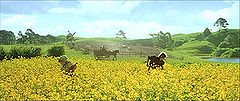
The fields of the Shire in the Lord of the Rings movie trilogyOther names Sûza, Sûzat (Westron)
i Drann (Sindarin)Description Secluded area settled exclusively by Hobbits Location Northwestern Arnor Lifespan Third Age – Fourth Age Lord Thain and Mayor of the Shire Books The Lord of the Rings The Shire is a region of J. R. R. Tolkien's fictional Middle-earth, described in The Lord of the Rings and other works. The Shire refers to an area settled exclusively by Hobbits and largely removed from the goings-on in the rest of Middle-earth. It is located in the northwest of the continent, in the large region of Eriador and the Kingdom of Arnor. Its name in Westron was Sûza "Shire"[1] or Sûzat "The Shire".[2] Its name in Sindarin was i Drann.[3]
Contents
Geography
According to Tolkien, the Shire measured 40 leagues (193 km, 120 miles[4]) from the Far Downs in the west to the Brandywine Bridge in the east, and 50 leagues (241 km, 150 miles) from the northern moors to the marshes in the south.[5] This is confirmed in an essay by Tolkien on translating The Lord of the Rings,[6] where he describes the Shire as having an area of 18,000 square miles (47,000 km2).[7]
The original territory of the Shire was bounded on the east by the Baranduin River, on the north by uplands rising to the old centre of Arnor, on the west by the White Downs, and on the south by marshland south of the River Shirebourne. After the original settlement, hobbits also expanded to the east into Buckland between the Baranduin and the Old Forest, and (much later) to the west into the Westmarch between the White Downs and the Tower Hills.
The Shire was originally divided into four Farthings. The outlying lands of Buckland and the Westmarch were formally added after the War of the Ring.[5] Within the Farthings there are some smaller unofficial clan homelands: the Tooks nearly all live in or near Tuckborough in Tookland, for instance. A Hobbit surname often indicates where the family came from: Samwise Gamgee's last name derives from Gamwich, where the family originated. Buckland was named for the Oldbucks (later called the Brandybucks).
The Shire is described as a small but beautiful and fruitful land, beloved by its inhabitants. The Hobbits had an extensive agricultural system in the Shire but were not industrialised. The landscape included small pockets of forest (again similar to the English countryside). Various supplies were produced in the Shire, including cereals, fruit, wood and pipe-weed.
Inspiration
On Tolkien's maps, the Shire is located at about the same position as England is on modern European maps and has been cited as an example of Merry England ideology. Throughout the narrative, Tolkien also implies numerous points of similarity between the two, such as weather, agriculture and dialect.
In particular, the central part of the Shire corresponds to the West Midlands region of England, extending to Worcestershire (where Tolkien located his "home" in particular, his mother's family being from Evesham), Shropshire, Warwickshire, Herefordshire and Staffordshire, as argued by Tom Shippey forming a "cultural unit with deep roots in history"[8] The Northfarthing, with its heavy snowfalls, may correspond to Yorkshire or the Lake District, while the Southfarthing lay far enough south to support the cultivation of wine and tobacco ("pipe-weed").
The name "Shire" harks back to T.H. White's book England Have My Bones, where White says that he lives in "the Shire" (with a capital "s").
The industrialisation of the Shire was based on Tolkien's childhood experience of the blighting of the Worcestershire countryside by the spread of heavy industry. The rebellion of the Hobbits and the restoration of the pre-industrial Shire may be interpreted as a prescription of voluntary simplicity as a remedy to the problems of modern society. Saruman, the character responsible for the pollution of the Shire, derives his name partly from Sarehole Mill, in the vicinity of which Tolkien spent "the most idyllic period" of his childhood.[9] The Shire is, of course, not simply "identical" to the West Midlands. The region in a more remote past, as Mercia, serves at the same time as a model for the Mark of the Rohirrim.
 Iceland divided in farthings, in Hans Henrik Knoff's map, 1761
Regions of the Shire
The original part of the Shire were subdivided into four Farthings ("fourth-ings" or "quarterings").[10] The Three-Farthing Stone marked the tripoint where the borders of the Eastfarthing, Westfarthing and Southfarthing of the Shire came together, by the East Road.[11] (Iceland was traditionally also divided in Farthings, or "fourth parts", as the Shire is.)
Buckland, across the Baranduin River to the east, and the Westmarch, between the Far Downs and the Tower Hills to the west, were not part of the original grant to the hobbits by King Argeleb II of Arthedain. These were formally given to the hobbits as the East and West Marches of the Shire by King Elessar after the War of Ring, in S.R. 1462 (F.A. 41).[10][12] Buckland had been long settled by then: Gorhendad Oldbuck led hobbits from the East Farthing across the river in T.A. 2340,[12] and Buckland became "sort of a colony of the Shire".[13] There is no mention of settlement in the Westmarch until Elessar's gift; Sam Gamgee's daughter Elanor and her husband Fastred later settled there, and Fastred was created Warden of Westmarch.[12]
Northfarthing
The Northfarthing is the least populous part of the Shire. It is where most of the Shire's barley crop is grown,[14] and the only farthing where heavy snow is common.[15] The historic Battle of Greenfields was fought here.[16]
- Long Cleeve was the home of a splinter of the Took clan, descendants of Bandobras "Bullroarer" Took known as the North-Tooks, who settled here after the Battle of Greenfields.[17]
- The village of Hardbottle was the home of the Bracegirdle family, to whom Lobelia Sackville-Baggins belonged.[14] Tolkien's unfinished index to The Lord of the Ring places Hardbottle in the Southfarthing[18] (and some maps, notably Karen Wynn Fonstad's Atlas of Middle-earth, have used this location). But in Tolkien's more extensive entry in his guide for translators, it is located explicitly in "the North Farthing" [sic].[19]
- Binbdbole Wood is one of the larger forests of the Shire. Misspelled "Bindbale Wood" in the first Ballantine paperback edition, the misspelling has been carried forward in many commentaries, including Foster's Guide and Fonstad's Atlas.[20]
Westfarthing
The western part of the Shire. It ran from the Three-Farthing Stone west as far as the Far Downs,[11][21] and included the White Downs.[22]
- Michel Delving on the White Downs is the chief town of the Shire.[21] Its name means simply "large excavation".[23] The Mayor of Michel Delving, with a seven-year term, is the only elected official of the Shire.[10] At the time of the War of the Ring, the Mayor was Will Whitfoot,[24], the fattest hobbit in the Westfarthing.[25] Michel Delving housed the mathom-house, a museum for old items,[21] including for a time Bilbo Baggins's mithril chain mail coat.[26][27][28]
- Little Delving is a village to the north of Michel Delving.[11]
- Waymeet (spelled "Waymoot" on the Shire map in the Prologue of The Lord of the Rings) grew up at the junction of the Great East Road with the older South Road that crossed the Baranduin at Sarn Ford before the Brandywine Bridge was built.[29][30]
- Tuckborough is the centre of the Took homeland where most Tooks dwell.[10] The Thain's extended family lives here in the Great Smials.[21][24]
- Bywater is a village situated on the East Road along The Water, a river running through the centre of the Shire.[11] It was known for two inns, "the Green Dragon"[31] and "the Ivy Bush".[32] It was also the site of the Battle of Bywater on November 3, T.A. 3019, the last battle in the War of the Ring.[24][12]
- Rushock Bog is a swampy area along The Water, situated near the town of Needlehole.[11]
- Hobbiton
is a village along The Water a short walk to the west of Bywater. A large hill (The Hill) lay to the north, and under its southern slopes Bilbo's father Bungo built the luxurious smial Bag End above the lane of Bagshot Row.[33][32][34] This is the home of Bilbo Baggins, Frodo Baggins and Samwise Gamgee, where both The Hobbit and The Lord of the Rings begin and end. Tolkien borrowed "Bag End" from the name of his aunt's farmhouse in the tiny Worcestershire village of Dormston.[35] In the books, it is supposedly a translation of the word Labin-nec in the fictional Westron language. This had much the same meaning, and a similar relationship to Labingi (the Westron form of Baggins) as Bag End to Baggins.[36]
 Bag End the home of Bilbo Baggins in the Lord of the Rings movie trilogy
On the north bank of the Water in Hobbiton was "The Mill", with a large water-wheel and a yard behind it. Sandyman the Miller owned the Mill and operated it with the help of his son Ted Sandyman. Lotho Sackville-Baggins had the Old Mill knocked down and the New Mill built in its place. The New Mill was an ugly red-brick building with a tall chimney. It was bigger than the Old Mill and full of wheels and strange contraptions to increase production. The New Mill straddled the Water and poured pollutants into the stream. It was operated by Men, and Ted Sandyman stayed on to help them. When Saruman came to the Shire in September of 3019, the Mill was no longer used for grinding grain but for some industrial purpose; and loud noises, smoke, and filth issued from it. After Saruman was killed and the Chief's Men defeated at the Battle of Bywater, the New Mill was removed.[24][14]
Southfarthing
The Southfarthing is the site of Longbottom, where the best pipe-weed was grown, owing to the area's warmer climate.[37]
- At Longbottom (meaning "long valley")[38] Tobold Hornblower introduced the cultivation of pipe-weed to the Shire with plantations in his garden, ca. T.A. 2670.[37][12]
- The Green Hill Country, a region of rolling countryside in the central part of the Shire, extends into both the Southfarthing and the Eastfarthing.[11][39]
- The Overbourne Marshes, a swampy area along the western bank of the Baranduin, across the river from the mouth of the Withywindle. The River Shirebourne flows through the marshes into the Baranduin just south of Haysend.[11]
- Sarn Ford is the stony ford across the Baranduin on the southern borders of the Shire.[40] A road leaving the Great East Road at Waymeet crosses the ford and meets the Greenway farther east.[11] The Rangers guarded this entrance to the Shire, but in October, T.A. 3018, the Nazgûl hunting for the One Ring drove them off;[41] some of the Nazgûl crossed into the Shire, while others followed the Rangers toward the Greenway.[12]
Eastfarthing
The Eastfarthing bordered Buckland and contained the towns Frogmorton and Whitfurrows and the farms of the Marish.[11][13] The farmers near the Brandywine largely acknowledged the authority of the Oldbucks, even after the latter moved across the river and became the Brandybucks.[13]
- The Marish is the name of fertile but marshy farmlands along the Brandywine River. The Marish was settled about thirty years after the Shire had been created, by Stoors who arrived there from Dunland.[21][12] The Marish was important in Shire history as the home of Bucca, the first of the Shire-thains. Gorhendad, one of his descendants, crossed the Brandywine and founded Buckland.[13] Farmer Maggot lived at Bamfurlong in the Marish.[42]
- Stock is the major town of the Marish and the location of "the Golden Perch", an inn with a reputation for excellent beer.[42] Stock Road was a road that ran eastwards from Tuckborough in the Westfarthing across the Green Hill Country and past the Yale to Stock.[11]
- The Yale is a low-lying farming area shown on the Shire Map between the Stock Road and the East Road.[43][11] This was the homeland of the Boffin family, and several Boffins in a genealogical table (deleted from Appendix C before publication) came from the Yale.[44]
- Scary is a village in the northern part of the Eastfarthing at the southern feet of the Hills of Scary.[11][14] A road ran south from Scary to cross the Water at Budgeford and join the Great East Road at Whitfurrows.[11] During the War of the Ring, provisions were stored in the quarry east of Scary by the Chief's Men, and after the Scouring of the Shire the Hobbits took advantage of these stores for the Yule holiday.[14]
- Woody End is a forested upland near the village of Woodhall. Frodo and his friends, on their journey to Buckland, encountered Gildor's party there.[39].
Buckland
Not originally part of the Shire, Buckland lay east of the Baranduin (Brandywine) river. The area was protected from the nearby Old Forest by the "High Hay", a tall hedge which forms the eastern border of Buckland, running from the Brandywine Bridge in the north to the confluence of the Withywindle with the Baranduin near the village of Haysend in the south. The main entrance to Buckland from the north is a gate in the Hay, called variously the Buckland Gate, the North Gate, or the Hay Gate, located "where the Hedge runs down to the river-bank, just this side of the Bridge,"[13] opening onto the East Road from the Shire to Bree.
Unlike other hobbits the Bucklanders are prepared for danger and less naive than the Shire-hobbits. They close the Hay Gate and lock their own front doors at night, and are prepared to rush to arms at the sound of the Horn of Buckland. Most Bucklanders were originally of Stoor stock, and they were the only hobbits known to use boats.[13]
- Bucklebury is the main town of Buckland. The Master of Buckland, hereditary chieftain of the Brandybuck family, maintained his home here at Brandy Hall.[13]
- The Bucklebury Ferry, a raft-ferry some ten miles south of the Bridge, provides another crossing of the Brandywine from the Shire to Buckland. (Tolkien originally put the distance at twenty miles, but this was corrected in later editions.) It is unmanned, to be used by hobbits as needed. En route to the new house at Crickhollow, Frodo, Sam, Merry and Pippin crossed the river using the Ferry just ahead of one of the Black Riders, who was forced to go around to the Brandywine Bridge since no boats were kept on the western bank of the river.[42]
- Crickhollow was a village in Buckland. After selling Bag End, Frodo Baggins moved to a house in Crickhollow. Meriadoc Brandybuck and Fredegar Bolger prepared the house ostensibly for Frodo to occupy in retirement, but the purchase of the house was a ruse to allow Frodo and Samwise Gamgee to leave the Shire unobtrusively.[39] Merry and Pippin lived for some time after their return to the Shire in the house at Crickhollow.[14]
Westmarch
After the events of the War of the Ring at the start of the Fourth Age, King Elessar granted the hobbits of the Shire effective self-rule inside his reunited kingdom, banning any Men from entering the land.[12]
He also granted the Shire a stretch of new land: this reached from the ancient western borders of the Shire, the Far Downs, to the Tower Hills. The area between the downs and the hills became known as the Westmarch. Like Buckland, it was not part of any of the four Farthings.[12]
The eldest daughter of mayor Samwise Gamgee, Elanor the Fair, married Fastred of Greenholm, and they moved to the Westmarch, settling in Undertowers. After the passing of master Samwise into the Grey Havens, they and their children became known as the Fairbairns of the Towers or Wardens of Westmarch. The Red Book of Frodo and Bilbo Baggins passed into their keeping, becoming known as the Red Book of Westmarch.[12]
History
The Shire was settled by Hobbits in the year 1601 of the Third Age (Year 1 in Shire Reckoning). The Hobbits (who originally lived in the vale of Anduin) had migrated west over the perilous Misty Mountains in the decades before that, and before entering the Shire they had lived in Dunland and parts of the depopulated Arnorian splinter-realms Cardolan and Rhudaur. It has been speculated that the Hobbits had originally moved west to escape the troubles of Mirkwood, and the evil caused by the Easterlings.
The Shire was a part of Arthedain, and as such a part of Arnor. The Hobbits obtained official permission from King Argeleb II at Norbury (Fornost) to settle the lands, which were not populated and were seen as the king's hunting grounds. The King stipulated three conditions to this grant; that the hobbits should acknowledge his Lordship, that they should maintain the roads within the Shire and finally that they should aid his messengers. The Hobbits therefore considered themselves subjects of the king and sent some archers to the great battles Arnor fought against Angmar. After the fall of Arnor, the Shire remained a minor but independent, self-governing realm. The chiefs of the Clans elected an official named the Thain to hold the king's powers after the North-kingdom fell. The first Thains were the heads of the Oldbuck clan. The position later came to be held by the Tooks.
Its small size, relative lack of importance, and brave and resilient Hobbit population made it too modest an objective for conquest. More importantly, the Shire was guarded and protected by the Dúnedain Rangers, who watched the borders and kept out intruders. The only strangers to enter the Shire were the Dwarves travelling on the Great Road that ran through the Shire to and from their mines in the Blue Mountains, and the occasional Elves on their way to the Grey Havens.
This peaceful situation changed after Bilbo Baggins's acquisition of the One Ring in the year 1341 of the Shire Reckoning (Third Age 2941). Shortly after the beginning of the events described in The Lord of the Rings (autumn of SR 1418), the Shire was first visited by the Nine Ringwraiths and then captured by Saruman through his underling Lotho Sackville-Baggins, who turned the Shire into a police state and began a massive campaign to industrialize it, bringing widespread misery and severely damaging its ecology. It was liberated with the help of Frodo, Sam, Merry, and Pippin after the end of the Quest of the Ring through their victory at the Battle of Bywater. After Aragorn's return as the King of Arnor and Gondor, the Shire became a protected enclave inside the Reunited Kingdom. Aragorn is known to have issued an edict that forbade the entrance of full-sized Men into the Shire. The Shire was soon restored with magic soil from Galadriel's Lórien garden (presented as a gift to Sam). The year SR 1420 was considered by the inhabitants of the Shire to be the most productive and prosperous year in their history.
Government
The Shire was a voluntarily orderly society. The only government services were the Message Service (the post) and the Watch, the police, whose officers were called Shirriffs, and whose chief duties involved rounding up stray livestock. The total number of regular Shirriffs was 12, three for each Farthing. There was also a somewhat larger and fluctuating number of Bounders, a kind of unofficial border control. At the beginning of The Lord of the Rings, there were many more Bounders than had been required for centuries, and they were unusually busy: one of the few signs obvious to the Hobbits of the Shire of the troubled times.
To a large extent, individual families and clans handled their own internal affairs. Where a prominent family was associated with a certain district, the head of that family would also exercise a kind of authority over his area. Thus, the Master of the Hall or Master of Buckland (the two titles are used interchangeably), hereditary head of the Brandybuck family, was the effective ruler of Buckland. The title Master of the Hall comes from his more immediate authority over Brandy Hall, the greatest of the dwelling places of the Brandybuck family, filling Buck Hill in Bucklebury. The Master also exercises a good deal of authority in the Marish, a region of the Eastfarthing just across the Brandywine from Buckland. Similarly, the head of the Took family, often just called the Took, ruled the ancestral Took dwelling of Great Smials, the village of Tuckborough, and the wider area known as the Tookland.
There were only two Shire-wide officials, the Thain and the Mayor. The Thainship was a hereditary office, set up after the collapse of the Kingdom of Arthedain, to hold the King's authority over the Shire. In practice, the Thain's duties were limited, mostly related to defence: "The Thain was the master of the Shire-moot, and captain of the Shire-muster and the Hobbitry-in-arms; but as muster and moot were only held in times of emergency, which no longer occurred, the Thainship had ceased to be more than a nominal dignity." Nevertheless, the feeling remained widespread that, in the absence of a King, the Thain was the source for all proper authority in the Shire, and during Saruman's intervention in the Shire in S.R. 1419, Thain Paladin II, aided by many Hobbits and particularly his Took clan, led armed opposition to Saruman's forces from his capital at Tuckborough.
When Frodo left the Shire at the outset of The Lord of the Rings S.R. 1418, the office of Thain had existed for 1,039 years. The first Thain, Bucca of the Marish, took office in S.R. 379; he and his 11 successors of the Oldbuck family held the Thainship for 361 years. When Gorhendad Oldbuck led his family to settle Buckland (S.R. 740), the office of Thain passed to Isumbras I, head of the Took family, which held the Thainship ever since. In S.R. 1418, the Thain was Paladin II, the 31st Thain and the 19th of the Took line.
Thains of the Shire include:
- Bucca of the Marish (379-?)
- 11 Thains of the Oldbuck line, possibly including Gorhendad Oldbuck, who removed to Buckland
- Isumbras I Took (740-?)
- [8 Thains of the Took line]
- Isengrim II (?-1122)
- Isumbras III (1122–1159)
- Ferumbras II (1159–1201)
- Fortinbras I (1201–1248)
- Gerontius, the Old Took (1248–1320)
- Isengrim III (1320–1330)
- Isumbras IV (1330–1339)
- Fortinbras II (1339–1380)
- Ferumbras III (1380–1415)
- Paladin II (1415–1434)
- Peregrin (1434–1484, abdicated)
- Faramir (1484-?)
The chief official of the Shire was the Mayor of Michel Delving. Elected every seven years at the "Free Fair" held on the White Downs in the Westfarthing, the Mayor was the Postmaster and First Shirriff of the Shire.
The Hobbits of the Shire generally obeyed the Rules, that is, the ancient laws of the North Kingdom, and there was no real need to enforce them; all Hobbits voluntarily obeyed them as they were both ancient and just. Hobbits had lawyers, but these dealt mostly with wills and such matters; there is no record of a formal court system, still less of criminal prosecutions or punishments. Frodo stated that in the Shire no Hobbit had ever been known intentionally to kill another Hobbit. Sméagol's wicked behaviour, including his murder of Déagol (which occurred outside the Shire), led Frodo to doubt that Sméagol was a hobbit at all.
At the resumption of the throne by King Elessar, the Shire again became part of the restored Kingdom of Arnor. Elessar permitted the Hobbits to keep their own laws and customs. (The office of Thain was also left undisturbed.) In 1427, Elessar issued an edict prohibiting Men from entering the Shire and declaring it a Free Land under the protection of Arnor.
References
- ^ The Return of the King, Appendix F
- ^ Tolkien, The Peoples of Middle-earth, Vol. XII of The History of Middle-earth, p. 45.
- ^ Vinyar Tengwar #31, pp. 21-2
- ^ Tolkien takes a league to be 3 miles, see Unfinished Tales, The Disaster of the Gladden Fields, Appendix on Númenórean Measure.
- ^ a b The Fellowship of the Ring, Prologue
- ^ Guide to the Names.
- ^ Guide to the Names, entry on "Farthing".
- ^ Tom Shippey, Tolkien and the West Midlands: The Roots of Romance, Lembas Extra (1995), reprinted in Roots and Branches, Walking Tree Publishers (2007); map
- ^ Shippey (2007), p. 56
- ^ a b c d The Fellowship of the Ring, "Prologue" : "Of the Ordering of the Shire".
- ^ a b c d e f g h i j k l m The Fellowship of the Ring, Map of a part of the Shire.
- ^ a b c d e f g h i j The Return of the King, Appendix B.
- ^ a b c d e f g The Fellowship of the Ring, "A Conspiracy Unmasked".
- ^ a b c d e f The Return of the King, "The Grey Havens".
- ^ The Fellowship of the Ring, "The Ring Goes South": "Except on the high moors of the Northfarthing a heavy fall was rare in the Shire".
- ^ The Return of the King, "The Scouring of the Shire": "the only battle since Greenfields, 1147, away up in the Northfarthing".
- ^ The Return of the King, Appendix C.
- ^ Hammond and Scull, p. 665.
- ^ Guide to the Names, entry for "Hardbottle".
- ^ Hammond and Scull, p. lvii.
- ^ a b c d e The Fellowship of the Ring, "Prologue" : "Concerning Hobbits".
- ^ The Lord of the Rings, General Map.
- ^ Hammond and Scull, p. 26.
- ^ a b c d The Return of the King, "The Scouring of the Shire".
- ^ The Fellowship of the Ring, "At the Sign of the Prancing Pony".
- ^ The Hobbit, "The Last Stage".
- ^ The Fellowship of the Ring, "The Ring Goes South".
- ^ The Fellowship of the Ring, "A Journey in the Dark".
- ^ Foster, entry for "Waymeet".
- ^ The Brandywine Bridge was built in the days of the North Kingdom ("Prologue" : "Concerning Hobbits"), but Sarn Ford was used as a crossing far earlier (Unfinished Tales, "History of Galadriel and Celeborn", p. 239).
- ^ The Fellowship of the Ring, "The Shadow of the Past".
- ^ a b The Fellowship of the Ring, "A Long Expected Party".
- ^ The Hobbit, "An Unexpected Party".
- ^ The Hill, with Bag End and Bagshot Row, as well as The Mill are shown in a colour plate by Tolkien, included in most hardback editions of The Hobbit, and in Hammond and Scull, J.R.R. Tolkien: Artist & Illustrator, Houghton-Mifflin, 1995, p. 106.
- ^ Carpenter, Humphrey (1977), Tolkien: A Biography, New York: Ballantine Books, ISBN 0-04-928037-6
- ^ Christopher Tolkien, The History of Middle-earth, Volume XII, The Peoples of Middle-earth, "The Appendix on Languages", p. 48.
- ^ a b The Fellowship of the Ring, "Prologue" : "Concerning Pipeweed".
- ^ Guide to the Names, entry for "Longbottom".
- ^ a b c The Fellowship of the Ring, "Three is Company".
- ^ Unfinished Tales, Index, entry for "Sarn Ford".
- ^ Unfinished Tales, "The Hunt for the Ring", p. 341.
- ^ a b c The Fellowship of the Ring, "A Shortcut to Mushrooms".
- ^ Hammond and Scull, p. lx.
- ^ The Peoples of Middle-earth, "The Family Trees", pp. 88, 97–101.
Works cited
- Stanton, Michael N. (2006). "Shire, The". In Drout, Michael D. C.. J. R. R. Tolkien Encyclopedia: Scholarship and Critical Assessment. Routledge. pp. 607–608. ISBN 0-415-96942-5.
- J.R.R. Tolkien, Guide to the Names in The Lord of the Rings, in Jared Lobdell (ed.), A Tolkien Compass, Open Court, 1975.
- Hammond and Scull, The Lord of the Rings: A Reader's Companion, HarperCollins, 2005.
- Rober Foster, The Complete Guide to Middle-earth, Ballantine Books, 1978.
See also
- Thains of the Shire
- List of hobbit families
- Gandalf
Categories:- Middle-earth realms


Wikimedia Foundation. 2010.