- Meppershall
-
Coordinates: 52°01′01″N 0°20′24″W / 52.017°N 0.340°W
Meppershall 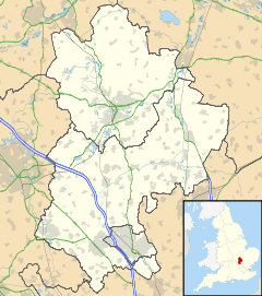
 Meppershall
Meppershall shown within BedfordshirePopulation 1,810 [1] OS grid reference TL140366 Unitary authority Central Bedfordshire Ceremonial county Bedfordshire Region East Country England Sovereign state United Kingdom Post town Shefford Postcode district SG17 Dialling code 01462 Police Bedfordshire Fire Bedfordshire and Luton Ambulance East of England EU Parliament East of England UK Parliament Mid Bedfordshire List of places: UK • England • Bedfordshire Meppershall is a hilltop village in Bedfordshire near Shefford, Campton, Shillington, Stondon and surrounded by farmland. The Village and the Manor House are mentioned in the Domesday book in 1086.
The Manor House belonged to the De Meppershall family for nearly 300 years following 1086, however the present house is early 17th century.
Until 1844 Meppershall was partially in Hertfordshire and Bedfordshire. The detached portion of Hertfordshire was transferred to Bedfordshire in 1844, following the Counties (Detached Parts) Act 1844.
St. Marys church dates back to the Normans. The Parish Records of St Mary, Meppershall, have been published on CD by the Parochial Church Council[2]
Before the advent of greenhouses, Meppershall was a very poor community with large families living in two up, two down type thatched cottages built of brick with stone floors. However so many greenhouses were built in the village that it was known as "glass city" growing salad crops for local markets and shipped further afield via the railway.
As well as farming the village earned its income from coprolite digging. Coprolite is the fossilised dung of pre-historic creatures, which when ground and treated with sulphuric acid produces a superphosphate fertiliser. To extract it a long trench was dug on one side of a field. The overlaying clay was then dug out until the nodule bed was reached. If the depth of clay to be removed was more than eight to nine feet, the trench was made in two or three steps and as the nodules were taken out, so the trench was re-filled with the earth already removed. The nodule bed was shovelled into barrows and taken to the washing mill. This consisted of a circular iron trough with a pivot in the centre to which a set of travelling rakes was attached, these being dragged round by horses and a constant stream of water was kept running through the trough until the clay washed off. The dirty water then was drained off and the nodules carted away. The coprolite was worth about £3 a ton in 1890, yielding some 300 tons per acre. A good fossil digger could earn as much as £2 a week. This industry has also died out.
References
- ^ Bedfordshire County Council, Population Estimates and Forecasts, estimate for 2007.
- ^ Parochial Church Council Information February 2011.
External links
Categories:- Villages in Bedfordshire


Wikimedia Foundation. 2010.