- Bridgeport, New Jersey
-
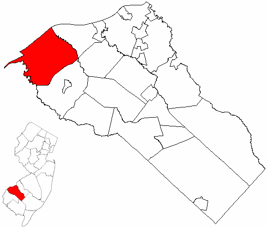
 Logan Township highlighted in Gloucester County. Inset map: Gloucester County highlighted in the State of New Jersey.
Bridgeport is an unincorporated area within Logan Township, located in Gloucester County, New Jersey. The area is served as United States Postal Service ZIP Code 08014.
As of the United States 2000 Census, the population for ZIP Code Tabulation Area 08014 was 635.
Contents
History
Bridgeport, along with Swedesboro, was one of only two settlements established in New Jersey as a part of the New Sweden colony, the fort at Nya Elfsborg having been abandoned. It was originally called New Stockholm, but the name was changed at a later date.[1] [2]
After the 2001 anthrax attacks, a facility was set up in Bridgeport using a linear accelerator from the Titan Corporation to irradiate federal mail.[3]
Geography
Bridgeport lies along the Delaware River at the mouth of the Raccoon Creek. US 322 enters New Jersey in Bridgeport via the Commodore Barry Bridge, and continues on to cross US 130 and Interstate 295 before leaving Logan Township. Route 44 is an old alignment of US 130, beginning at a point north of US 322. Unsigned Route 324 is an East-West state highway completely within Bridgeport, running from where a ferry used to take US 322 across the river to a dead end next to the current US 322. There is a private marina and a small airfield in town, and a railroad line crosses Raccoon Creek at the Conrail Railroad Bridge in Bridgeport at mile 2.0.
References
- ^ The Swedes and Finns in New Jersey (Federal Writers' Project of WPA. Bayonne, New Jersey: Jersey Printing Company, Inc. 1938)
- ^ Family Search.com: Map of Delaware Valley in 17th century showing forts & settlements with date of founding
- ^ Postmaster Asks Senate For Bailout Of $5 Billion, The Washington Post, November 9, 2001
External links
- Official Logan Township Website
- Census 2000 Fact Sheet for Zip Code Tabulation Area 08014 from the United States Census Bureau
Municipalities and communities of Gloucester County, New Jersey City 
Boroughs Clayton | Glassboro | National Park | Newfield | Paulsboro | Pitman | Swedesboro | Wenonah | Westville | Woodbury Heights
Townships Deptford | East Greenwich | Elk | Franklin | Greenwich | Harrison | Logan | Mantua | Monroe | South Harrison | Washington | West Deptford | Woolwich
CDPs Communities Almonesson | Bridgeport | Clarksboro | Cooper | Cross Keys | Ferrell | Franklinville | Greenfields Village | Harrisonville | Hurffville | Malaga | Mickleton | Monroeville | Mount Royal | New Brooklyn | Red Bank | Repaupo | Richwood | Sewell | Thorofare
Categories:- Populated places in Gloucester County, New Jersey
- Unincorporated communities in New Jersey

Wikimedia Foundation. 2010.