- Northcliffe, Western Australia
-
This article is about the town located in Australia. For the newspaper group, see Northcliffe Media.
Northcliffe
Western Australia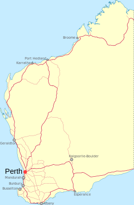
 Northcliffe
Population: 412 (2006 Census)[1] Established: 1923 Postcode: 6262 Elevation: 118 m (387 ft) Location: LGA: Shire of Manjimup State District: Blackwood-Stirling Federal Division: O'Connor Coordinates: 34°36′58″S 116°07′26″E / 34.616°S 116.124°E
Northcliffe is a town located in the lower South West region of Western Australia, about 28 kilometres (17 mi) south of the town of Pemberton. At the 2006 census, Northcliffe had a population of 412.[1]
It is largely surrounded by karri, marri and jarrah forest and is close to the Warren, D'Entrecasteaux and Shannon national parks. Primarily a farming area since Group Settlement, both logging and conservation interests are represented in Northcliffe.
The town was the centre of a Group Settlement Scheme in the 1920s, and was surveyed at the request of the Premier of Western Australia, James Mitchell in 1923. It became the terminus of the Bridgetown-Jarnadup railway, and was gazetted in May 1924. Mitchell named it after Lord Northcliffe, owner of The Times and the Daily Mail in London, and Director of Propaganda in the British government during World War I, who had died in 1922.[2]
Contemporary community organisations in Northcliffe include Northcliffe Pioneer Museum, Northcliffe Streetscape, Northcliffe Telecentre, Northcliffe Arts Association, Southern Forest Arts Association, Northcliffe Workers Club, Northcliffe Recreation Association, Northcliffe Visitor Centre and Northcliffe Town Hall.[3]
Locations of great natural beauty close to the town include Mt Chudalup (a granite monolith), Northcliffe Forest Park and the beaches of Windy Harbour. Sites of importance to Aboriginal people include Tookalup.[4]
The town boasts a primary/district high school, a Post Office, cafe, museum, recreation centre, town hall, hotel, gallery, a local supermarket, a public playground with barbecue and gazebo.[5]
A significant and well known local business is the Bannister Downs dairy. The dairy sells milk and related products in biodegradable containers through various local, regional and Perth-based outlets.[6][7]
Politics
Polling place statistics are presented below from the Northcliffe polling place in the federal and state elections as indicated.
2007 Federal Election
Source: AECLiberal 42.3% Labor 30.2% Greens 13.5% Independent 10.9% One Nation 2.42% 2004 Federal Election
Source: AECLiberal 49.7% Labor 24.6% Greens 18.6% One Nation 3.67% Democrats 1.13% 2001 Federal Election
Source: AECLiberal 41.1% Labor 22.9% Greens 16.3% One Nation 12.8% Democrats 3.69% 2005 State Election
Source: WAECLiberal 56.1% Labor 23.2% Greens 15.6% New Country 2.30% One Nation 1.79% 2001 State Election
Source: WAECLiberal 40.3% Greens 21.1% Labor 15.6% One Nation 13.9% Independent 7.19% 1996 State Election
Source: WAECLiberal 58.4% Labor 25.2% Democrats 9.51% CEC 6.94% References
- ^ a b Australian Bureau of Statistics (25 October 2007). "Northcliffe (State Suburb)". 2006 Census QuickStats. http://www.censusdata.abs.gov.au/ABSNavigation/prenav/LocationSearch?collection=Census&period=2006&areacode=SSC55121&producttype=QuickStats&breadcrumb=PL&action=401. Retrieved 23 July 2011.
- ^ Western Australian Land Information Authority. "History of country town names". http://www.landgate.wa.gov.au/corporate.nsf/web/History+of+country+town+names. Retrieved 2008-02-12.
- ^ Manjimup Shire Community Directory 2009/2010
- ^ Manjimup Shire Community Directory 2009/2010
- ^ Northcliffe Karri Pigeon community newspaper, various issues
- ^ Back of Bannister Downs milk carton
- ^ The West Australian newspaper, various editions featuring businesswoman Sue Daubney
Towns in the South West region of Western Australia Major centres Bunbury · Busselton · Collie · Dunsborough · Harvey · Manjimup · Margaret River
Towns Acton Park · Alexandra Bridge · Allanson · Augusta · Balingup · Benger · Binningup · Boyanup · Boyup Brook · Bramley · Bridgetown · Brookhampton · Brunswick Jn. · Burekup · Capel · Carbunup River · Chowerup · Cookernup · Cowaramup · Cundinup · Dardanup · Deanmill · Dingup · Dinninup · Donnelly River · Donnybrook · Elgin · Ferguson · Forest Grove · Forrest Beach · Gnarabup · Gracetown · Greenbushes · Hester · Jardee · Jarrahwood · Karridale · Kirup · Kudardup · Kulikup · Ludlow · Mayanup · Metricup · Mullalyup · Myalup · Nannup · Nornalup · Northcliffe · Nyamup · Pemberton · Peppermint Grove Beach · Prevelly · Quindalup · Quinninup · Roelands · Rosa Brook · Shotts · Stratham · Uduc · Vasse · Walpole · Waterloo · Wilga · Windy Harbour · Witchcliffe · Wokalup · Wonnerup · Worsley · Yallingup · Yarloop · Yornup
Categories:- Towns in Western Australia
- South West (Western Australia)

Wikimedia Foundation. 2010.