- Hærvejen
-
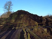 Hærvejen crossing the Dannevirke
Hærvejen (Danish, literally: the army road, German: Ochsenweg, literally: oxen way, Low German: Ossenpadd, literally: oxen path) is the name given to an ancient trackway in Denmark and Schleswig-Holstein. The route runs from Viborg via Flensburg to Hamburg, the territory of which it entered at Ochsenzoll ("oxen toll", "toll" in the meaning of "customs") and where it connected with other roads. It has been known by several other names throughout history, most importantly "the Cattle Road" (Studevejen) and "the Oxen Road" (Oksevejen / Ochsenweg).
Contents
History
 Povl's Bridge from 1744
The road runs more or less along the watershed of the Jutland Peninsula, similar to the ridgeways in England. By using this route one could avoid rivers, or ford them close to their origins where they were still shallow. As time went by this route was improved with paved fords, embankments and bridges. Concentrations of mounds, defensive ditches, settlements and other historic landmarks can be found along the road. While sections of it can be traced as far back as 4000 BC, newer road construction has erased many traces. Some of them show a width of up to 100 metres (330 ft).[1] The use of the road declined during the Viking age, as transportation by ship became more convenient. New cities were constructed along the coast instead of the road.
Two of Denmark’s oldest settlements, Viborg and Jelling are situated along the road.
In the southern, narrow part of the Jutish peninsula the trackway followed the edge of western marshes and eastern moraine country. Near Haderslev, Åbenrå, Flensburg, and Schleswig, it branched into western bypasses on the hills and accesses to the towns, each of them localized at the inner end of a long, narrow bay. One of the southern ends of the Ochsenweg has given its name to a suburb of Hamburg: Ochsenzoll is the locality of the ancient custom post.
Part of the tracks westerly bypassed Hamburg towards Wedel bei Hamburg or Blankenese,[2] where a ferry passing the Elbe connected to Cranz (then Prince-Archbishopric of Bremen[3]).[4] An easterly bypass headed for Zollenspieker Ferry (a Hamburg-Lübeckian condominium between 1420 and 1868[5]), passing the same river towards Hoopte in the then Principality of Lunenburg.[6] From south of the Elbe the cattle tracks continued up to Westphalia.[1]
Use
The road was primarily a trade road. The most important commodity was livestock (especially the eponymous oxen), but also amber, hides, honey and fur went south. Annually up to 50,000 head of cattle came along the oxen road.[1] Metal, glass and weapons went north. In spite of the most familiar Danish name, quite seldom it was used for military invasions, neither northwards, nor southwards.[citation needed] Nevertheless many defensive constructions can be found straddling the road up through Jutland.
Today
 A sign for the modern Danish Hærvejen walking route
Today modern highways follow the route of the old road. At a few places it is still possible to see the old tracks, embankments, sheep pens and fords. Parts of it have been converted into a long-distance walking route. A popular walk known as Hærvejsmarchen takes place each year. An international cycle route has been marked from the Elbe to Viborg.
External links
- [1] (Danish)
Notes
- ^ a b c Drunter oder drüber: Elbquerungen gestern und heute (Brochure on the exhibition in Staatsarchiv Hamburg between 30 October till 20 December 2002 on occasion of the opening of the 4th bore of the Elbe Tunnel), Joachim W. Frank (ed.), Hamburg: Staatsarchiv Hamburg / Amt für Geoinformation und Vermessung, 2002, p. 8. ISBN 3-89907-016-X
- ^ Blankenese became a part of Hamburg in 1937
- ^ Since 1648 Cranz belonged to the Duchy of Bremen, but forms a part of Hamburg since 1937.
- ^ Drunter oder drüber: Elbquerungen gestern und heute (Brochure on the exhibition in Staatsarchiv Hamburg between 30 October till 20 December 2002 on occasion of the opening of the 4th bore of the Elbe Tunnel), Joachim W. Frank (ed.), Hamburg: Staatsarchiv Hamburg / Amt für Geoinformation und Vermessung, 2002, p. 10. ISBN 3-89907-016-X
- ^ Since 1868 Zollespieker is a part of Hamburg.
- ^ Drunter oder drüber: Elbquerungen gestern und heute (Brochure on the exhibition in Staatsarchiv Hamburg between 30 October till 20 December 2002 on occasion of the opening of the 4th bore of the Elbe Tunnel), Joachim W. Frank (ed.), Hamburg: Staatsarchiv Hamburg / Amt für Geoinformation und Vermessung, 2002, p. 11. ISBN 3-89907-016-X
Part of a series on trade routes Amber Road · Hærvejen · Incense Route · Kamboja-Dvaravati Route · King's Highway · Roman-India routes · Royal Road · Salt Road · Siberian Route · Silk Road · Spice Route · Tea route · Varangians to the Greeks · Via Maris · Triangular trade · Volga trade route · Trans-Saharan trade · Old Salt Route · Hanseatic League · Grand Trunk RoadCategories:- International trade
- Trade routes
- Geography of Denmark
- Geography of Schleswig-Holstein
- History of Denmark
- History of Schleswig-Holstein
- Cycleways in Denmark
- Cycle paths in Schleswig-Holstein


Wikimedia Foundation. 2010.