- Colorado National Monument
-
Colorado National Monument IUCN Category III (Natural Monument)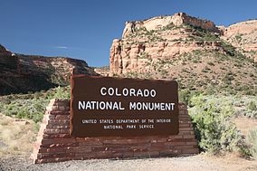

Location Mesa County, Colorado, USA Nearest city Grand Junction, CO Coordinates 39°02′33″N 108°41′10″W / 39.0425°N 108.68611°WCoordinates: 39°02′33″N 108°41′10″W / 39.0425°N 108.68611°W Area 20,534 acres (83.10 km2) Established May 24, 1911 Visitors 714,229 (in 2007) Governing body National Park Service  Monument Canyon
Colorado National Monument (locally referred to as The Monument) is a part of the National Park Service near the city of Grand Junction, Colorado. Spectacular canyons cut deep into sandstone and even granite–gneiss–schist rock formations, in some areas. This is an area of desert land high on the Colorado Plateau, with pinion and juniper forests on the plateau. The park hosts a wide range of wildlife, including red-tailed hawks and golden eagles, ravens, jays, desert bighorn sheep, and coyotes.[1] Activities include hiking, horseback riding, road bicycling, and scenic drives; a visitor center on the west side contains a natural history museum and gift shop. There are magnificent views from trails and the Rim Rock Drive, which winds along the plateau. Nearby are the Book Cliffs, and the largest flat-topped mountain in the world, the Grand Mesa.
Its feature attraction is Monument Canyon, which runs the width of the park, and includes rock formations such as Independence Monument, the Kissing Couple, and Coke Ovens. The monument includes 20,500 acres (32 square miles), much of which has been recommended to Congress for designation as wilderness.
Contents
Park history
The area was first explored by John Otto, a free spirit who settled in Grand Junction in the early 20th century. Prior to Otto's arrival, many area residents believed the canyons to be inaccessible to humans. Otto began building trails on the plateau and into the canyons.[2] As word spread about his work, the Chamber of Commerce of Grand Junction sent a delegation to investigate. The delegation returned praising both Otto's work and the scenic beauty of the wilderness area, and the local newspaper began lobbying to make it a National Park (which it never did become).
The area was established as Colorado National Monument on May 24, 1911. Otto was hired as the first park ranger, drawing a salary of $1 per month. For the next 16 years, he continued building and maintaining trails while living in a tent in the park.
The park became more well-known in the 1980s partly due to its inclusion as a stage of the major international bicycle race, the Coors Classic. The race through the park became known as "The Tour of the Moon", due to the spectacular landscapes the race passed through on Rim Rock Drive.
Climate
The Colorado National Monument sits on a large area of "High Desert" in Western Colorado. Summer temperatures are usually very hot, while winter temperatures can be generally cold at night. It does snow, but the snow usually melts very quickly in the dry and sunny climate of Colorado. Rainfall is scarce, and although the yearly precipitation averages are just above 10 inches, the exceedingly high evaporation rate classifies this area as desert land.
Climate data for Colorado National Monument Month Jan Feb Mar Apr May Jun Jul Aug Sep Oct Nov Dec Year Average high °F (°C) 37.4
(3.0)43.6
(6.4)52.9
(11.6)63.8
(17.7)74.1
(23.4)85.8
(29.9)91.9
(33.3)88.6
(31.4)79.8
(26.6)66.2
(19.0)49.2
(9.6)38.7
(3.7)64.3 Average low °F (°C) 19.0
(−7.2)23.4
(−4.8)30.0
(−1.1)37.7
(3.2)47.1
(8.4)56.5
(13.6)62.8
(17.1)60.1
(15.6)52.2
(11.2)41.1
(5.1)29.0
(−1.7)20.6
(−6.3)40.0 Precipitation inches (mm) 0.84
(21.3)0.68
(17.3)1.03
(26.2)0.94
(23.9)0.99
(25.1)0.66
(16.8)0.85
(21.6)1.25
(31.8)1.01
(25.7)1.14
(29)0.93
(23.6)0.78
(19.8)11.10
(281.9)Snowfall inches (cm) 9.3
(23.6)4.7
(11.9)4.7
(11.9)1.3
(3.3)0.1
(0.3)0
(0)0
(0)0
(0)0.1
(0.3)0.7
(1.8)3.6
(9.1)7.3
(18.5)31.8
(80.8)Source: www.wrcc.dri.edu/summary/climsmco.html [3] Trails
 The Coke Ovens Overlook is one of the many picturesque views in the park
The Monument contains many hiking trails, with lengths and difficulties to suit all tastes. Summer storms can cause flash floods as well as dangerous trail conditions. Rattlesnakes are found on the Monument, and rough terrain exists everywhere, but most trails are well-maintained. Winter cross-country skiing is occasionally possible on trails such as the Liberty Cap Trail.
Serpents Trail, perhaps the most popular, follows the route of the original road to the top of the Monument. This trail is accessible by parking lots at both ends, both located off Rim Rock Drive. Serpents Trail is well-maintained and provides stunning views of both the Monument itself and the Grand Valley below. One of the shortest trails, also popular, is Devil's Kitchen. The trailhead is located near the eastern entrance of the park on Rim Rock Drive. This trail is about 1 mile long, and ends in a sandstone grotto. Devil's Kitchen trail is well suited for families with smaller children, as the hike is short and the "kitchen" itself provides plenty of opportunity for child-sized exploration.
Liberty Cap trail starts from the valley floor and climbs to the rim of the Monument. Liberty Cap itself is an ancient sand dune, and provides a beautiful view of the Grand Valley. Corkscrew Trail, closed for many years but re-opened in mid-2006, branches off the Liberty Cap and skirts a small canyon and cliffs that cannot be seen from the valley floor. This trail, the only loop trail on the Monument, is about 3 miles long and features a less rigorous climb than Liberty Cap.
Monument Canyon trail, also popular, follows Monument Canyon for about 5 miles. This trail is often hiked up-and-back, and provides close-up views of Independence Monument, the Colorado National Monument's most distinct feature. The lower trailhead is accessible from CO 340 (Broadway).
No Thoroughfare Trail starts at the bottom of No Thoroughfare Canyon, near the east entrance. As the name implies, there is no official trail to the top of this canyon. The dead-end trail goes a few miles into the canyon, and up-and-back hiking is required. Some hikers have found a way to get through the entire canyon, but after a certain point the trail becomes difficult and unmarked. No Thoroughfare Canyon does have small waterfalls during the spring run-off, but is dry for most of the year.
Historic preservation
Many of the early visitor facilities at Colorado National Monument were designed by the National Park Service and constructed by the Public Works Administration and the Civilian Conservation Corps. Several of these areas have been placed on the National Register of Historic Places in recognition of this and in consequence of their adherence to the National Park Service Rustic design standards of the time. The entire Rim Rock Drive is a National Historic District, as well as the Serpents Trail, the Devils Kitchen Picnic Shelter, and three places in the Saddlehorn area: the Saddlehorn Caretaker's House and Garage, Saddlehorn Comfort Station, and the Saddlehorn Utility Area Historic District. The Visitor Center complex is also included as an example of the Mission 66 program.
Geology
The park's geologic record preserves three different groups of rock and sediment. The oldest rocks are Early to Middle Proterozoic gneiss and schist, including the Ute Canyon Stock. Overlying these, and separated by an angular unconformity, are mostly horizontally bedded Mesozoic sedimentary rocks, including the cliff-forming Wingate Sandstone. Overlying these are various types of Quaternary unconsolidated deposits such as alluvium, colluvium, and dunes. The sedimentary rocks are folded into monoclines by several faults, including the Redlands Thrust Fault.[4]
References
- ^ Colorado Division of Wildlife. http://wildlife.state.co.us/Education/TeacherResources/ColoradoWildlifeCompany/ColoradoNatlMonument.htm, accessed 8-03-09
- ^ Museum of Western Colorado. Grand Valley History, History Timeline. http://www.museumofwesternco.com/learn/grand-valley-history/history-timeline/?decade=1910. Accessed 8-03-09
- ^ http://www.wrcc.dri.edu/cgi-bin/cliMAIN.pl?cocolo
- ^ Scott, R.B., Harding, A.E., Hood, W.C., Cole, R.D., Livaccari, R.F., Johnson, J.B., Shroba, R.R. and Dickerson, R.P., 2001, Geologic map of the Colorado National Monument and adjacent areas, Mesa County, Colorado: U.S. Geological Survey, Geologic Investigations Series Map I-2740, scale 1:24000. [1]
External links
- Official National Parks Service site
- Colorado National Monument Association site
- Crescent Moon over Sentinel Spire (time-lapse video)
Protected Areas of the State of Colorado Federal National ParksNational MonumentsNational Recreation AreasNational Historic SitesNational Historic TrailsOld Spanish Trail · Pony Express Trail · Santa Fe TrailNational Scenic TrailContinental Divide TrailArapaho · Grand Mesa · Gunnison · Pike · Rio Grande · Roosevelt · Routt · San Isabel · San Juan · Uncompahgre · White RiverNational WildernessBlack Canyon of the Gunnison · Black Ridge Canyons · Buffalo Peaks · Byers Peak · Cache La Poudre · Collegiate Peaks · Comanche Peak · Dominguez · Eagles Nest · Flat Tops · Fossil Ridge · Great Sand Dunes · Greenhorn Mountain · Gunnison Gorge · Holy Cross · Hunter-Fryingpan · Indian Peaks · James Peak · La Garita · Lizard Head · Lost Creek · Maroon Bells-Snowmass · Mesa Verde · Mount Evans · Mount Massive · Mount Sneffels · Mount Zirkel · Neota · Never Summer · Platte River · Powderhorn · Ptarmigan Peak · Raggeds · Rawah · Sangre de Cristo · Sarvis Creek · South San Juan · Spanish Peaks · Uncompahgre · Vasquez Peak · Weminuche · West ElkNational Conservation AreasGunnison Gorge · McInnis CanyonsNational Wildlife RefugesAlamosa · Arapaho · Baca · Browns Park · Monte Vista · Rocky Flats · Rocky Mountain Arsenal · Two PondsState Arkansas Headwaters · Barr Lake · Bonny Lake · Boyd Lake · Castlewood Canyon · Chatfield · Cherry Creek · Cheyenne Mountain · Crawford · Eldorado Canyon · Eleven Mile · Golden Gate Canyon · Harvey Gap · Highline Lake · Jackson Lake · James M. Robb - Colorado River · John Martin Reservoir · Lake Pueblo · Lathrop · Lone Mesa · Lory · Mancos · Mueller · Navajo · North Sterling · Paonia · Pearl Lake · Ridgway · Rifle Falls · Rifle Gap · Roxborough · San Luis · Spinney Mountain · St. Vrain · Stagecoach · State Forest · Staunton · Steamboat Lake · Sweitzer Lake · Sylvan Lake · Trinidad Lake · Vega · Yampa RiverByers-Evans House · Colorado History Museum · El Pueblo · Fort Garland · Fort Vasquez · Georgetown Loop · Healy House Museum and Dexter Cabin · Pearce-McAllister Cottage · Pike Stockade · Trinidad History Museum · Ute Indian MuseumOther Beaver Meadows · Burlington Carousel · Black Hawk · Central City · Colorado Chautauqua · Cripple Creek · Durango-Silverton Railroad · Georgetown · Granada · Leadville · Lindenmeier Site · Lowry Ruin · Mesa Verde · Pikes Peak · Pike's Stockade · Raton Pass · Shenandoah-Dives Mill · Silver Plume · Silverton · Telluride · U.S. Air Force Academy Cadet AreaGarden of the Gods · Garden Park Fossil Area · Indian Springs Trace Fossil · Lost Creek Scenic Area · Morrison Fossil Area · Raton Mesa · Roxborough Park · Russell Lakes · Sand Creek · Slumgullion Earthflow · Spanish Peaks · Summit LakeAmerican Discovery Trail · Colorado Trail · Continental Divide Trail · Great Divide Trail · Kokopelli's Trail · Paradox Trail · Tabeguache TrailAlpine Loop · Cache la Poudre-North Park · Colorado River Headwaters · Dinosaur Diamond · Flat Tops · Frontier Pathways · Gold Belt · Grand Mesa · Guanella Pass · Highway of Legends · Lariat Loop · Los Caminos Antiguos · Mount Evans · Pawnee Pioneer · Peak to Peak · San Juan Skyway · Santa Fe Trail · Silver Thread · South Platte River Trail · Top of the Rockies · Trail of the Ancients · Trail Ridge · Unaweep/Tabeguache · West Elk LoopColorado Department of Natural Resources (web) National Register of Historic Places in Colorado National Monument Historic districts Colorado National Monument Visitor Center Complex | Rim Rock Drive Historic District | Saddlehorn Utility Area Historic District
NRHP properties Devils Kitchen Picnic Shelter | Saddlehorn Caretaker's House and Garage | Saddlehorn Comfort Station | Serpents Trail
See also: National Register of Historic Places listings in Colorado National Monument Categories:- IUCN Category III
- Colorado National Monument
- Geologic formations with imbedded sand dunes
- Protected areas established in 1911
- Protected areas of Mesa County, Colorado


Wikimedia Foundation. 2010.