Cittareale

Cittareale
Cittareale
—  Comune  —
Comune di Cittareale

Coat of arms
Cittareale is located in Italy
Cittareale
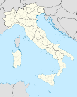
Location of Cittareale in Italy
Coordinates: 42°37′N 13°10′E / 42.617°N 13.167°E / 42.617; 13.167
Country Italy
Region Latium
Province Rieti (RI)
Frazioni Ara dei Colli, Bricca, Cagnerone, Ca Jenco, Cesetta, Collenasso, Collicelle, Conca, Folcara, Le Rose, Marianitto, Matrecciano, Mola Coletta, Pallottini, Santa Croce, Santa Giusta, Sacco, Scanzano, Sorecone, Trimezzo, Vetozza, Vezzano
Government
 - Mayor Giuseppe Fedele
Area
 - Total 58.8 km2 (22.7 sq mi)
Elevation 952 m (3,123 ft)
Population (30 April 2008[1])
 - Total 474
 - Density 8.1/km2 (20.9/sq mi)
Demonym Cittarealesi
Time zone CET (UTC+1)
 - Summer (DST) CEST (UTC+2)
Postal code 02010
Dialing code 0746
Website Official website

Cittareale is a comune (municipality) in the Province of Rieti in the Italian region Latium. It is located about 100 km northeast of Rome and 35 km northeast of Rieti.

Cittareale borders the following municipalities: Accumoli, Amatrice, Borbona, Cascia, Leonessa, Montereale, Norcia, Posta. The source of the Velino river are in the communal territory.

Cittareal is home to a large Rocca (castle), which had a strategical importance due to its position between the Kingdom of Naples and the Papal States. Its current appearance date to the reconstruction by the Aragonese in 1479. The church of St. Peter in Vetozza was built over a pre-existing temple dedicated to Vacuna, and later was owned by the Abbey of Farfa.

The Roman emperor Vespasian was born nearby.

References

  1. ^ All demographics and other statistics: Italian statistical institute Istat.


Wikimedia Foundation. 2010.

Игры ⚽ Нужно сделать НИР?

Look at other dictionaries:

  • Cittareale — Escudo …   Wikipedia Español

  • Cittareale — Cittareale …   Deutsch Wikipedia

  • Cittareale — Administration Pays  Italie Région …   Wikipédia en Français

  • Cittareale — Original name in latin Cittareale Name in other language Cittareale State code IT Continent/City Europe/Rome longitude 42.61624 latitude 13.15788 altitude 941 Population 482 Date 2012 02 15 …   Cities with a population over 1000 database

  • Falacrinae — (auch Vicus Phalacrinae) war eine antike Siedlung in Italien im Gebiet der Sabiner. Sie lag vermutlich beim Ortsteil Collicelle der heutigen italienischen Gemeinde Cittareale, wo seit 2005 unter der Leitung von Giovanna Alvino von der… …   Deutsch Wikipedia

  • Falacrinae — ( la. Vicus Phalacrinae; it. Falacrine) is a village of Ancient Rome that was the birthplace of the emperor Vespasian.LocationThe location of Falacrinae has been the subject of debate. The village is described as lying just beyond Reate (modern… …   Wikipedia

  • Accumoli — Accumoli …   Deutsch Wikipedia

  • Borbona — Borbona …   Deutsch Wikipedia

  • Burgen und Schlösser in Italien — Diese Liste führt Burgen und Burgruinen, Residenzen, Schlösser, Lustschlösser, Jagdschlösser und Schlossruinen sowie Villen, Adelssitze und Paläste in Italien auf (Alphabetisch nach Region, Provinz und Gemeinde). Beachte! Dies ist keine… …   Deutsch Wikipedia

  • Castel Sant'Angelo (Latium) — Castel Sant’Angelo …   Deutsch Wikipedia

Share the article and excerpts

Direct link
Do a right-click on the link above
and select “Copy Link”