- Metropolitan Borough of Solihull
-
Metropolitan Borough of Solihull — Metropolitan Borough — 
Coat of Arms of the Borough CouncilShown within West Midlands
Sovereign state United Kingdom Constituent country England Region West Midlands Administrative county West Midlands Founded Admin. HQ Solihull Government - Type Metropolitan borough - Leadership: Leader and cabinet - MPs: Lorely Burt (LD)
Caroline Spelman (C)Area - Total 68.8 sq mi (178.3 km2) Area rank 175th Population (2010 est.) - Total 206,100 - Rank Ranked 77th - Density 2,993.8/sq mi (1,155.9/km2) Time zone Greenwich Mean Time (UTC+0) - Summer (DST) British Summer Time (UTC+1) Postcode ISO 3166-2 ONS code 00CT OS grid reference NUTS 3 Ethnicity 91.8% White
4.2% South Asian
1.6% Mixed Race
1.5% Black British
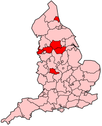
0.9% Chinese and other[1]Website solihull.gov.uk The Metropolitan Borough of Solihull is a metropolitan borough of the West Midlands, in west-central England. It is named after its largest town, Solihull, from which Solihull Metropolitan Borough Council is based. For Eurostat purposes it is a NUTS 3 region (code UKG32) and is one of five boroughs or unitary districts that comprise the "West Midlands" NUTS 2 region. Much of the large residential population in the north of the borough centres on the communities of Castle Bromwich, Chelmsley Wood, Fordbridge, Kingshurst, Marston Green and Smith's Wood. In the south are the towns of Solihull and Shirley.
Contents
History
Solihull probably derived its name from a 'miry or muddy' or soily hill. The parish church was built on a hill of stiff red marl, which turned to sticky mud in wet weather.
In 1894, Solihull (including the parishes of Shirley, Baddesley Clinton, Barston, Lapworth, Balsall, Bushwood, Elmdon, Knowle, Nuthurst, Packwood and Tanworth-in-Arden) was made into the Solihull Rural District in the county of Warwickshire. In 1932 some of its rural areas were taken away when the RDC was succeeded by Solihull Urban District Council. Expansion continued and Queen Elizabeth II granted a charter in 1954 making Solihull into a Municipal Borough; ten years later it was given the status of County Borough. Reorganisation of boundaries and council responsibilities in 1974 created the Metropolitan Borough of Solihull by the merger of the Solihull County Borough and most of the Meriden Rural District, which forms the main rural part of the borough and county. It included Balsall Common, Barston, Berkswell, Bickenhill, Castle Bromwich, Chelmsley Wood, Elmdon, Fordbridge, Hampton in Arden, Hockley Heath, Kingshurst, Knowle, Marston Green, Meriden, Olton, Smiths Wood, Solihull, Shirley and Temple Balsall.
In 1986 the Solihull borough effectively became a unitary authority when the West Midlands County Council was abolished. It remains part of the West Midlands for ceremonial purposes, and for functions such as policing, fire and public transport.
Geography
The borough is bordered by the M6 and the M40 and split by the M42 which divides the urban centre of the borough from the rural south and east. The borough’s transport links have led to a number of established large businesses being based in the borough, such as Land Rover, the National Exhibition Centre and Birmingham Airport. A short automatic light transport system links the airport to the nearby Birmingham International railway station. Around three quarters of the borough is greenbelt and a large proportion of that is worked farmland. The borough shares its boundaries with Birmingham to the west and north, Coventry to the east, Warwickshire to both the north and south and Worcestershire to the south west. The borough contains a sizeable rural area known as the Meriden Gap (after the village of Meriden) which serves as a green belt separating the Birmingham conurbation from the city of Coventry.
Council
See also: Solihull local electionsElections to the council are held in three out of every four years, with one third of the 51 seats on the council being elected at each election. Since the 2011 election The Conservative Party has had a majority on the council.
At the 2011 election to the council, the following members were returned:
Year Conservative Liberal Democrat Labour Green Independent 2011 29 12 6 3 1 However, on 16th May 2011 Liberal Democrat Howard Allen defected to the Green party giving them 4 seats and reducing the liberal democrats 11 For election purposes the council is divided up into the following wards based on civil parishes. Each ward is represented by three councillors:
- Bickenhill
- Blythe
- Castle Bromwich
- Chelmsley Wood
- Dorridge and Hockley Heath
- Elmdon
- Kingshurst and Fordbridge
- Knowle
- Lyndon
- Meriden
- Olton
- Shirley East
- Shirley South
- Shirley West
- Silhill
- Smith's Wood
- St Alphege
Coat of arms
The constituent parts of the borough's coat of arms are:
- Battlements, sickles and an oak tree with golden acorns, which represent the rural and agricultural nature of the Forest of Arden.
- The Black Griffin is taken from the arms of the Earls of Aylesford, who are associated with Meriden.
- The Silver Fleur-de-lys comes from the Digby family, who were associated with Fordbridge.
- The Black Greyhound is taken from the arms of the Greswolds, the family who built the 15th century house called the Manor House in the High Street, Solihull.
A stylised version of the coat of arms can be seen on the top left of Solihull Metropolitan Borough Council's website pages, and the official, heraldic version appears on a dedicated page on the same site - external links below.
Economy
This is a chart of trend of regional gross value added of Solihull at current basic prices published (pp. 240–253) by Office for National Statistics with figures in millions of British Pounds Sterling.
Year Regional Gross Value Added4 Agriculture1 Industry2 Services3 1995 1,929 12 496 1,421 2000 2,959 8 870 2,082 2003 4,023 8 1,121 2,893 ^1 includes hunting and forestry
^2 includes energy and construction
^3 includes financial intermediation services indirectly measured
^4 Components may not sum to totals due to rounding
Settlements in Solihull
- See also List of areas in Solihull
Localities in the borough include:
- Balsall, Balsall Common, Barston, Bentley Heath, Berkswell, Bickenhill, Blossomfield
- Castle Bromwich, Catherine-de-Barnes, Chadwick End, Chelmsley Wood, Cheswick Green, Coleshill Heath, Copt Heath
- Dickens Heath, Dorridge
- Elmdon, Elmdon Heath
- Fordbridge
- Hampton-in-Arden, Hockley Heath
- Kingshurst, Knowle
- Lyndon
- Marston Green, Meriden, Monkspath Street
- Olton
- Packwood
- Sharmans Cross, Shirley, Silhill, Smith's Wood, Solihull
- Temple Balsall, Tidbury Green
- Whitlock's End
Notable people
- Michael Buerk - BBC news presenter and journalist was born and educated in Solihull.
- 51 breaks - Indie Prog band formed in Solihull
- Richard Hammond - Top Gear presenter and radio presenter was born in Solihull.
- Jasper Carrott - Born and lived in the Solihull Area with his daughter Lucy Davis
- Martin Johnson - Rugby World Cup- winning England team captain and later their manager was born in Solihull.
References
External links
- Solihull Metropolitan Borough Council
- The official tourism website for the Solihull Borough
- Solihull's coat of arms
- Solihull Observer The Local Solihull Newspaper
Ceremonial county of West Midlands Metropolitan districts City of Birmingham · City of Coventry · City of Wolverhampton · Metropolitan Borough of Dudley · Metropolitan Borough of Sandwell · Metropolitan Borough of Solihull · Metropolitan Borough of WalsallMajor settlements Aldridge · Bilston · Birmingham · Blackheath · Bloxwich · Brierley Hill · Brownhills · Coseley · Coventry · Cradley Heath · Darlaston · Dudley · Fordbridge · Halesowen · Oldbury · Rowley Regis · Smethwick · Solihull · Stourbridge · Sutton Coldfield · Tipton · Walsall · Wednesbury · Wednesfield · West Bromwich · Willenhall · Wolverhampton
See also: West MidlandsRivers River Blythe · River Cole · River Penk · River Rea · Smestow Brook · River Sherbourne · River Sow · River Sowe · River Stour · River TameCanals Topics Black Country · Centro · Conservation areas · Coventry/Bedworth Urban Area · History of West Midlands County · Museums · West Midlands conurbationDistricts of the West Midlands Region Herefordshire 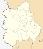
Shropshire Staffordshire Warwickshire West Midlands Birmingham · Coventry · Dudley · Sandwell · Solihull · Walsall · Wolverhampton
Worcestershire Bromsgrove · Malvern Hills · Redditch · Worcester · Wychavon · Wyre Forest
Categories:- Metropolitan boroughs
- Solihull
- Politics of Solihull
- Local government in the West Midlands (county)
- NUTS 3 statistical regions of the United Kingdom
- Local government districts of the West Midlands (region)


Wikimedia Foundation. 2010.