- Division No. 1, Newfoundland and Labrador
-
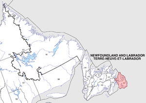
Division No. 1, Newfoundland and Labrador is a census division covering the entire Avalon Peninsula including the Isthmus of Avalon of the Canadian province of Newfoundland and Labrador. Like all census divisions in Newfoundland and Labrador, but unlike the census divisions of some other provinces, the division exists only as a statistical division for census data, and is not a political entity.
The area has the largest population of the province, totaling 248,418 in 2006. The total land area is 9,218.43 square kilometers. The coast of the Avalon Peninsula is inundated by four main bays and a number of smaller bays. The four main bays are; Trinity Bay, Conception Bay, St. Mary's Bay and Placentia Bay. The largest bay would be Placentia Bay.
The capital St. John's, of the province is located in this division along with the second largest of the three cities of the province, Mount Pearl. The majority of the towns and villages are located along the coast in much of the four main bays as mentioned.
Towns include: Admirals Beach, Aquaforte, Arnold's Cove, Avondale, Bauline, Bay Bulls, Bay Roberts, Bay de Verde, Bay Roberts, Biscay Bay, Bishop's Cove, Branch, Brigus, Bryant's Cove, Cape Broyle, Carbonear, Chance Cove, Chapel Arm, Clarke's Beach, Colinet, Colliers, Come By Chance, Conception Bay South, Conception Harbour, Cupids, Fermeuse, Ferryland, Flatrock, Fox Harbour, Gaskiers, Hant's Harbour, Harbour Grace, Harbour Main-Chapel's Cove-Lakeview, Heart's Content, Heart's Delight-Islington, Heart's Desire, Holyrood, Logy Bay-Middle Cove-Outer Cove, Long Harbour-Mount Arlington Heights, Mount Carmel-Mitcells Brook-St. Catherines, New Perlican, Norman's Cove-Long Cove, North River, Old Perlican, Paradise, Petty Harbour-Maddox Cove, Placentia, Point Lance, Point Kirwan, Portugal Cove South, Portugal Cove-St. Philip's, Pouch Cove, Renews, Riverhead, Salmon Cove, Small Point-Adam's Cove-Blackhead-Broad Cove, South River, Southern Harbour, Spaniard's Bay, St. Bride's, St. Joseph's, St. Mary's, St. Shott's, St. Vincent's-St. Stephen's-Peter's RIver, Sunnyside, Torbay, Trepassey, Upper Island Cove, Victoria, Wabana, Whitbourne, Whiteway, Winterton and Witless Bay.
Unorganized Subdivisions:
External links
- Division No. 1 Profile - Statistics Canada. 2002. 2001 Community Profiles. Released June 27, 2002. Last modified: 2005-11-30. Statistics Canada Catalogue no. 93F0053XIE
- Statistics Canada Map of Division
See also
 Subdivisions of Newfoundland and Labrador
Census divisions Cities Other communities Bishop's Falls · Bonavista · Botwood · Carbonear · Channel – Port aux Basques · Clarenville · Conception Bay South · Deer Lake · Ferryland · Fogo · Gander · Grand Bank · Grand Falls-Windsor · Happy Valley – Goose Bay · Harbour Grace · Hopedale · Labrador City · Marystown · Nain · Norris Arm · Pasadena · Peterview · Placentia · Red Bay · St. Anthony · Stephenville · Twillingate · Torbay · Woody Point · Makkovik Category:Newfoundland and Labrador ·
  Portal:Newfoundland and Labrador ·
  WikiProject:Newfoundland and LabradorCategories:

Wikimedia Foundation. 2010.