- Christmas Island Airport
-
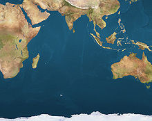
Christmas Island Airport IATA: XCH – ICAO: YPXM Summary Airport type Public Operator PDL Toll Location Christmas Island Elevation AMSL 916 ft / 279 m Coordinates 10°27.0′S 105°41.4′E / 10.45°S 105.69°ECoordinates: 10°27.0′S 105°41.4′E / 10.45°S 105.69°E Map Location on a map of the Indian Ocean Runways Direction Length Surface m ft 18/36 2,103 6,900 Asphalt Sources: Australian AIP,[1] DAFIF[2][3] Christmas Island Airport (IATA: XCH, ICAO: YPXM) is an airport located on Christmas Island,[2] a territory of Australia in the Indian Ocean. The island is located 2,600 kilometres (1,600 mi) northwest of the Western Australian city of Perth, 500 km (310 mi) south of the Indonesian capital, Jakarta, and 975 km (606 mi) east-northeast of the Cocos (Keeling) Islands.
Although located on Australian territory, the airport is classified as a Category 4 international airport for all arrivals, including those from Australia. It is owned by the Department of Transport and Regional Services (DOTARS), but is operated under contract by PDL Toll. The Government's decision to contract its airport operations in 2004 resulted in a reduction of the work force, which caused major industrial upheaval on a local basis, seeing Forte Airport Management, the contractor at the time, forced to defend in the Industrial Relations Commission its right to recruit staff under an Australian Workplace Agreement.[citation needed]
Contents
History
From the late 1940s, when the island was still a British colony administered by Singapore and the Straits Settlements Administration, it was serviced occasionally by RAF Short Sunderland flying boats before the construction of the airport. Landing at Christmas Island in flying boats was difficult, since there is no sheltered port. As a result, aircraft were sometimes damaged landing in the ocean swells, and had to wait for spare parts and engineers to come by plane.[citation needed]
"Tampa" crisis
A brief revival of the "old days" happened in 2001 during the "Tampa" crisis when the heightened RAAF traffic was complemented by a large number of DIMIA and media charters. During this incident, traffic at the airport is said to have been "near-continuous". Traffic relating to the processing of refugees and illegal immigrants has been frequent since the days of the "Tampa", and is set to continue with completion of the construction of a permanent processing centre on the island.[citation needed]
Satellite launch facility
After the closure of the casino, the Resort was taken over by the Asia Pacific Space Centre, which developed plans for a satellite launch facility on Christmas Island. The company, with solid financial participation from the Australian Government, had planned to start satellite launches in 2004. Technical staff was to include 350-400 Russian rocket scientists and engineers, and componentry was to be flown in on Antonov 124 and Boeing 747 freighters. To achieve this, the airport would need major extensions, and the Government allocated around A$55m to the task. This included a 600 m (1,969 ft) runway extension, plus additional taxiways, apron space, and other infrastructure, and resulted in a major review of the airport master plan, which is still current today. The master plan was reviewed on a "significant project" basis, and does not require structural review in the short term. For various reasons, the space project did not reach maturity, and the planned extensions were not carried out.[citation needed]
Facilities
Asia Pacific Airlines Boeing 727
The airport resides at an elevation of 916 feet (279 m) above mean sea level. It has one runway designated 18/36 with an asphalt surface measuring 2,103 by 45 metres (6,900 × 148 ft).[1][2]
The airport's location at the top of a hill, with a 2% mid-runway gradient, makes it a challenging landing for pilots.
Airlines and destinations
Airlines Destinations Virgin Australia Cocos (Keeling) Islands, Perth Traffic
Traffic to and from the airport varies greatly. The occasional charters from overseas airlines, such as Malaysia Airlines and SilkAir occur from time to time.[citation needed] Tourist attractions such as the migration of the Christmas Island red crab and the island's Christmas Island Resort have caused spikes in traffic levels. The construction of an immigration detention centre on the island resulted in a temporary increase in Royal Australian Air Force and Department of Immigration and Citizenship arrivals.[citation needed]
Statistics
Christmas Island Airport airport served 14,287 revenue passengers during financial year 2009-2010,[4] ranking it 85th amongst airports in Australia.
Annual passenger and aircraft statistics for Christmas Airport[4] Year Revenue passengers Aircraft movements 2001-02 6,5152292002-03 8,7783032003-04 7,5042492004-05 8,1252552005-06 8,0932562006-07 8,0722622007-08 8,5944122008-09 6,6652462009-10 14,287395See also
References
- ^ a b YPXM – CHRISTMAS ISLAND (PDF). AIP En Route Supplement from Airservices Australia, effective 25 August 2011
- ^ a b c Airport information for YPXM from DAFIF (effective October 2006)
- ^ Airport information for XCH at Great Circle Mapper. Source: DAFIF (effective Oct. 2006).
- ^ a b "Airport Traffic Data 1985-86 to 2009-10". Bureau of Infrastructure, Transport and Regional Economics (BITRE). June 2010. http://www.bitre.gov.au/info.aspx?ResourceId=191&NodeId=96. Retrieved 29 July 2011.
External links
Categories:- Airports in territories of Australia
- Christmas Island
Wikimedia Foundation. 2010.


