- Kotyli
-
For other uses, see Kotyli (disambiguation).
Kotyli
ΚοτύληLocation 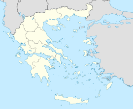
 Kotyli
Coordinates 41°20′N 24°53′E / 41.333°N 24.883°ECoordinates: 41°20′N 24°53′E / 41.333°N 24.883°E Location within the peripheral unit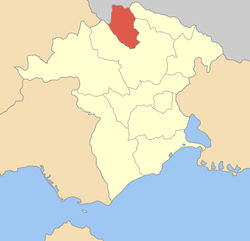
Government Country: Greece Region: East Macedonia and Thrace Regional unit: Xanthi Municipality: Myki Mayor: Mustafa Homko Population statistics (as of 2001) Municipal unit - Population: 2,331 Other Time zone: EET/EEST (UTC+2/3) Auto: AH Kotyli (Greek: Κοτύλη; Turkish: Kozluca; Bulgarian: Козлуджа, Kozludzha) is a former community in the Xanthi peripheral unit, East Macedonia and Thrace, Greece. Since the 2011 local government reform it is part of the municipality Myki, of which it is a municipal unit.[1] Population 2,331 (2001). The community consists of the settlements Kotyli, Aimoni, Dimari and Pachni.
See also
References
- ^ Kallikratis law Greece Ministry of Interior (Greek)
Municipal unit of Kotyli KotyliMunicipal unit of Myki Municipal unit of Satres Municipal unit of Thermes Categories:- Populated places in Xanthi (peripheral unit)
- East Macedonia and Thrace geography stubs


Wikimedia Foundation. 2010.