- Aichi Prefecture
-
For the company, see Aichi Steel Corporation.
Aichi Prefecture Japanese transcription(s) – Japanese 愛知県 – Rōmaji Aichi-ken 
Symbol of Aichi Prefecture
Coordinates: 35°10′48.68″N 136°54′48.63″E / 35.1801889°N 136.9135083°ECoordinates: 35°10′48.68″N 136°54′48.63″E / 35.1801889°N 136.9135083°E Country Japan Region Chūbu Island Honshū Capital Nagoya Government – Governor Hideaki Ōmura (since February 2011) Area – Total 5,153.81 km2 (1,989.9 sq mi) Area rank 28th Population (February 1, 2011) – Total 7,408,640 – Rank 4th – Density 1,437.51/km2 (3,723.1/sq mi) ISO 3166 code JP-23 Districts 7 Municipalities 54 Flower Kakitsubata (Iris laevigata) Tree Hananoki (Acer pycnanthum) Bird Scops-owl (Otus scops japonicus) Fish Kuruma prawn (Penaeus japonicus) Website pref.aichi.jp/global/en Aichi Prefecture (愛知県 Aichi-ken) is a prefecture of Japan located in the Chūbu region.[1] The region of Aichi is also known as the Tōkai region. The capital is Nagoya. It is the focus of the Chūkyō Metropolitan Area.[2]
Contents
History
Originally, the region was divided into the two provinces of Owari and Mikawa.[3] After the Meiji Restoration, Owari and Mikawa were united into a single entity. In 1871, after the abolition of the han system, Owari, with the exception of the Chita Peninsula, was established as Nagoya Prefecture, while Mikawa combined with the Chita Peninsula and formed Nukata Prefecture. Nagoya Prefecture was renamed to Aichi Prefecture in April 1872, and was united with Nukata Prefecture on November 27 of the same year.
The government of Aichi Prefecture is located in the Aichi Prefectural Government Office in Nagoya, which is the old capital of Owari.
The Expo 2005 World Exposition was held in Seto and Nagakute.
The name 'Aichi'
In the third volume of the Man'yōshū there is a poem by Takechi Kurohito 'The cry of the crane, calling to Sakurada; it sounds like the tide, draining from Ayuchi flats, hearing the crane cry'. Ayuchi is the original form of the name Aichi, and the Fujimae tidal flat is all that remains of the earlier Ayuchi-gata. It is now a protected area.[4][5]
For a time, an Aichi Station stood on the JR Central Kansai Line (at the time the Kansai Railway) between Nagoya and Hatta stations, but its role was overtaken by the Sasashima Live station on the Aonami Line and the Komeno Station on the Kintetsu Nagoya Line.
Geography
Located near the center of the Japanese main island of Honshū, Aichi Prefecture faces the Ise and Mikawa Bays to the south and borders Shizuoka to the east, Nagano to the northeast, Gifu to the north, and Mie to the west. It measures 106 km east to west and 94 km south to north and forms a major portion of the Nōbi Plain. With 5,153.81 km² it accounts for approximately 1.36% of the total surface area of Japan. The highest spot is Chausuyama at 1,415 m above sea level.
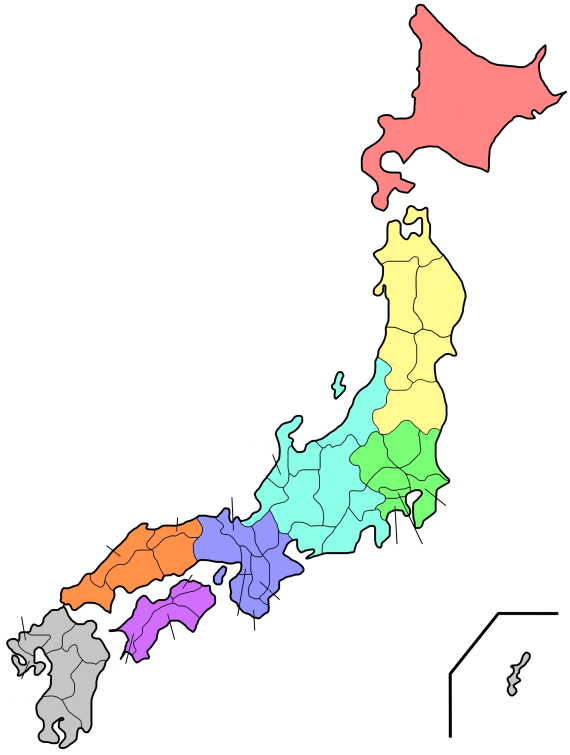
 Map of Aichi Prefecture.
The western part of the prefecture is dominated by Nagoya, Japan's fourth largest city, and its suburbs, while the eastern part is less densely populated but still contains several major industrial centers. Due to its robust economy, for the period from October 2005 to October 2006, Aichi was the fastest growing prefecture in terms of population, beating Tokyo, at 7.4 per cent.
Cities
Thirty-Seven cities are located in Aichi Prefecture:
Towns and villages
Towns and villages in each district:
Mergers
Main article: List of mergers in Aichi PrefectureEconomy
Aichi's industrial output is higher than any other prefecture in Japan: the prefecture is known as the center of Japan's automotive and aerospace industries. Companies headquartered in Aichi include:
Aisin Seiki Kariya Brother Industries, Ltd. Nagoya Central Japan Railway Company Nagoya Denso Corporation Kariya Makita Corporation Anjō Matsuzakaya Nagoya Nagoya Railroad Nagoya Nippon Sharyo Nagoya Noritake Nagoya Toyota Motor Corporation Toyota Companies such as Fuji Heavy Industries, Mitsubishi Motors, Pfizer, Sony, Suzuki, Bodycote, and Volkswagen Group also operate plants and/or branch offices in Aichi.
Demographics
As of 2001, Aichi Prefecture's population was 50.03% male and 49.97% female. 139,540 residents (nearly 2% of the population) are of foreign nationality.
Population by age (2001) Age % Population % Male % Female 0 - 9 10.21 10.45 9.96 10 - 19 10.75 11.02 10.48 20 - 29 15.23 15.71 14.75 30 - 39 14.81 15.31 14.30 40 - 49 12.21 12.41 12.01 50 - 59 15.22 15.31 15.12 60 - 69 11.31 11.22 11.41 70 - 79 6.76 6.01 7.52 over 80 3.12 2.01 4.23 unknown 0.38 0.54 0.23 Sports
 Aichi Prefectural Government Office
The sports teams listed below are based in Aichi.
Football (soccer)
- Nagoya Grampus (Nagoya)
- F.C. Kariya (Kariya)
Baseball
- Chunichi Dragons (Nagoya)
Volleyball
- Toyoda Gosei Trefuerza (Nishikasugai District)
- Denso Airybees (Nishio)
- Toyota Auto Body Queenseis (Kariya)
Rugby
Tourism
Notable sites in Aichi include the Meiji Mura open-air architectural museum in Inuyama, which preserves historic buildings from Japan's Meiji and Taishō periods, including the reconstructed lobby of Frank Lloyd Wright's old Imperial Hotel (which originally stood in Tokyo from 1923 to 1967).
Other sites in Aichi include the tour of the Toyota car factory in the city by the same name, the monkey park in Inuyama, and the castles in Nagoya, Okazaki, Toyohashi, and Inuyama.
Because of Aichi's location along the Eastern seacoast, there are some scenic spots, but other than the Atsumi Peninsula surf beaches there are no significant beach destinations when compared to neighboring Shizuoka Prefecture. Most attractions are man-made destinations, dealing with the region's history or modern marvels.
Notes
 Satellite picture of Mikawa Bay.
- ^ Nussbaum, Louis-Frédéric. (2005). "Aichi-ken" Japan Encyclopedia, p. 11 at Google Books; "Chūbu" Japan Encyclopedia, p. 126 at Google Books.
- ^ Nussbaum, "Nagoya" p. 685 at Google Books.
- ^ Nussbaum, "Provinces and prefectures" Japan Encyclopedia, p. 780 at Google Books.
- ^ "Summary of Aichi Prefecture". Aichi Prefecture. http://www.pref.aichi.jp/global/en/summary/profile/background.html. Retrieved 23 March 2011.
- ^ Kato, Sadamichi (2000). "Rediscovering an Ancient Poem to Save a Tidal Flat". International Studies in Literature and Environment (Oxford University Press) 7 (2): 189–197.
References
- Nussbaum, Louis-Frédéric and Käthe Roth. (2005). Japan encyclopedia. Cambridge: Harvard University Press. 10-ISBN 0-674-01753-6; 13-ISBN 978-0-674-01753-5; OCLC 58053128
External links
- Aichi travel guide from Wikitravel
- Official Aichi Prefecture homepage
- Aichi Prefectural Tourist Association
 Aichi Prefecture
Nagoya (capital city) 
Other cities Aichi District Ama District Chita District Kitashitara District Nishikasugai District Niwa District Nukata District Regions and administrative divisions of  Japan
JapanRegions 
Prefectures Hokkaido Tōhoku Kantō Chūbu Kansai Chūgoku Shikoku Kyushu Categories:


Wikimedia Foundation. 2010.