Mbomou River

Mbomou River
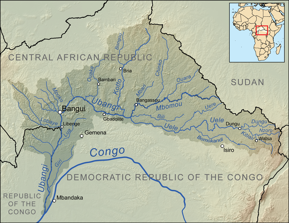
Map showing the Mbomou River within the Ubangi River drainage basin.

The Mbomou River or Bomu (also spelled M'bomou in French) forms part of the boundary between the Central African Republic (CAR) and the Democratic Republic of the Congo (DRC).

The Mbomou merges with the Uele River to form the Ubangi River. The Ubangi, a tributary of the Congo, also serves as part of the border between the CAR and the DRC.


Coordinates: 4°07′44″N 22°26′10″E / 4.129°N 22.436°E / 4.129; 22.436


Wikimedia Foundation. 2010.

Игры ⚽ Нужен реферат?

Look at other dictionaries:

  • Mbomou — can also refer to the Mbomou River. Mbomou is one of the 14 prefectures of the Central African Republic. It covers an area of 61,150 km² and has a population of 132,740 (2003 census), giving a population density of only 2.2 inhabitants/km². The… …   Wikipedia

  • Bomu River — River, central Africa. Flowing west, it forms the boundary between northern Congo and southern Central African Republic (where it is called the Mbomou). It flows in a wide 500 mi (800 km) curve through savannas to join the Uele River and form the …   Universalium

  • Ubangi River — This article is about the African river. For misuse of Ubangi for African women with lip plates, see Lip plate#Ubangi misnomer. Map showing the Ubangi River drainage basin …   Wikipedia

  • Congo River — The Congo River River The Congo River near Mossaka …   Wikipedia

  • Kwango River — Coordinates: 3°14.666′S 17°22.416′E / 3.244433°S 17.3736°E / 3.244433; 17.3736 …   Wikipedia

  • Aruwimi River — Coordinates: 1°13′24″N 23°35′39″E / 1.223209°N 23.594298°E / 1.223209; 23.594298 …   Wikipedia

  • Chari River — Map showing the Chari River drainage basin. Chari …   Wikipedia

  • Ouham River — Coordinates: 9°18′59″N 18°13′35″E / 9.31639°N 18.22639°E / 9.31639; 18.22639 …   Wikipedia

  • Nana Barya River — Coordinates: 7°58′43″N 17°43′35″E / 7.97861°N 17.72639°E / 7.97861; 17.72639 …   Wikipedia

  • Chiloango River — The Chiloango River (Portuguese: Rio Chiluango) is a river in western Central Africa. It forms the western most part of the border between the Democratic Republic of the Congo and the Republic of Congo, and then forms approximately half of the… …   Wikipedia

Share the article and excerpts

Direct link
Do a right-click on the link above
and select “Copy Link”