- Dales & District
-
Dales & District 
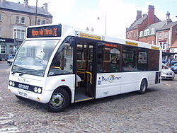
A Dales & District Optare Solo.Parent Procters Coaches Headquarters Northallerton Service area North Yorkshire Service type Bus Routes 33 Destinations Darlington, Northallerton, Thirsk Web site Dales & District website Dales & District is a bus operator based in North Yorkshire, England.[1] Owned by Procters Coaches it has its main depot at Leeming Bar by the side of the A1.[2]
The company's original network included services up Wensleydale and around Northallerton. Following the announcement by Arriva North East that they were to close their depot in Richmond and stop running many rural services in the area Dales & District agreed to take on the operation of most of the council-funded rural services. This move saw a huge expansion in Dales & Districts operations with a large increase in the number of vehicles causing local disagreement due to the overnight storage of buses outside their Leeming Bar depot until it can be expanded. However, Dales & District has become the main bus operator for the north-west of North Yorkshire, including services to Darlington.
It operates the 73 service which provides a bus link for passengers on the Wensleydale Railway between their terminus at Leeming Bar railway station and mainline services at Northallerton railway station. From April 2010, the company took over the running of the 767 service from Harrogate to Leeds Bradford Airport from Harrogate and District[3], although the service only lasted a year, before being withdrawn due to budget cuts at North Yorkshire County Council [4]
Contents
Routes
Route Destination 29 Richmond - Aldbrough - Darlington 30 Richmond - Swaledale 31
31A
31B
31CRichmond Town Services 32 Richmond - Hudswell 34
X34Richmond - Catterick Village - Darlington 53 RAF Leeming - Leeming Village - Morton on Swale - Ainderby Steeple - Northallerton 54 Richmond - Catterick Garrison - Catterick Bridge - Catterick Village - Kirkby Fleetham - Great Fencote - Scruton - Morton on Swale - Northallerton 55 Richmond - Brompton on Swale - Scorton - Bolton on Swale - Great Langton - Yafforth - Northallerton 70 Northallerton - Thirsk - Ripon 70A
71
74
74A
75Northallerton Town Service 72 Northallerton - Brompton - Hurworth - Darlington 73 Richmond - Bedale - Northallerton 136 Ripon - Wath - Melmerby Business Park 138 Ripon - Galphay - Kirkby Malzeard - Masham 139 Ripon - Fountain's Abbey Circular Service 144 Bedale - Snape - Masham 146 Thirsk Station Link 148
149Thirsk - Sowerby (149) - Topcliffe (148) - Topcliffe - Asenby - Busby Stoop (149) - Sowerby (148) - Thirsk 151 Thirsk - Ripon 152 Thirsk - Hambleton 153 Thirsk - Northallerton 155 Thirsk - Norby Estate 156 Bedale - Leyburn - Aysgarth - Hawes - Gayle 157 Bedale - Leyburn - Redmire - Hawes - Gayle 856 Wensleydale Flyer: Northallerton - Bedale - Leyburn - Aysgarth - Hawes Major locations served
- Askrigg
- Aysgarth
- Bedale
- Catterick Garrison
- Darlington
- Hawes
- Leyburn
- Manfield
- Masham
- Muker
- Northallerton
- RAF Leeming
- Reeth
- Richmond
- Ripon
- Thirsk
- Thornton Rust[5]
See also
References
- ^ "Show Bus Operator Details for Dales and District". Carlberry.co.uk. http://www.carlberry.co.uk/op/Dales_and_District_Leeming_Bar.htm. Retrieved 8 May 2009.
- ^ "Dales and District Page". Procters Coaches. http://procterscoaches.co.uk/dales.php. Retrieved 17 April 2011.
- ^ "Airportxpress Route 767". Harrogate and District. http://www.harrogatebus.co.uk/news.jsp?newsID=19. Retrieved 5 March 2010.
- ^ "Britain has no choice over EU bailout". Yorkshire Post. http://www.yorkshirepost.co.uk/news/debate/your-letters/britain_has_no_choice_over_eu_bailout_1_3253558. Retrieved 17 April 2011.
- ^ "Dales & District bus services - Summary". getdown.org.uk. http://getdown.org.uk/bus/search/dales-district.shtml. Retrieved 8 May 2009.
External links
Bus companies based in Yorkshire and the Humber East Riding of Yorkshire 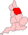
North Lincolnshire North Yorkshire Arriva Yorkshire · Connexionsbuses · Dales & District · First York (York park and ride) · Harrogate & District · Transdev York · York Pullman · Yorkshire Coastliner
South Yorkshire (PTE) Arriva Yorkshire · First South Yorkshire · Sheffield Community Transport · Stagecoach Sheffield · Stagecoach Yorkshire · Tates Travel · TM Travel · Veolia Transport
West Yorkshire (PTE) Arriva Yorkshire · Centrebus Holdings (K-Line, The Huddersfield Bus Company) · First West Yorkshire (First Bradford, First Calderdale & Huddersfield, First Leeds) · Geldards Coaches · Halifax Joint Committee · Harrogate & District · JJ Longstaff and Sons · Keighley & District · Stotts Coaches · Yorkshire Coastliner
National Categories:- Transport in North Yorkshire
- Bus operators in England


Wikimedia Foundation. 2010.