- Wicklow
-
For other uses, see Wicklow (disambiguation).
Wicklow
Cill Mhantáin— Town — Farmland and view of Wicklow Town

Coat of armsLocation in Ireland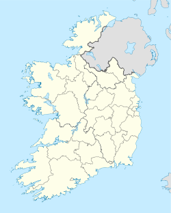
 Wicklow
Coordinates: 52°58′40″N 6°01′59″W / 52.9779°N 6.033°WCoordinates: 52°58′40″N 6°01′59″W / 52.9779°N 6.033°W Country Ireland Province Leinster County County Wicklow Elevation 69 m (226 ft) Population (2006) – Urban 6,930 – Rural 3,140 Irish Grid Reference T312940 Website wicklow.ie Wicklow, Irish: Cill Mhantáin, meaning "church of the toothless one"[1][2]) is the county town of County Wicklow in Ireland. Located south of Dublin on the east coast of the island, it has a population of 10,070 according to the 2006 census.[3] The town is situated to the east of the N11 route between Dublin and Wexford. Wicklow is also connected to the rail network, with Dublin commuter services now extending to the town. Additional services connect with Arklow, Wexford and Rosslare Europort, a main ferry port. There is also a commercial port, mainly importing timber and textiles.
Contents
Toponymy
Old mentions : Wykinglo in 1173, Wygingelow in 1185, Wykinglo in 1192, Wykinglowe in 1355.[4][5]
The Swedish toponymist Magne Oftedal[6] criticises the usual explanation : Old Norse Vikingr "Viking" or male's name Viking and Old Norse ló "meadow", that is to say « The Vikings'meadow » or « Viking's meadow »
He notices that -lo was never used outside Norway (cf. Oslo) and Scandinavia. Furthermore, this word is almost never combined with a male's name or a general word meaning "a category of person". Moreover, "Viking" never appears in toponymic records. For him, the first element can be explained as Uikar- or Uik- "bay" in Old Norse and the intermediate N of the old forms is a mistake by the clerks.
However, all recorded forms show this N. That is the reason why Liam Price[7] says it is probably a Norwegian place-name and A. Sommerfelt[8] gives it as a former Vikinga-ló et understands it as "the Vikings' meadow". Nevertheless, the Irish patronimics Ó hUiginn et Mac Uiginn (English O'Higgins et Maguigan) could bring a key for the meaning "Meadow of a man called Viking".[9]
Wykinglo was the usual name used by the Viking sailors and the traders who travelled around the Anglo-Scandinavian world. De facto, the Normans and the Anglo-Normans who conquered Ireland, only knew this name, that became finally the most popular one. The Normans, who invaded and came to dominate the area, preferred the non-Gaelic place-name. Although the anglicised name Kilmantan[10] was used for a time, it gradually fell out of use.
The origin of the Irish name Cill Mhantáin bears no relation to the name Wicklow. It has an interesting folklore of its own. Saint Patrick and some followers are said to have tried to land on Travailahawk beach, to the south of the harbour. Hostile locals attacked them, causing one of Patrick's party to lose his front teeth. Manntach (toothless one), as he became known, was undeterred and returned to the town, eventually founding a church.[citation needed] Hence Cill Mhantáin, meaning "church of the toothless one". However there is no evidence, material or written, for the existence of such a local holy man.[citation needed]
History
 Main Street
Local history contends that the town of Wicklow was founded by the Vikings, probably around 795 AD. However, given the area's natural harbour and fertile hinterland, it is likely that a small settlement existed before the Vikings landed.[11]
The Norman influence can still be seen today in some of the town's place and family names. After the Norman invasion, Wicklow was granted to Maurice FitzGerald who set about building the 'Black Castle', a land-facing fortification that lies ruined on the coast immediately south of the harbour. The castle was briefly held by the local O'Byrne, the O'Toole and Kavanagh clans[12] in the uprising of 1641 but was quickly abandoned when English troops approached the town. Sir Charles Coote, who led the troops is then recorded as engaging in "savage and indiscriminate" slaughter of the townspeople in an act of revenge.[13] Local oral history contends that one of these acts of "wanton cruelty" was the entrapment and deliberate burning to death of an unknown number of people in a building in the town. Though no written account of this particular detail of Coote's attack on Wicklow is available, a small laneway, locally referred to as "Melancholy Lane", is said to have been where this event took place.
Though the surrounding County of Wicklow is rich in bronze age monuments, the oldest surviving settlement in the town is the Franciscan Abbey (ruined). This is located at the west end of Main Street, within the gardens of the local Roman Catholic parish grounds. Other notable buildings include the Town Hall and the Gaol, built in 1702 and recently renovated as a heritage centre and tourist attraction. The East Breakwater, arguably the most important building in the town, was built in the early 1880s by Wicklow Harbour Commissioners. The architect was William George Strype and the builder was John Jackson of Westminster. The North Groyne was completed by about 1909 - John Pansing was the designer and Louis Nott of Bristol the builder. The Gaol was a place of execution up to the end of the 19th century and it was here that Billy Byrne, a leader of the 1798 rebellion, met his end in 1799. He is commemorated by a statue in the town square. The gaol closed in 1924 and is today a tourist attraction with living displays and exhibits.[14]
At Fitzwilliam Square in the centre of Wicklow town is an obelisk commemorating the career of Captain Robert Halpin, commander of the telegraph cable ship Great Eastern, who was born in Wicklow in 1836.[11]
Geography
Wicklow town forms a rough semicircle around Wicklow harbour. To the immediate north lies 'The Murrough', a popular grassy walking area beside the sea, and the eastern coastal strip. The Murrough is a place of growing commercial use, so much so that a road by-passing the Town directly to the commercial part of the area commenced construction in 2008 and was completed in summer of 2010. The land rises into rolling hills to the west. The dominant feature to the south is the rocky headlands of Bride's Head and 'Wicklow Head', the easternmost mainland point of the Republic of Ireland.
Economy
 Wicklow Harbour
 A boat in Wicklow Harbour
Since 1995, the town has undergone significant change and expansion reflecting the simultaneous growth in the Irish economy. Considerable residential development has taken place to the west of the town along Marlton Road (R751). More recently, housing developments have been concentrated to the northwest of the town towards the neighbouring village of Rathnew. The completion of the Ashford/Rathnew bypass in 2004 has meant that Wicklow is now linked to the capital, Dublin, lying 42 km to the north, by dual carriageway and motorway. These factors have led to a steady growth in population of Wicklow and its surrounding townlands while its importance as a commuter town to Dublin increases.
See also
References
- ^ Camille DeAngelis. Moon Ireland, Avalon Travel, 2007, ISBN 1598800485, p111
- ^ Seán Connors. Mapping Ireland: from kingdoms to counties, Mercier Press, 2001, ISBN 1856353559, p45
- ^ Population CSO 2006
- ^ Liam Price, The Place-Names of the Barony of Newcastle, p. 171.
- ^ Donall Mac Giolla Easpaig, L'influence scandinave sur la toponymie irlandaise in L'héritage maritime des Vikings en Europe en l'ouest, Colloque international de la Hague, Presses universitaire de Caen 2002. p. 467 et 468. Translation Jacques Tranier.
- ^ Scandinavian Place-Names in Ireland in Proceedings of the Seventh Viking Congress (Dublin 1973), B. Alquist and D. Greene Editions, Dublin, Royal Irish Academy 1976. p. 130.
- ^ Price p. 172.
- ^ The English forms of the Names of the Main Provinces of Ireland, in Lochlann. A Review of Celtic Studies. IA. Sommerfelt Editions, Trad. ang. of Oslo University Press 1958. p. 224.
- ^ Mac Giolla Easpaig p. 468
- ^ Placenames Database of Ireland - Wicklow: Archival records
- ^ a b The illustrated road book of Ireland. Automobile Association. 1970.
- ^ Wills, James Lives of illustrious and distinguished Irishmen. MacGregor, Polson, 1840, p. 449.
- ^ Wills, James Lives of illustrious and distinguished Irishmen. MacGregor, Polson, 1840, p. 448.
- ^ S Shepherd et al. (1992). Illustrated guide to Ireland. Reader's Digest.
Bibliography
- Cleary, J and O'Brien, A (2001) Wicklow Harbour: A History, Wicklow Harbour Commissioners
External links
Places in County Wicklow County town: WicklowTowns - Arklow
- Bray
- Greystones
- Wicklow
Villages - Aghavannagh
- Annamoe
- Ashford
- Aughrim
- Avoca
- Ballinaclash
- Baltinglass
- Blessington
- Carnew
- Charlesland
- Coolafancy
- Coolboy
- Delgany
- Donard
- Dunlavin
- Enniskerry
- Glendalough
- Glenealy
- Grangecon
- Greenan
- Hollywood
- Kilcoole
- Killincarrig
- Kilmacanogue
- Kilpedder
- Kilquade
- Kiltegan
- Knockananna
- Lacken
- Laragh
- Newcastle
- Newtownmountkennedy
- Rathdangan
- Rathdrum
- Rathnew
- Redcross
- Roundwood
- Shillelagh
- Stratford-on-Slaney
- Tinahely
- Valleymount
- Woodenbridge
Townlands - List of townlands in County Wicklow
- Category:Mountains and hills of County Wicklow
- Category:Rivers of County Wicklow
- Category:Geography of County Wicklow
Categories:- Wicklow (town)
- Towns and villages in County Wicklow
- Port cities and towns in the Republic of Ireland
- County towns in the Republic of Ireland


Wikimedia Foundation. 2010.