- Mount Bulusan
-
Bulusan Volcano Mount Bulusan 
Bulusan volcano seen here from the west.Elevation 1,565 m (5,135 ft) [1] Prominence 1,547 m (5,075 ft) [citation needed] Listing Ultra Location Luzon, Philippines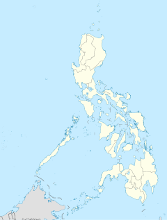
 Bulusan Volcano
Coordinates 12°46′12″N 124°03′00″E / 12.77°N 124.05°ECoordinates: 12°46′12″N 124°03′00″E / 12.77°N 124.05°E[1] Geology Type Stratovolcano Last eruption February 2011 Mount Bulusan, or Bulusan Volcano, is the southernmost volcano on Luzon Island in the Republic of the Philippines. It is situated in the province of Sorsogon in the Bicol region, 70 km (43 mi) southeast of Mayon Volcano and approximately 250 km (160 mi) southeast of the Philippine capital of Manila.
It is one of the active volcanoes in the Philippines.
Contents
Physical features
Bulusan is classified by volcanologists as a stratovolcano (composite volcano) and covers the northeast rim of Irosin caldera that was formed about 40,000 years before present. It has an peak elevation of 1,565 m (5,135 ft) above sea level with a base diameter of 15 km (9.3 mi).
Located around the mountain are four craters and four hot springs. Crater No. 1, called Blackbird Lake, is 20 m (66 ft) in diameter and 15 m (49 ft) deep. The oval Crater No. 2 is 60 by 30 m (200 by 98 ft) and 15 m (49 ft). Crater No. 3 is about 90 m (300 ft) in diameter and 20 m (66 ft) deep and Crater No. 4, which is near the northeastern, rim opened during the 1981 eruption. There is also a 100-metre (330 ft) fissure measuring 5 to 8 m (16 to 26 ft) wide below Crater No. 4.
Its hot springs are San Benon Springs, Mapaso Springs, San Vicente Springs, Masacrot Springs.
Its adjacent volcanic edifices are Mt. Homahan, Mt. Binitacan, Mt. Batuan, Mt. Calungalan, Mt. Calaunan, Mt. Tabon-Tabon, Mt. Juban, and Mt. Jormajan.
Eruptions
Bulusan is generally known for its sudden steam-driven or phreatic explosions. It has having erupted 15 times since 1885 and is considered as the 4th most active volcano in the Philippines after Mayon, Taal, and Kanlaon.
Evacuation procedures
There are evacuation procedures in place for parts of the peninsula, the farms nearest the volcano are evacuated, and many of the village schools are closed if it is considered possible that a more destructive eruption could occur.
 Mount Bulusan in activity in February 2007
Recent activities
March - June, 2006
The Philippine Institute of Volcanology and Seismology (PHIVOLCS) declared Alert Level 1 on March 19, 2006 after it recorded increased seismic unrest. On June 8, 2006, volcanologists raised the Alert Level to 2 (moderate level of seismic unrest) after it spewed ash. On June 9, the resulting ash cloud damaged a number of houses in the nearby town of Casiguran, 5 kilometres (3.1 mi) north of the volcano, and reached Sorsogon City, about 20 kilometres (12 mi) north of Bulusan.
On June 13, 2006, volcanologists said new craters were created by the mild explosions of Mount Bulusan. Aside from the new craters, two of the volcano's four craters appeared to have merged and cracks were observed on the crater on the western side of the summit. Another eruption took place on April 8, 2007[2]
July – October, 2007
Following some signs of volcanic activity, on the morning of July 31, 2007, 9.37 AM (local time), there was a loud explosion described by locals as like a bomb going off. A cloud of steam and ash shot into the air from Mount Bulusan to a height of 5 kilometres (3.1 mi), drifted and deposited over the surrounding countryside. The eruption lasted for 20 minutes.[3]
On October 4, 2007, two episodes of ash explosions occurred as recorded by the seismic network. The explosions were not visually observed due to thick clouds covering the volcano's summit. The events were recorded as explosion type-earthquakes at 1:34 AM and 1:39 AM. The seismic network recorded 40 volcanic earthquakes and 8 short duration harmonic tremors during the previous 24 hours. Ground deformation surveys along the Inlagadian leveling line at the northeast flank indicated a slight inflation of the volcano's edifice. Field investigation conducted showed trace to light ashfalls affecting barangays San Roque, San Rafael, Sitio Tawog of Porog, Porog proper and Bulusan town proper, all in the municipality of Bulusan.
The October 2007 ash explosions at Bulusan Volcano were preceded by sporadic swarms of small to moderate-sized amplitude earthquakes, which began occurring on the last week of September 2007.[4] Evacuations took place during the July-August episodes of activity. [5]
November, 2010
On November 7, 2010, PHIVOLCS recorded increased seismic activity at Bulusan Volcano, 24 hours after the active volcano spewed a 600-metre (2,000 ft) ash column and grayish steam on November 5, 2010. State volcanologists noted that at least 10 volcanic earthquakes and four explosion-type events have been documented subsequent to the emission of ash and steam at 8 a.m. on Saturday (5 November 2010). PHIVOLCS also noted that steaming activity was characterized by strong emission of white steam column that reached a maximum height of 200 meters above the crater rim. It warned the public not to enter the four-kilometer permanent danger zone from the volcano. People residing near the valleys and streams were also advised to be "extra alert" against sediment-laden stream flows in the event of heavy rains.[6] More ash ejection were reported on November 8-9, 2010 with ash fall on areas in Juban and Irosin towns in Sorsogon province. A PHIVOLCS bulletin on November 9, 2010 stated that eight volcanic earthquakes were recorded from the volcano during the past 24 hours and weak to moderate emission of ash explosion was observed. PHIVOLCS also warned residents near valleys and streams against sediment-laden stream flows in the event of heavy and continuous rainfall.[7]
February, 2011
After months of little activity, the volcano suddenly erupted and sent a plume of ash 2 kilometres (1.2 mi) high, after water reacted with the hot magma. PHIVOLCS has said such explosions are likely to continue for the coming weeks. Initially, hundreds of nearby residents evacuated on their own, but the government has stepped in to evacuate thousands more, and imposed a 4-kilometre (2.5 mi) travel ban around the crater. They also advised airplanes to avoid the immediate perimeter due to ash and debris in the air. [8]
External links
- NASA Earth Observatory satellite image of ash plume at Mount Bulusan
- Smithsonian Institution's Global Volcanism Program: Bulusan
- Philippine Institute of Volcanology and Seismology (PHIVOLCS) Bulusan Volcano Page
- Photos of Bulusan volcano (Geographic.org)
See also
- Erupting volcanoes in the Philippines
- Active volcanoes in the Philippines
- Potentially active volcanoes in the Philippines
- Inactive volcanoes in the Philippines
References
- ^ a b "Bulusan". Global Volcanism Program, Smithsonian Institution. http://www.volcano.si.edu/world/volcano.cfm?vnum=0703-01=. Retrieved 2006-06-12.
- ^ "Easter Sunday alert: Bulusan explodes; Taal acting up, too". GMANews.TV. http://www.gmanews.tv/story/37377/.
- ^ Inquirer.com
- ^ Bulusan Volcano Bulletin
- ^ "Bulusan eruption 2007's 25th, big bang possible". The Manila Times. http://www.manilatimes.net/national/2007/aug/01/yehey/top_stories/20070801top2.html.
- ^ Bulusan Volcano Shows Increased Seismic Activity | The Manila Bulletin Newspaper Online
- ^ Bulusan volcano spews more ash | ABS-CBN News | Latest Philippine Headlines, Breaking News, Video, Analysis, Features
- ^ Thousands flee as Philippine volcano erupts - Yahoo! News
Categories:- Stratovolcanoes
- Subduction volcanoes
- Volcanoes of Luzon
- Mountains of the Philippines
- Active volcanoes of the Philippines
- Active volcanoes


Wikimedia Foundation. 2010.