- Cherokee Park
-
For the American former professional basketball player, see Cherokee Parks.
Cherokee Park 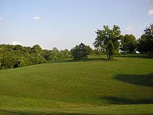
Cherokee Park, Baringer HillType Municipal Location East Louisville, Kentucky Coordinates 38°14′28″N 85°41′49″W / 38.24120°N 85.69690°WCoordinates: 38°14′28″N 85°41′49″W / 38.24120°N 85.69690°W Area 409 acres (166 ha) Created 1892 Operated by Metro Parks Cherokee Park is a 409-acre (166 ha) municipal park located in Louisville, Kentucky, United States. It was designed, like 18 of Louisville's 123 public parks, by Frederick Law Olmsted, the father of landscape architecture. Beargrass Creek runs through much of the park, and is crossed by numerous pedestrian and automobile bridges.
According to The Trust for Public Land, Cherokee Park has 500,000 visitors annually, making it tied for the 69th most popular municipal park in the United States.[1]
Contents
History
Cherokee Park opened in 1892, has always been a major draw, and was a key factor in sparking development in nearby parts of town.
Pre-development
 A map of the private land tracts that became Cherokee Park in 1893. Streets renamed since 1893 include Grinstead Drive (Daisy Lane) and Lexington Road (Work House Road).
The land comprising Cherokee Park was originally part of a 4,000-acre (16 km2) military land grant in 1773 to James Southall and Richard Charlton.
A 43-acre (170,000 m2) portion of the land passed to Judge Joshua Fry Bullitt, who sold it in 1868 to foundry magnate Archibald P. Cochran. Cochran established an estate there called Fern Cliff, which operated as a museum for a while but has since been demolished.
As the land was located around Beargrass Creek, it was hilly and ill suited to farming. Prior to its conversion as a park, the land was used primarily for animal grazing, although much of it was wooded.[2] By 1893 the land was carved into six estates, including Cochran's (which was sold to the city after his death in 1889). The other estates belonged to the Bonnycastle 63 acres (250,000 m2), Barret 20 acres (81,000 m2), Morton & Griswold 106 acres (0.43 km2), Alexander 25 acres (100,000 m2) families, respectively. Those and two small lots under 1-acre (4,000 m2) were bought by 1891. Additional land from the Longest, Barringer and Belknap families would be added to expand the park to its modern size.[3]
Park development
In 1887, a city park system was proposed with three large suburban parks: east, west and south. The initial name of the eastern park was to be Beargrass Park, but in 1891, as was fashionable in the late 19th century, a name that evoked the romantic imagery of native Americans was chosen.
Cochran's name lives on in Cochran Hill, which became notable in the late 1960s when two tunnels were dug under it at a cost of $1.9 million so that I-64 would not have as extreme an impact on the park as it was run through it. The twin tunnels remain, running for about 425 feet (130 m) in length under the hill. Various groups, including one called Save Our Parks, formed as early as the 1940s to oppose running highways through the parks, and were largely responsible for forcing a tunnel as a compromise.[4]
The tunnels, which opened in 1970, are one of three sites in Kentucky deemed "exceptionally significant" by the Federal Highway Administration. This designation, in turn, means it will be very difficult for the stretch of interstate running through the park ever to be widened.[5]
In 2010, a proposal by the city to replace the Hogan Fountain Pavilion with two smaller structures created public opposition that led to a citizen fundraising effort to repair the existing structure, rather than replace it.[6]
Tornado damage in 1974
Much of the park was heavily damaged in the April 3, 1974 tornado Super Outbreak. The tornado was an F4 on the Fujita scale. A city forester surveying the aftermath said, "I don't believe that anyone alive today will see Cherokee Park as it was before the storm."[7]
Because of the loss of thousands of mature trees, a massive re-planting effort was undertaken, financed in large part by a grant from the United States government under the Disaster Relief Act of 1974. However, to qualify for these funds, the park had to be restored to its pre-tornado design as faithfully as possible. The original Olmsted plans were consulted for the park's "rebirth" (as it was called at the time), with 2,500 trees and 4,600 shrubs planted in the restoration effort.
Crime
Vandalism and petty crime has long plagued Cherokee Park. Vandalism was reported as early as 1936.[8] In the 1950s into the mid-1960s newspapers reported with amusement on the serial theft of elements of the Hogan's Fountain monument - especially a bronze turtle - with headlines such as "Cherokee Park Turtle on the Loose Again"[9] and "Bronze Turtle Steps Lively - Flees Cherokee Park Nest". According to a park commissioner, after the vandals saw the stories in print, they would always deposit the stolen pieces, which weighed about 100 pounds, somewhere in the park. Eventually they were all bolted down from beneath such that vandals were unable to remove them.[10] More seriously, the Daniel Boone statue at the park's Eastern Parkway entrance was toppled on May 21, 1962, causing severe damage to it. Park officials claimed police had seen but not arrested a crowd of youths drinking openly near the statue earlier in the day, police denied the charge.[11]
A 1970 newspaper article looked back on the tradition of turtle thievery with nostalgia, reporting that Hogan's Fountain had by the 1970s become a nightly gathering place for hundreds of teenagers, who openly sold and used drugs, despite an increasing police presence, usually arresting youths on loitering charges and chasing out dealers of more serious drugs such as heroin.[12]
Portions of the park were redesigned both to remove popular loitering locations and to increase the park's usability to families and individuals for recreation. Combined with an increased police presence, these tactics greatly deterred drug use and gay cruising, however vandalism remains a minor problem. During periods of good weather, the park is invariably full of local residents engaged in a wide range of fitness activities as well as leisurely strolling or picnicking. On those rare occasions that two or more inches of snow fall, hundreds of locals take to the parks hills for informal sledding and snowboarding.
Landmarks
 Detail of the Enid Yandell statue at Hogan's Fountain
Cherokee Park contains many landmarks and points of interest. Many are self-contained areas within the larger park, set apart from each other by the natural terrain and creative use of landscaping. Because of the size and design of the park, many events can occur at the same time without interrupting each other.
- Big Rock - A large rock in Beargrass Creek, which also lends its name to a picnic area and playground nearby. The rock itself is used for picnics, and as an ill-advised jumping spot (its flat surface offers about an 8-foot (2.4 m) drop into the shallow creek water below).
- Scenic Loop - A 2.43-mile (3.9-km) mixed-use road around much of the park, with separate lanes for pedestrians and motorized vehicles.[13]
- Frisbee Field - A large open field used for many purposes, most commonly soccer and Ultimate.
- Baringer Hill - Commonly called "Dog Hill," "Kite Hill," or "Hill Number One." Once popular for kites, after a renovation in the late 1990s it has become better known as a gathering point for dog owners. This occasionally attracts the ire of park visitors who do not appreciate canines, especially those who, in violation of local ordinances, are unleashed. A fenced dog park located at the top of Cochran Hill opened in 2007.
- Hogan's Fountain - A dog- and horse-watering fountain located atop a hill on the Scenic Loop, Hogan's Fountain was financed by the Hogan Family of Anchorage, Kentucky, in 1905. The fountain was sculpted by Enid Yandell, and features the Greek God Pan. It was officially unveiled on August 31, 1905. The name Hogan's Fountain is also often extended to the nearby hilltop area, which includes a large gazebo, baseball diamond, children's fountains and a basketball court. This spot was once known as Bonnycastle Hill. Hogan's Fountain is a popular place for group meetings, family reunions and picnics.
- Lover's Lane - A secluded, heavily forested stretch of scenic loop just past Hogan's Fountain.
- Cochran Hill - A hillside between Frisbee Field and Lexington Road, and site of a dog park.
- Christensen Fountain - A recently restored fountain near the Lexington Road entrance.
- Nettleroth Bird Sanctuary - Located in a quiet corner of the park, between Scenic Loop and a residential neighborhood.
Entrances
The park is situated in the Highlands.[13] As the city of Louisville expanded around the park, many developers donated land to the park in exchange for the right to connect roads to it. The numerous entrances have made navigating the park notoriously confusing to visitors. Neighborhoods with entrances to the park include Cherokee Triangle, Bonnycastle, Highlands-Douglass, Crescent Hill and Seneca Gardens.
Features
 Postcard of a scene from Cherokee Park at the base of Baringer Hill, early 20th century
- Archery range - Near Beals Branch Road
- Ballfield - At Hogan's Fountain
- Baringer Spring - Rustic stream crossed by several wide wooden bridges and scenic walkways, entrances at Frisbee Field and at Baringer Hill
- Fullcourt basketball - At Hogan's Fountain
- Bike trail - Throughout park, crosses the scenic loop in many places. The scenic loop itself, with two moderately steep hills, is popular with road bikers.
- Bridle trail
- Golf course & clubhouse (9 holes). Opened in 1907.[14]
- Hiking trails - All are mixed use trails
- Horseshoe pits - At Hogan's Fountain
- Picnic pavilions - Large pagoda-style structure at Hogan's Fountain
- Picnic tables - At and near Hogan's Fountain
- Playgrounds - At Hogan's Fountain, Big Rock and Baringer Hill
- Rugby field - Also used for Frisbee and Soccer
- Restrooms - At Baringer Hill, Hogan's Fountain and Big Rock
- Spray pool - At Hogan's Fountain
- Tennis - Off Barret Hill Road
- Willow Pond - Off Grinstead Drive, next to golf course
- Dog run - Opened August 2007, located atop Cochran Hill
Activities
 Big Rock
- Walking/Hiking (see link below)
- Running/Jogging (see link below)
- Dog Walking (Baringer Hill - aka "Dog Hill")
- Bike Riding (trails and road)(see link below)
- Fishing (willow pond)
- Sledding
- Picnics
- Baseball
- Basketball
- Football
- Rugby (see link below)
- Soccer
- Ultimate Frisbee
- Geocaching
- Archery
- Weddings (occasionally)
- Live action role-playing
See also
- City of Parks
- The Highlands (Louisville)
- Iroquois Park
- List of attractions and events in Louisville, Kentucky
- List of parks in Louisville, Kentucky
- Seneca Park
- Shawnee Park
References
- ^ "America's Most Visited City Parks" (PDF). 2008-10-01. Archived from the original on 2009-03-31. http://www.webcitation.org/5fgh5pn16. Retrieved 2009-03-31.
- ^ Louisville Parks: A Story of Growth. Louisville Board of Parks. 1938. p. 3.
- ^ English, Judith Hart (1972). Louisville's 19th Century Suburban Growth. University of Louisville. pp. 84–89.
- ^ Green, Marcus (2006-06-12). "I-64 removal: Fans but little proof". Courier-Journal. p. 1A.
- ^ Elson, Martha (2007-01-17). "Tunnel could stop wider I-64".
- ^ The Courier-Journal "Cherokee pavilion project gets $10,000 magazine grant", The Courier-Journal, February 18, 2011, accessed February 18, 2011.
- ^ As quoted in Samuel W. Thomas, ed (1974). Tornado! April 3, 1974. pp. 8–9.
- ^ "Vandals Destroy 7 Cherokee Park Lights". Courier-Journal. 1936-07-06. pp. A1.
- ^ "Cherokee Park Turtle on the Loose Again". Courier-Journal. 1960-07-20. pp. 16B.
- ^ "Lion's Head is Lost By Hogan's Fountain". Courier-Journal. 1967-10-07. pp. B1.
- ^ "Park Laxity is denied by Police". Courier-Journal. 1962-05-23. p. 1.
- ^ Filiatreau, John (1970-06-06). "Cherokee Park, a gathering place for the young, drug sellers... and police". Courier-Journal. pp. A1.
- ^ a b Stahl, Linda (2009-02-09). "Outdoorsy? Welcome to Xanadu". Courier-Journal. http://www.courier-journal.com/apps/pbcs.dll/article?AID=999970809007. Retrieved 2009-02-09.[dead link]
- ^ Louisville Parks: A Story of Growth. Louisville Board of Parks. 1938. p. 5.
External links
Informational
- Olmsted History
- Cherokee Park — The Cultural Landscape Foundation
- Bike-Trail review
- Metro Parks - Cherokee Park
- Bike Trail Information
- Images of Cherokee Park (Louisville, Ky.) in the University of Louisville Libraries Digital Collections
- Save Hogan's Fountain Teepee Pavilion
Maps
Groups/Clubs
- Louisville Olmsted Parks Conservancy
- Cherokee Road Runners
- Louisville Rugby Club
- Kentucky Mountain Bike Association
- Louisville Ultimate Frisbee Association Plays games in Cherokee and nearby Seneca Parks
List of Parks in Louisville Metro Area Kentucky Parks Beargrass Creek · Belvedere · Bernheim Forest · Blackacre · Central Park · Cherokee Park · Chickasaw Park · Extreme Park · Fort Nelson Park · Joe Creason · Iroquois Park · Jefferson Memorial Forest · Seneca Park · Shawnee Park · Tom Sawyer State Park · Waterfront ParkIndiana Parks Charlestown State Park · Clark State Forest · Falls of the Ohio State Park · Lapping Park · Perrin Park · Sam Peden Community Park · Warder ParkCategories:- Parks in Louisville, Kentucky
- Dog parks in the United States


Wikimedia Foundation. 2010.