- Colorado Eastern Plains
-
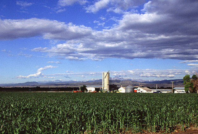
 Corn growing in Larimer County
 High Plains in Eastern Colorado.
The Eastern Plains of Colorado refers to a region of the U.S. state of Colorado east of the Rocky Mountains and east of the population centers of the Front Range.
Contents
Geography
 Irrigation system in Yuma County, on the far Eastern Plains of Colorado.
The Eastern Plains are part of the High Plains, which are the westernmost portion of the Great Plains. The region is characterized mostly by rolling plains, divided by the South Platte River and Arkansas River valleys. There are also several deciduous forests and a few large natural lakes and rivers throughout the region. The Eastern Plains rise from approximately 3,500 feet at the eastern border of Colorado with Kansas, where the Arkansas River leaves the state, to 6,000 feet east of the Denver Basin.[1]
Most of the Eastern Plains region lies within Colorado's 4th congressional district.
Climate
The Eastern Plains have a semi-arid climate and receive little rainfall.[2] Much of the area relies on irrigation to survive. Summers are typically hot and dry, often bringing thunderstorms, which are often severe, to the area, with some occasionally forming landspouts and tornadoes. Eastern Colorado winters are cold and dry, with significant snowfalls and icy conditions. Temperatures can sometimes fall to -40 to -30 degrees Fahrenheit in extreme cold waves, although this is rare.[3]
History
 Many of the original settlers of Eastern Colorado had to build sod houses where lumber was scarce.
Native Americans
Eastern Colorado was once home to many Native American tribes. The Plains Indians that lived in the region included the Arapahoe, Cheyenne, Kiowa, Pawnee, and Sioux. [4] The Ute people formally ruled all over central and western Colorado, and onto the eastern plains as well. The Comanche once ruled all over southeastern Colorado, and the Jicarilla Apache ruled in southeastern Colorado as well.[5]
Settlement
The original settlers of Eastern Colorado were German immigrants who farmed in the area. Many of the family farms in the region are still operated by the descendants of these immigrants.
Population
The Eastern Colorado plains are among the most sparsely populated areas in the continental United States. Some of the region, with the exception of comparatively urban areas like Sterling, is experiencing depopulation, which in some areas began with the influenza pandemic of 1918 and agricultural price collapses after World War I.[6] The Dust Bowl devastated the region and further accelerated this outmigration. Kiowa County demonstrates the population decline and its associated effects.
Parks
 The Pawnee Buttes, located in the Pawnee National Grassland on the high plains in Northeastern Colorado.
 Picture Canyon, located in the Comanche National Grassland, is typical of the scattered canyons found on the high plains in Eastern Colorado, Eastern New Mexico, West Texas, and the Oklahoma panhandle.
Both the Pawnee National Grasslands and Comanche National Grasslands are located in the Eastern Plains. They are composed of marginal farmlands that were withdrawn from agriculture and consolidated under federal control beginning in the Dust Bowl.[7]
Agriculture
Eastern Colorado is largely farmland, with many small farming communities. The major cash crops are corn, wheat, hay, oats, and soybeans.[8] There is also significant livestock farming, dairy and poultry farming, including chicken for meat and eggs, and turkey farming. Most of the towns in the region have grain elevators and prominent water towers.[9] Also, over 90% of the farms in Eastern Colorado are family farms.[10]
Education
In Eastern Colorado most small towns have their own schools and sports teams, but in some parts where depopulation has been the worst, a single school is shared among surrounding towns. There are also a number of schools serving students in grades K-12 run by religious groups or public school districts. Eastern Colorado is one of the few remaining places in the United States with still operating one room school houses.[11]
Religion
The most prominent religion in Eastern Colorado is Christianity, with Roman Catholicism the largest denomination.[citation needed]
Transportation
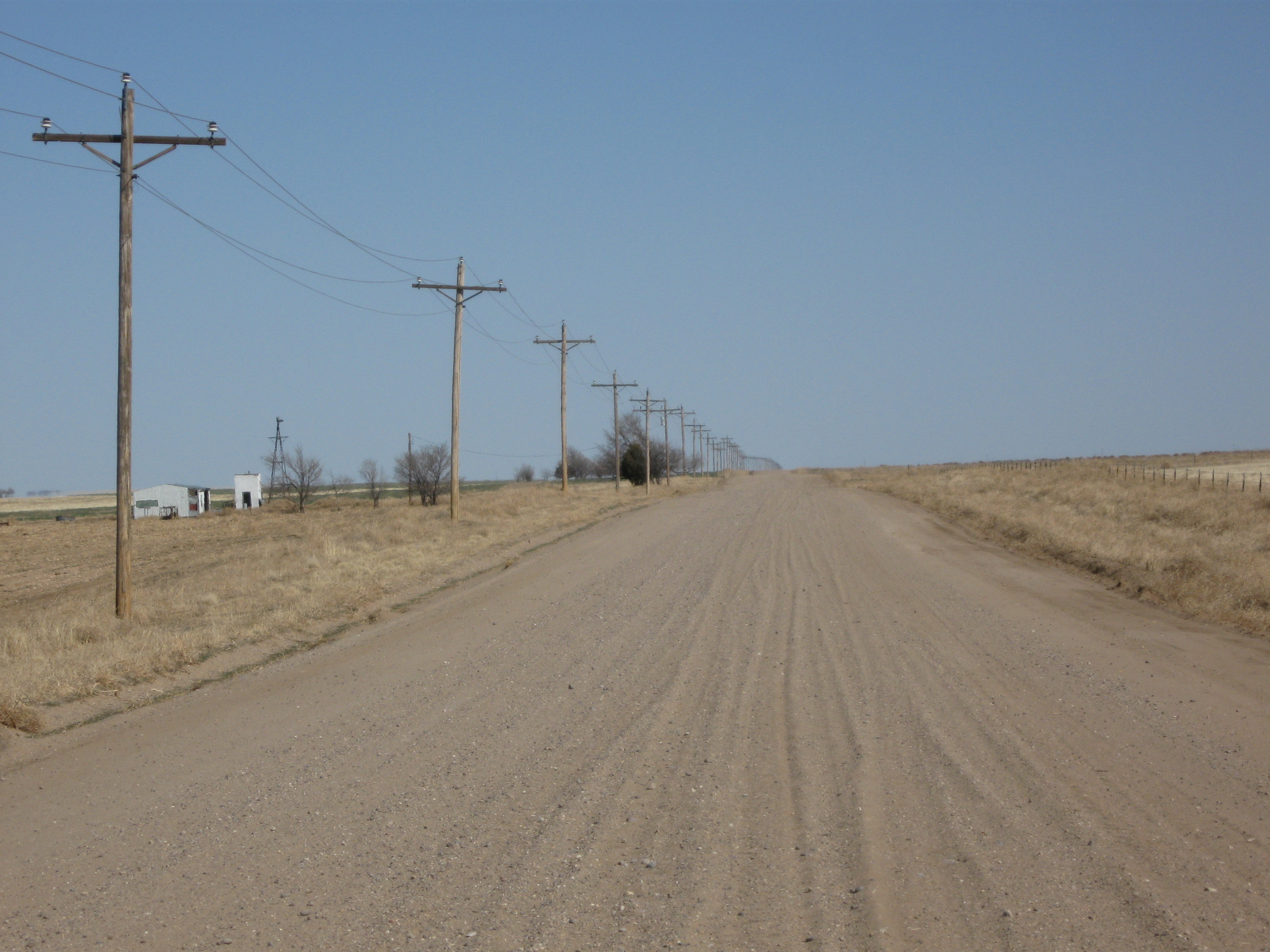
Eastern Colorado roads span the gamut from paved roads to gravel roads to dirt roads. The unpaved roads are typically county or local roads that do not receive enough traffic to be paved. Some of the major paved roads include:
- US Route 6
- US Route 24
- US Route 36
- US Route 40
- US Route 50
- US Route 160
- US Route 287
- US Route 350
- US Route 385
- CO Highway 10
- CO Highway 11
- CO Highway 36
- CO Highway 59
- CO Highway 71
- CO Highway 86
- CO Highway 94
- CO Highway 96
See also
References
- ^ "Eastern Plains". Colorado State University. http://waterknowledge.colostate.edu/plains.htm. Retrieved December 5, 2007.
- ^ http://www.wrcc.dri.edu/summary/climsmco.html
- ^ http://climate.colostate.edu/climateofcolorado.php
- ^ http://www.rootsweb.ancestry.com/~conamer/
- ^ http://www.accessgenealogy.com/native/colorado/
- ^ "Pawnee National Grassland History". U.S. Department of Agriculture, Forest Service. March 24 2004. http://www.fs.fed.us/r2/arnf/about/history/pawnee/index.shtml. Retrieved 2007-12-01.
- ^ "Chronological History of National Grasslands" (PDF). U.S. Department of Agriculture, Forest Service. http://www.fs.fed.us/r2/psicc/about/history/NGhistory.pdf. Retrieved 2007-12-05.
- ^ http://www.nass.usda.gov/Statistics_by_State/Ag_Overview/AgOverview_CO.pdf
- ^ http://www.nass.usda.gov/Statistics_by_State/Ag_Overview/AgOverview_CO.pdf
- ^ http://en.wikipedia.org/wiki/Family_farms
- ^ http://profiles.nationalrelocation.com/profiles/search
Categories:- Regions of Colorado
- Geography of Weld County, Colorado


Wikimedia Foundation. 2010.