- Malvern Hills (district)
-
Malvern Hills District — Non-metropolitan district — Malvern Hills shown within Worcestershire
Sovereign state United Kingdom Constituent country England Region West Midlands Non-metropolitan county Worcesthershire Status Non-metropolitan district Admin HQ Malvern Incorporated 1 April 1974 (current boundaries established 1 April 1998) Government - Type Non-metropolitan district council - Body Malvern Hills District Council - Leadership Leader & Cabinet (Conservative) - MPs Michael Spicer
Bill WigginArea - Total 222.8 sq mi (577.1 km2) Area rank 78th (of 326) Population (2010 est.) - Total 75,400 - Rank 295th (of 326) - Density 338.4/sq mi (130.7/km2) - Ethnicity 98.6% White Time zone GMT (UTC0) - Summer (DST) BST (UTC+1) ONS code 47UC OS grid reference SO7645142913 Website malvernhills.gov.uk Malvern Hills is a local government district in Worcestershire, England. Its council is based in the town of Malvern, and its area covers most of the western half of the county that borders Herefordshire. It was originally formed in 1974 and was subject to a significant boundary reform in 1998. In the 2001 census the population of the Malvern Hills district was 35,042 males and 37,130 females, totalling 72,172 people. The age profile is slightly skewed to the over 50s.
Contents
History
 Malvern Hills in Hereford and Worcester, 1974–1998
In 1974 the district of Malvern Hills was created from the former districts of Bromyard Rural District and Ledbury Rural District in Herefordshire, along with Malvern Urban District and Martley Rural District and Upton upon Severn Rural District in Worcestershire.
The current boundaries were formed on 1 April 1998 when the county of Hereford and Worcester (which had been created in 1974, following the Local Government Act 1972) reverted, with some border changes, to the two former counties of Worcestershire and Herefordshire. The new Malvern Hills district boundary was formed from parts of the existing district of Malvern Hills and Leominster. The remainder of these districts became part of Herefordshire. The 1998 boundary changes added Tenbury Wells to the district, but Bromyard and Ledbury returned to be administered by the newly created Herefordshire Council.
Governance
Malvern Hills is a non-metropolitan district of the county of Worcestershire, and comprises 54 civil parishes. The Malvern Hills District is divided into 21 electoral wards. [1]
Boundary changes
Following the 1996 boundary changes according to the split up of the county of Hereford and Worcester into the former traditional counties of Worcestershire and Herefordshire, the district acquired from the existing district of Leominster, the parishes of Bayton, Bockleton, Eastham, Hanley, Knighton-on-Teme, Kyre, Lindridge, Mamble, Pensax, Rochford, Stanford with Orleton, Stockton-on-Teme, Stoke Bliss and Tenbury. In the existing district of Malvern Hills, the parishes of Abberley, Alfrick, Astley and Dunley, Berrow, Birtsmorton, Bransford, Broadheath, Broadwas, Bushley, Castlemorton, Clifton upon Teme, Cotheridge, Croome D'Abitot, Doddenham, Earl's Croome, Eldersfield, Great Witley, Grimley, Guarlford, Hallow, Hanley Castle, Hill Croome, Hillhampton, Holdfast, Holt Fleet, Kempsey, Kenswick, Knightwick, Leigh, Little Malvern, Little Witley, Longdon, Lower Sapey, Lulsley, Madresfield, Malvern, Malvern Wells, Martley, Newland, Pendock, Powick, Queenhill, Ripple, Rushwick, Severn Stoke, Shelsley Beauchamp, Shelsley Kings, Shelsley Walsh, Shrawley, Suckley, Upton upon Severn, Welland, West Malvern and Wichenford.[2]
Geography
Main article: Malvern HillsThe Malvern Hills themselves offer scenic views over the counties of Herefordshire and Worcestershire and the District includes much of the Malvern Hills Area of Outstanding Natural Beauty. The River Teme is famous for its fishing and runs across the District, from Tenbury Wells, to its union with the River Severn near Worcester, close to the site of the Battle of Worcester. Historically, the Teme Valley was famous for its orchards and hop yards, though these have declined in recent years. The River Severn forms the eastern boundary of the District for many miles and is also popular with anglers. The area has a significant Spa heritage and Malvern water is bottled and distributed commercially worldwide. The Spa buildings (The Pump Rooms) survive at Tenbury Wells and many free spring water sources are available to the public in and around Malvern.
Energy policy
In May 2006, a report[3] commissioned by British Gas showed that housing in Malvern Hills produced the 6th highest average carbon emissions in the country at 7,329 kg of carbon dioxide per dwelling.
References
- ^ List of Committees, Malvern District Council. Retrieved 23 May 2009
- ^ Statutory Instrument 1996 No. 1867 The Hereford and Worcester (Structural, Boundary and Electoral Changes) Order 1996 Re-creation of separate counties of herefordshire & Worcestershir-creation of historic councils. retrieved 10 January 2010
- ^ Green City report
External links
- Brief history (and images) at the BBC website
- Malvern Hills District Council official web site
- Malvern Tourist Information Centre
- Information about the Tenbury Wells area
Districts of the West Midlands Region Herefordshire 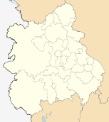
Shropshire Staffordshire Warwickshire West Midlands Birmingham · Coventry · Dudley · Sandwell · Solihull · Walsall · Wolverhampton
Worcestershire Bromsgrove · Malvern Hills · Redditch · Worcester · Wychavon · Wyre Forest
Coordinates: 52°5′1.17″N 2°20′37.31″W / 52.0836583°N 2.3436972°W
Categories:- Local government in Worcestershire
- Malvern, Worcestershire
- 1998 establishments in England
- Non-metropolitan districts of Worcestershire
- Local government districts of the West Midlands (region)


Wikimedia Foundation. 2010.