- Deir Hanna
-
Deir Hanna Hebrew transcription(s) – Hebrew דֵיר חַנָּא – ISO 259 Deir Ḥannaˀ – Also spelled Deir Hana (official)
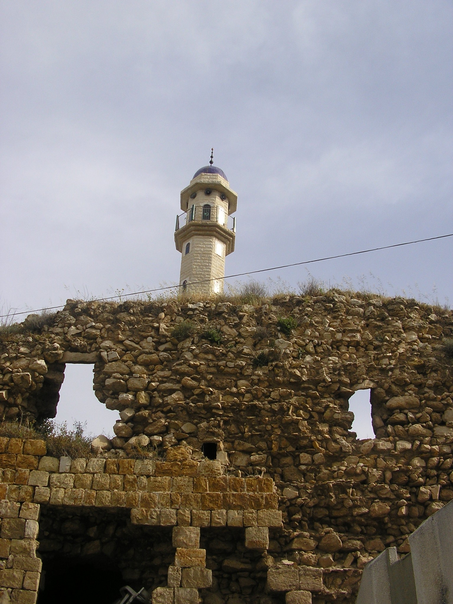
Dayr Hanna (unofficial)Arabic transcription(s) – Arabic دير حنا The remains of Dhaher al-Omar's castle in Deir Hanna
 Deir Hanna
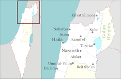
Coordinates: 32°51′44.68″N 35°22′16.21″E / 32.8624111°N 35.3711694°ECoordinates: 32°51′44.68″N 35°22′16.21″E / 32.8624111°N 35.3711694°E District North Government – Type Local council (from 1975) – Head of Municipality Samir Hussein Area – Total 7,500 dunams (7.5 km2 / 2.9 sq mi) Population (2005) – Total 8,500 Name meaning "John's Monastery" Deir Hanna (Arabic: دير حنا, Hebrew: דֵיר חַנָּא)[1] is a local council in the North District of Israel, located on the hills of the Lower Galilee, 23 kilometres (14 mi) southeast of Acre. At the end of 2005, the town had a population of 8,500 approximately 80% of them being Muslims and the remaining 20% being Christian.[2]
Contents
History
In the 2nd to 4th centuries, the Jewish village of Kfar Yohanna (כפר יוחנה) was known in as the seat of the Cohens of Yakhin, the 21st of the 24 Priestly Courses or Priestly Watches (משמרות הכהונה).[citation needed]
According to one source, in the Crusader times Deir Hanna was a fief know as "Ber Henne", belonging to Phillipe le Rous. However, according to Petersen, there are no traces of Crusader occupation in the village.[3]
Deir Hanna was a base for the az-Zaydānī -family, and as such increased greatly in importance with Dhaher al-Omar rise to power in the 18th century.[3]
 Deir Hanna at night as seen from Lotem
In the late 19th century, it was described as: "High walls all around the village, which is built of stone. The walls have round towers, and were built by Dhaher el Amrs son, Sad el Amr. It is situated on the top of a high ridge, and contains about 400 Christians. It is surrounded by olive-groves and arable land. Water is obtained from cisterns and an old paved birkeh to the north of the village."[4]
At the time of the 1931 census, Deir Hanna had 117 occupied houses and a population of 427 Muslims and 136 Christians.[5] In 1945, it had 750 Arab inhabitants, who owned a total of owned 15,350 dunams of land.[6]
The town has been through a thorough modernization process in the last 10 years, and now has a full education system, health care facilities and sports playgrounds. Deir Hanna forms the Land Day triangle with Sakhnin and Arraba.
Notable buildings
Deir Hanna has a castle from the Dhaher al-Omar era. Parts of the castle are still standing, as are the walls, the old village church and a mosque, and it is considered a tourist attraction.
Persons associated with Deir Hanna
- Hiam Abbass - actress
See also
References
- ^ "The Convent of St John", according to Palmer, 1881, p125
- ^ http://www.cbs.gov.il/population/new_2007/table3.pdf
- ^ a b Petersen, 2001, p. 132
- ^ Conder and Kitchener, 1881, SWP, I, p. 364
- ^ E. Mills, ed (1932). Census of Palestine 1931. Population of Villages, Towns and Administrative Areas. Jerusalem: Government of Palestine. p. 100.
- ^ Government of Palestine, Department of Statistics. Village Statistics, April, 1945. Quoted in S. Hadawi, Village Statistics, 1945. PLO Research Center, 1970 p.40
Bibliography
- Cohen, A. (1973), Palestine in the Eighteenth Century: Patterns of Government and Administration, Hebrew University, Jerusalem. (p. 95, Cited in Petersen, 2001)
- Conder, Claude Reignier and H.H. Kitchener (1881): The Survey of Western Palestine: memoirs of the topography, orography, hydrography, and archaeology. London:Committee of the Palestine Exploration Fund. vol 1
- Hadawi, Sami (1970), Village Statistics of 1945: A Classification of Land and Area ownership in Palestine, Palestine Liberation Organization Research Center, http://www.palestineremembered.com/Articles/General-2/Story3150.html
- Edwards, C., Livingstone, K., and Petersen, A. D. (1993), Dayr Hanna: an Eighteenth-Century Fortified Village in Galilee, in Levant, 25, pp 63-92 (Cited in Petersen, 2001)
- Guérin, M. V. (1880): Description Géographique, Historique et Archéologique de la Palestine. Galilee 1 part. (p. 463 ff)
- Hadawi, Sami (1970), Village Statistics of 1945: A Classification of Land and Area ownership in Palestine, Palestine Liberation Organization Research Center, http://www.palestineremembered.com/Articles/General-2/Story3150.html
- Palmer, E. H. (1881): The survey of Western Palestine: Arabic and English name lists collected during the survey by Lieutenants Conder and Kitchener, R. E. Transliterated and explained by E.H. Palmer.
- Petersen, Andrew (2001): A Gazetteer of Buildings in Muslim Palestine: Volume I (British Academy Monographs in Archaeology) p.132-135
- TIR: Tsafrir, Y., L Di Segni and J. Green (1994): Tabula Imperium Romani: Iudaea-Paleastina; Eretz Israel in the Hellenistic, Roman and Byzantine Periods, Jerusalem. 163
- Volney, Constantin-François (1788): Travels Through Syria and Egypt, in the Years 1783, 1784, and 1785: Bccontaining the Present Natural and Political State of Those Countries, Their Productions, Arts, Manufactures, and Commerce : with Observations on the Manners, Customs, and Government of the Turks and Arabs : Illustrated VOL II out of II. (p 265 in the 1959-edition, p. 136 here)
External link
Categories:- North District (Israel)
- Local councils in Israel
- Arab localities in Israel
- Daher al-Omar fortifications
- Israel geography stubs


Wikimedia Foundation. 2010.