- Plitvička Jezera
-
Plitvička Jezera — Municipality — Map of the Plitvička Jezera municipality within its county Location of Plitvička Jezera within Croatia
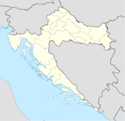
 Plitvička Jezera
Coordinates: 44°52′N 15°37′E / 44.867°N 15.617°E Country Croatia County Lika-Senj Government – Mayor Ivica Kukuruzović (HDZ) Area – Total 539.08 km2 (208.1 sq mi) Elevation 612 m (2,008 ft) Population (2001)[1] – Total 4,668 – Density 9/km2 (23.3/sq mi) Time zone CET (UTC+1) – Summer (DST) CEST (UTC+2) Postal code 53 231 Area code(s) 053 Website www.tzplitvice.hr Plitvička Jezera (pronounced [plîtv̞itʃkaː jɛzɛ̌ra] or just Plitvice [plîtv̞itsɛ]; Plitvice Lakes, in English) is a municipality (općina) in central Croatia, in the eastern part of the Lika-Senj county, that lies in and near the eponymous Plitvice Lakes National Park, bisected by the D1 main road (Zagreb–Split). Its total area is 539.08 km². The main town and seat of the municipality is Korenica. Other smaller towns and villages are Bjelopolje, Jezerce, Gornji Vaganac, Ličko Petrovo Selo, Plitvice and Smoljanac.
Contents
Demographics
According to 2001 census, its total population was 4,668. The ethnic composition of Plitvička Jezera is 67.3% Croat and 30.5% Serb. The pre-war numbers show a Serb majority.[citation needed]
The settlements in the municipality are:[2]
- Bjelopolje
- Čanak
- Čujića Krčevina
- Donji Babin Potok
- Donji Vaganac
- Drakulić Rijeka
- Gornji Babin Potok
- Gornji Vaganac
- Gradina Korenička
- Homoljac
- Jasikovac
- Jezerce
- Kalebovac
- Kapela Korenička
- Kompolje Koreničko
- Končarev Kraj
- Korana
- Korenica
- Kozjan
- Krbavica
- Ličko Petrovo Selo
- Mihaljevac
- Novo Selo Koreničko
- Oravac
- Plitvica Selo
- Plitvička Jezera
- Plitvički Ljeskovac
- Poljanak
- Ponor Korenički
- Prijeboj
- Rastovača
- Rešetar
- Rudanovac
- Sertić Poljana
- Smoljanac
- Šeganovac
- Trnavac
- Tuk Bjelopoljski
- Vranovača
- Vrelo Koreničko
- Vrpile
- Zaklopača
- Željava
History
During the Croatian War of Independence and the Krajina uprising, many areas were mined to stop enemy advances. The area around Korana Bridge has recently been demined,[3] but there are still some others still suspected to be mine contaminated, as for reports from the local NGO Croatian Mine Action Centre.[4]
Many local inhabitants of Serb ethnicity left the municipality during the war, with around 1,500 - 2,000 of them returning once the situation improved.[5]
Economy
It is most famous for the Plitvice Lakes National Park, a major tourist destination and its main source of income, together with arable lands, grazing lands and woods. Due to the Plitvice Lakes National Park unique geological evolution and beauty, it was entered in the UNESCO world heritage list in 1979.
According to Human Rights Watch, many of the ethnic Serbian returnees were experiencing a higher unemployment rate, and were also being "excluded from work in municipal or town-run services and institutions, including the National Park".[5]
See also
References
- ^ "Population contingents, by towns/municipalities, census 2001". Croatian Bureau of Statistics. http://www.dzs.hr/Eng/censuses/Census2001/Popis/E01_01_02/e01_01_02_zup09.html. Retrieved 2008-12-29.
- ^ http://www.dzs.hr/Eng/censuses/Census2001/Popis/E01_01_03/e01_01_03_zup09-4553.html
- ^ http://www.hcr.hr/index.php?link=aktualnosti-opsirnije&aid=375&lang=en Mine Action in Croatia
- ^ http://www.hcr.hr/index.php?link=karta-LSzup&lang=en Croatian Mine Action Centre (HCR) minefields in Ličko-Senjska county.
- ^ a b http://www.hrw.org/reports/2003/croatia0903/9.htm Human Rights Watch (2003): Broken Promises: Impediments to Refugee Return. New York, USA.
External links
- Plitvice lakes National park
- Population Data
- Tourist Board of the Municipality of Plitvice Lakes
- Plitvice lakes secondary school
Subdivisions of Lika-Senj County Towns 
Municipalities Stara Novalja · Brinje · Donji Lapac · Karlobag · Lovinac · Perušić · Plitvička Jezera · Udbina · VrhovineCoordinates: 44°52′50″N 15°36′58″E / 44.88056°N 15.61611°E
Categories:- Populated places in Lika-Senj County
- Municipalities of Croatia


Wikimedia Foundation. 2010.