- New Dorp, Staten Island
-
Coordinates: 40°34′26″N 74°06′59″W / 40.57389°N 74.11639°W
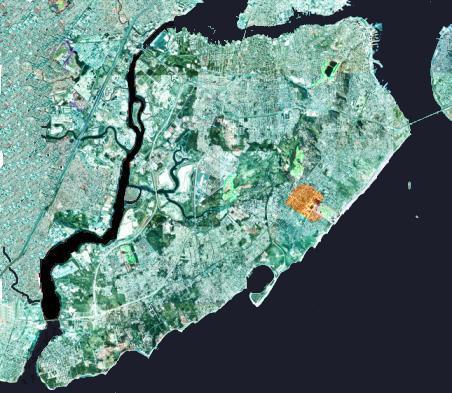
 The approximate area of the neighborhood of New Dorp on Staten Island is shown highlighted in orange
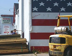 A worker enters a lumberyard in New Dorp.The lumberyard shut down in 2009
 A stretch of Hylan Boulevard in New Dorp
New Dorp – an anglicization of Nieuwe Dorp, Dutch for New Village – is a neighborhood in Staten Island, one of the five boroughs of New York City, United States. The community lies near the foot of Todt Hill, with Grant City immediately to its north, Oakwood bordering to the south, and New Dorp Beach bordering on the east. Formerly one of the most important towns on the island before suburbanization, it was the center of much activity during the American Revolution. Despite surrounding development, the neighborhood has retained its distinct character as a town, and is one of the most thriving commercial centers on the Island.
Like all of Staten Island, the area of New Dorp was populated by American Indians going back over 10,000 years. At the time of the arrival of the Europeans in the 17th Century, it was inhabited primary by the Raritans and other subgroups of the Lenape tribe.
The first recorded European settlement of the area was in 1671. The English, after having taken over the New Netherland colony from the Dutch, expanded the previous Dutch settlements along the South Shore at Oude Dorp ("Old Village") which had been established ten years earlier. In the late 19th century, it became the home to members of the prominent Vanderbilt family, many of whom are buried here in the Moravian Cemetery. The Vanderbilt farm was later used by the U.S. Army, as Miller Air Field and in the 1970s became part of Gateway National Recreation Area.
Today, the neighborhood's population is a majority Italian-American, Irish-American , Albanian-American , Polish-American and Russian-American ancestry.
Contents
Education
New Dorp is zoned to Public School (P.S.) 41: New Dorp and Intermediate School (I.S.) 2: George L. Egbert. Several high schools are located in the area, including Staten Island Technical High School, New Dorp High School, and Richmondtown Preparatory High School. Private elementary schools include Our Lady Queen of Peace Parish Elementary School, New Dorp Christian Academy, and St Margaret Mary.
Public libraries
The New York Public Library operates the New Dorp Branch at 309 New Dorp Lane.[1]
Public services
New Dorp is the home of Engine Company 165 (nicknamed "The Toxic Avengers") and Ladder Company 85 (nicknamed "The Monster Truck") of the Fire Department of New York. Engine 165 is the only Engine Company in Staten Island that has clothing to deal with hazardous materials, and it also has extra hazmat training.
New Dorp is served by the Staten Island Railway's station on New Dorp Lane/Railroad Avenue, as well express buses along Hylan Blvd. It is also served by the S78/S79 on Hylan Blvd and the S74/S76 on Richmond Road.
Notable residents
- Jacques Reich (1852-1923) - portrait etcher
References
- Notes
- ^ "New Dorp Branch." New York Public Library. Retrieved on December 22, 2008.
Categories:- Staten Island geography stubs
- Geography of Staten Island
- Neighborhoods in Staten Island


Wikimedia Foundation. 2010.