- County Cavan
-
County Cavan
Contae an Chabháin
Coat of armsMotto: Feardhacht is Fírinne (Irish)
"Manliness and Truth"
Country Ireland Province Ulster Dáil Éireann Cavan-Monaghan EU Parliament North-West constituency County seat Cavan Government - Type County Council Area - Total 1,931 km2 (745.6 sq mi) Area rank 19th Population (2011) 72,874 - Rank 25th Car plates CN Website cavancoco.ie County Cavan (Irish: Contae an Chabháin) is a county in Ireland. Cavan County Council is the local authority responsible for the county, and is part of the Border Region. County Cavan is located in the province of Ulster, and is named after the town of Cavan. The population of the county is 72,874 according to the 2011 census.
Contents
Geography and political subdivisions
Cavan borders six counties, Leitrim to the west, Fermanagh and Monaghan to the north, Meath to the east and Longford and Westmeath to the south. Cavan shares a 70 km (43 mi) border with County Fermanagh in Northern Ireland. Cavan is the 19th largest of the 32 counties in area and the 25th largest by population.[1] It is also the sixth largest of Ulster's nine counties in size and the seventh largest by population.
Baronies
There are eight historic baronies in the county. While baronies continue to be officially defined units, they are no longer used for many administrative purposes. Their official status is illustrated by Placenames Orders made since 2003, where official Irish names of baronies are listed under "Administrative units".
- Castlerahan (Caisleán Raithin)
- Clankee (Clann Chaoich)
- Clanmahon (Clann Mhathúna)
- Loughtee Lower (Lucht Tí Íochtarach)
- Loughtee Upper (Lucht Tí Uachtarach) - whose chief town, Cavan, is also the county town
- Tullygarvey (Teallach Ghairbhíth)
- Tullyhunco (Teallach Dhúnchadha)
- Tullyhaw (Teallach Eathach) - the largest in the county at 89,852 acres (363.6 km2)
Civil parishes and townlands
Main article: List of townlands of County CavanTownlands are the smallest officially defined geographical divisions in Ireland, there are approximately 1979 townlands in the county.
Towns and villages
Main article: List of towns and villages in County Cavan- Arvagh
- Bailieborough
- Ballinagh
- Ballyconnell
- Ballyhaise
- Ballyjamesduff
- Ballymagauran
- Bawnboy
- Belturbet
Geography
The county is characterised by drumlin countryside dotted with many lakes and hills. The north-western area of the county is sparsely populated and mountainous. The Breifne mountains contains the highest point, Cuilcagh at 665 metres (2,182 ft).
Cavan is the source of many rivers in Ireland. Shannon Pot on the slopes of Culicagh is the source of the River Shannon, the longest river in Ireland at 386 km (240 mi). The River Erne is a major river which rises from Beaghy Lough, two miles (3 km) south of Stradone in Cavan and flows for 120 km (75 mi) to Lough Erne. Other rivers in the county include the Blackwater River from Lough Ramor which joins the River Boyne at Navan. the Dee which springs near Bailieborough, the River Annalee which flows from Lough Sillan and joins the Erne, the Cladagh river rises from Culicagh and flows into Fermanagh. The Glyde and the Owenroe also source in Cavan.
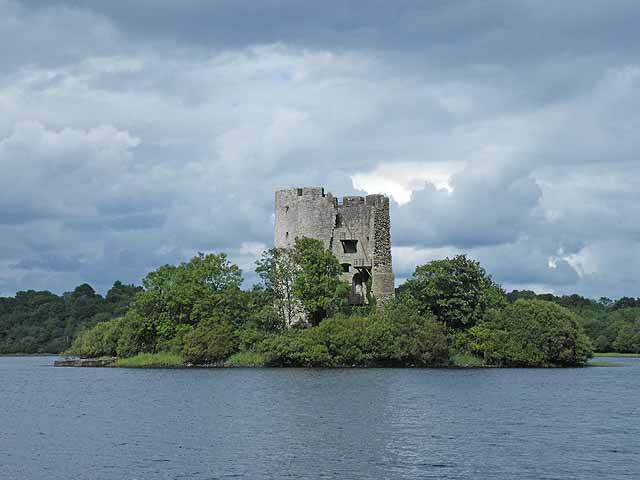
Cavan is known as 'The Lakeland County' and is reputed to contain 365 lakes. At 18.8 km2 (7.3 sq; mi), Lough Sheelin is the county's largest lake situated in the south of the county and forms a three way border on its waters between counties Meath and Westmeath and Cavan.[2] A large complex of lakes form in the north and west of Cavan into designated Specially Protected Areas (SPA), example of this being Lough Oughter. Other important wildlife protected lakes such as Lough Gowna and Lough Ramor are in the south and east of the county. Cavan has a mainly hilly (drumlin) landscape and contains just under 7,000 hectares (17,297 acres) of forested area, 3.6% of Cavan's total land area. The county contains forests such as Bellamont Forest near Cootehill, Killykeen Forest Park at Lough Oughter (a Coillte state forest concern),Dún na Rí Forest Park and the Burren Forest.
Climate
See also: Climate of IrelandBallyhaise, Cavan Climate chart (explanation) J F M A M J J A S O N D 78826882661035812457156571711592012891912581699813668937683Average max. and min. temperatures in °C Precipitation totals in mm Imperial conversion J F M A M J J A S O N D 3.146352.746352.649372.353392.259432.263512.368543.566532.361473.955442.7493834637Average max. and min. temperatures in °F Precipitation totals in inches Met Éireann records the climate data for Cavan from their station at Ballyhaise. Under Köppen climate classification, Cavan experiences a maritime temperate oceanic climate with cold winters, mild humid summers, and a lack of temperature extremes. The average maximum January temperature is 8.0 °C (46 °F), while the average maximum July temperature is 19.1 °C (66 °F). On average, the sunniest months are May and June, while the wettest month is October with 98 mm (4 in) of rain, and the driest months are May and June with 57 mm (2 in) respectively. Humidity is high year round and rainfall is evenly distributed throughout the year, with the annual precipitation at Ballyhaise being 832 mm (33 in)
On average, snow showers occur between November and March. In 2010, record low temperatures for November, December and January were recorded in Cavan. In late December, the temperature at the station fell to −15.4 °C (4 °F), its lowest ever. On Tuesday 21st of December 2010, a daily maximum of −9.4 °C (15 °F) was recorded at Ballyhaise, the lowest daily maximum ever recorded in Ireland. Summer daytime temperatures range between 15 °C (59 °F) and 22 °C (72 °F), with temperatures rarely going beyond 25 °C (77 °F).[3] Like much of Ireland, the county experiences long summer days and short winter days. The annual sunshine hours the county receives on average range between 1,300 and 1,500 hours.[4]
History
In medieval times, the area of Cavan was part of the petty kingdom of East Bréifne or Brefney O'Reilly after its ruling Gaelic family. This in turn was a division of the 11th century Kingdom of Bréifne. For this reason the county is colloquially known as the Breffni County.[5] A high degree of defence was achieved by using the natural landscape of drumlin hills and loughs. The poorly drained heavy clay soils contributed as an obstacle against invasion.
Historically, Cavan was part of the western province of Connacht, but was transferred to Ulster in 1584 when Bréifne was shired and became the county of Cavan. In the south, the Lough Sheelin area was part of Leinster until the late 14th century.
Parts of Cavan were subjected to Norman influence from the twelfth century and the remains of several motte and bailie fortifications are still visible mainly in the east of the county, as well as the remains of stronger works such as Castlerahan and Clogh Oughter castle. The influence of several monastic orders also owes its origins to around this time with abbey remains existent in locations such as Drumlane and Trinity Island.
The Plantation of Ulster from 1610 saw the settlement and origins of several new towns within the county that include Bailieborough, Cootehill, Killeshandra and Virginia. Existing towns such as Cavan and Belturbet became over time more important as trading centres. Wars aimed at trying to unsettle the Plantation only led to further plantations of English and Scottish settlers into the county and the beginnings of a thriving flax and linen industry.
Some areas of Cavan were hard hit by the Great Famine potato blight between 1845-49. The winter of 1847 is particularly noted for the high levels of deaths nationally caused by diseases such as typhus and cholera. Several instances of eviction also occurred during the nineteenth century, with one such story where the local landlord in Mountnugent parish decided to evict over 200 people. The famous ballad "By Lough Sheelin Side" is based on this event witnessed by the local Catholic priest.
Politics
The county is merged with Monaghan into one Dáil national government constituency, Cavan–Monaghan (five seats). The 2011 general election had a voter turnout of 72.7%.[6] After the election, the TDs elected to the constituency were; Sean Conlan (Monaghan FG), Heather Humphreys (Monaghan FG), Caoimhghín Ó Caoláin (Monaghan SF), Joe O'Reilly (Cavan FG) and Brendan Smith (Cavan FF). Members of the 24th Seanad are Senators Diarmuid Wilson (Cavan FF) and Kathryn Reilly (Cavan SF). The county falls within the Border, Midland and Western region for certain European Union purposes. It is also a part of the Border Regional Authority.
Local government
Main Article: Cavan County Council
Cavan is divided into Four County Electoral Areas: Bailieborough, Ballyjamesduff, Belturbet and Cavan. There are three Town Councils: Cavan Town, Belturbet and Cootehill.[7] The politics of the county can be considered conservative. The centre-right parties Fine Gael and Fianna Fáil are the largest parties with 13 and 8 councillors respectively with democratic socialist Sinn Féin representing the left-wing with four councillors. The 2009 Cavan Local Elections had an average voter turnout of 64.48%, the highest electoral area being Belturbet with just under 70%.
Party Seats % of Votes Fine Gael 13 45.3% Fianna Fáil 8 34.5% Sinn Féin 4 12% Labour Party 0 2.4% Green Party 0 0.5% Independent 0 5.3% Places of interest
See also: List of National Monuments in County CavanNatural Attractions
- Killeshandra Loop Walk
- Dún na Rí Forest Park
- Killykeen Forest Park
- Marble Arch Caves Global Geopark
- Lough Sheelin
- Cuilcagh
- Shannon-Erne Waterway
Transport
Road
Two national primary routes pass through the county, The N3 road and the N16 road. The N3 is the longest route in Cavan, crossing the county for 60 km (37 mi) from the Meath border at Whitegate near Virginia and through Belturbet into Fermanagh. The N16 begins in Sligo and ends at Blacklion in the far northwestern tip of Cavan, it crosses the county for roughly 7 km (4 mi).
Three national secondary routes pass through the county. The N87 road begins in Belturbet and passes through Ballyconnell and Swanlinbar before crossing into County Fermanagh where it becomes the A32. The N54 route from Monaghan and Clones joines the N3 at Butlersbridge. The N55 links Cavan to the large town of Athlone via Ballinagh and Granard.
Bus Éireann provide bus services to villages and towns across the county, including a direct route from Cavan to Dublin Airport.
Rail
In the mid 1850s the Midland Great Western Railway built a line between the Inny Junction in Co. Westmeath (along their expanding network which was eventually to reach Sligo) and Cavan town. The first railway station to open in Cavan, was Cavan railway station in 1856. Many notable railway stations were built in the 1800s such as Kingscourt railway station and the Cavan and Leitrim Railway. The railways were an important part of the economic development of Cavan and carried passengers and freight to all over Ireland. The railways also helped the popularity of GAA in Cavan grow, spectators could travel easily between towns.
After World War II, due to the shortage of coal in the country, uneconomic lines were terminated. In 1947 all passenger services were terminated though the transport of freight and livestock continued. The Great Northern Railway (G.N.R.) continued to serve the Cavan and Leitrim Railway. However, in 1959 all services along the remaining rail lines were terminated and the stations along their routes were closed.
Water
In the historical context and before water levels in lakes were lowered, water transport in the region was once very important through the complex of lakes and waterways that fed into the major river systems such as the Erne, Shannon and Boyne. Today however this is mainly confined to leisure craft on the River Erne from Belturbet and Ballyconnell as well as for angling activities.
Sport
In Gaelic football, Cavan GAA competes annually in the All-Ireland Senior Football Championship, which it has won 5 times between 1933 and 1952. The team is currently in division 3 of the National Football League and division 4 of the National Hurling League. Hurling is a declining sport in the county and the Cavan county board has discussed disbanding the senior team to promote the sport at junior level.[8] The current senior football captain is Seanie Johnston.
The first GAA club founded in Cavan was Ballyconnell in 1885. However the club didn’t affiliate to GAA Central Council until March 1886 so that can be taken as the founding of the GAA in Cavan and Ulster.[9] The most successful club in Cavan is Cornafean with 20 Senior Football Championship titles, their last title was won in 1956. The most successful club in recent years has been Cavan Gaels GAA which has won 8 of the last 11 Senior Football Championships. Cavan Gaels are the current senior football champions, defeating Castlerahan in the 2011 decider. No team from Cavan has ever won a national or provincial title.
There is a strong history of athletics in Cavan, with a 300m Tartan track in Shercock and other athletics facilities throughout the county. There are five athletics clubs in the county at present, but there have been many more over the years. The current athletics clubs are Annalee AC, Bailieborough AC, Innyvale AC, Laragh AC and Shercock AC.
Fishing is a very popular activity in Cavan because of its complex of large rivers and lakes.
 Cavan (blue) in action against The Queen's University of Belfast in the 2009 Dr. McKenna Cup
Below is a list of various sporting clubs in Cavan:
Club Sport League Cavan Gaels GAA Gaelic Football Cavan Senior Football Championship Killinkere Basketball North East League Bailieboro Celtic FC Football Meath & District League Mullahoran GFC Hurling Cavan Senior Hurling Championship Bailieborough AC Athletics Cavan County Championships Cornafean GAA Gaelic football Cavan Junior Football Championship Demographics
Historical populations Year Pop. ±% 1659 14,703 — 1821 195,076 +1226.8% 1831 227,933 +16.8% 1841 243,158 +6.7% 1851 174,071 −28.4% 1861 153,906 −11.6% 1871 140,735 −8.6% 1881 129,476 −8.0% 1891 111,917 −13.6% 1901 97,541 −12.8% 1911 91,173 −6.5% 1926 82,452 −9.6% 1936 76,670 −7.0% 1946 70,355 −8.2% 1951 66,377 −5.7% 1956 61,740 −7.0% 1961 56,594 −8.3% 1966 54,022 −4.5% 1971 52,618 −2.6% 1979 53,720 +2.1% 1981 53,855 +0.3% 1986 53,965 +0.2% 1991 52,796 −2.2% 1996 52,944 +0.3% 2002 56,546 +6.8% 2006 64,003 +13.2% 2011 72,874 +13.9% [10] As of April 2011, Cavan has a population of 72,874 making it the 25th largest county by population, ahead of Sligo and behind Offaly.[11] In 2009, Cavan (according to CSO statistics) had a natural population increase of 703 people (1,212 births minus 509 deaths).[11] Cavan has a higher percentage than the state average of people in the dependency age, 0-14 and over 65 with 34.7% in 2006, which is a drop from 36.6% in 2002. Cavan had a high age dependency ratio in 2002 of 66.91%, this was due to the migration of people who went for third level education elsewhere or who looked for work, most likely in the Greater Dublin Area. The language spoken in the county is predominantly English, with just 35% of the Cavan population also Irish speaking. The national census of April 2011 shows net migration slowing to a rate of 16.2% over that of previous periods. Between 2002 and 2006 Cavan had a population increase of 13.2%, and of this growth 83.4% was due to inward migration. In 2006 it was estimated that by 2011 the population of the county would surpass 70,000 people.
The preliminary 2011 Census results (published in July 2011) show a County Cavan population increase of 13.9%, the largest population growth in Ireland after County Laois. The population rose from 64,003 to 72,874 persons with an average increase of 15% seen in electoral areas in the southeast of the county. This increase is due to the continued population growth of N3/M3 proximity commuter towns such as Virginia, Ballyjamesduff, Bailieborough and Mullagh. Virginia is now the second largest populated town in the county. However a continued decrease as seen from earlier census results in areas of the north and west of the county, including urban areas such Cavan and Cootehill towns. The 2011 preliminary census results also listed the highest percentage of partially constructed and vacant houses situated in the north and west of the county, representing over 20% of its dwellings vacant.[12]
Nationalities
Nationality 2006 Irish UK Polish Lithuanian Other EU Rest of World Not Stated Total Number 56,906 1,884 810 776 858 1,356 674 63,264 Percentage 89.95% 2.98% 1.28% 1.23% 1.36% 2.14% 1.07% 100% The county's largest town is Cavan and the population density is 37 persons/km² (96 persons/sq mi)

Economy
Traditionally industry derived from agriculture; chiefly dairy milk processing as well as pig and beef farming. Other major industries such as Quinn Quaries and Gypsum Industries are also important employers within the county. There is a total farmed area of 138,314 hectares (341,781 acres) in the county, and there are approximately 249,217 cattle in Cavan.
By disposable income per person, Cavan ranks between Clare and Laois at 17th out of 27 in Ireland, at 94% of the State average.[13]
See also
- List of abbeys and priories in Ireland (County Cavan)
- Lord Lieutenant of Cavan
- High Sheriff of Cavan
References
- ^ Corry, Eoghan (2005). The GAA Book of Lists. Hodder Headline Ireland. pp. 186–191.
- ^ [1] - Shannon regional Fishers Board
- ^ [2] - Irish Times, Coldest Day in Ireland
- ^ [3] - Met Eireann - Monthly Weather Bulletin
- ^ http://ulster.gaa.ie/county/cavan/
- ^ [4] - Election 2011 Cavan-Monaghan
- ^ "Cavan County Council website". http://www.cavancoco.ie.
- ^ [5] - Cavan County Board
- ^ [6] - Cavan GAA
- ^ for post 1821 figures, 1653 and 1659 figures from Civil Survey Census of those years, Paper of Mr Hardinge to Royal Irish Academy March 14, 1865, For a discussion on he accuracy of pre-famine census returns see JJ Lee “On the accuracy of the Pre-famine Irish censuses Irish Population, Economy and Society edited by JM Goldstrom and LA Clarkson (1981) p54, in and also New Developments in Irish Population History, 1700-1850 by Joel Mokyr and Cormac O Grada in The Economic History Review, New Series, Vol. 37, No. 4 (Nov., 1984), pp. 473-488.
- ^ a b CSO - Students Corner: Facts about your County - Cavan
- ^ [7] - Census 2011 Preliminary Results
- ^ [8] - Irish Counties by Disposable Income
External links
- Cavan County Council
- Cavan Heritage website
- [9] Cavan Retail Strategy
- [10] Cavan Development plan for 2012, using data from 2000.
- [11] CSO statistics
Counties of Ireland The counties are listed per province Connacht 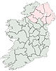
Munster Clare · Cork (Cork City) · Kerry · Limerick (Limerick City) · Tipperary (North Tipperary • South Tipperary) · Waterford (Waterford City)
Leinster Ulster Italics denote non-administrative counties. Brackets denote eponymous cities or non-traditional counties. † denotes counties of Northern Ireland Categories:- County Cavan
- Ulster
- Counties of the Republic of Ireland
- Local administrative units of the Republic of Ireland


Wikimedia Foundation. 2010.