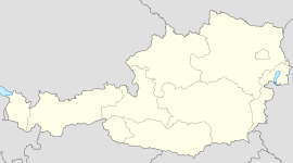
- Amstetten, Lower Austria
-
Amstetten Country Austria State Lower Austria District Amstetten Mayor Herbert Katzengruber (SPÖ) Area 52.22 km2 (20 sq mi) Elevation 275 m (902 ft) Population 22,948 (1 January 2011)[1] - Density 439 /km² (1,138 /sq mi) Time zone CET/CEST (UTC+1/+2) Licence plate AM Postal code 3300 Area code 07472 Website www.amstetten.noe.gv.at Coordinates: 48°07′0″N 14°52′0″E / 48.116667°N 14.866667°E
Amstetten (German pronunciation: [amˈʃtɛtən]) is a town in Lower Austria. It is the capital of the Amstetten District.
Contents
Geography
Is geographically located between 48 ° 07 ' N and 14 ° 52 ' E , at a height of 275 meters , has an area of 52.22 km ² , its population in 2001 was 22,595 inhabitants, with a population density of 441 habs / km ².
History
There are traces of human settlements from the Stone Age and the Bronze Age in the area. The first permanent settlement in the area to be mentioned in written sources was Ulmerfeld, mentioned in 995. The first mention of Amstetten itself is dated to 1111. In 1858, the town was linked to the rest of Austria-Hungary by railroad. Since 1868, it has also been the seat of the local district administration. During World War II, there were two subcamps of the Mauthausen-Gusen concentration camp in Amstetten.[2] The town was home to Josef Fritzl and Josef Hickersberger.[3]
Local economy
The Doka Group, a major international producer/supplier of formwork, has their company headquarters in Amstetten.
International relations
See also: List of twin towns and sister cities in AustriaTwin towns — Sister cities
Amstetten is partnered with:
 Ruelle-sur-Touvre, Charente since 1972
 Podolsk, Russia
References
Notes
Allhartsberg · Amstetten · Ardagger · Aschbach-Markt · Behamberg · Biberbach · Ennsdorf · Ernsthofen · Ertl · Euratsfeld · Ferschnitz · Haag · Haidershofen · Hollenstein an der Ybbs · Kematen an der Ybbs · Neuhofen an der Ybbs · Neustadtl an der Donau · Oed-Öhling · Opponitz · Seitenstetten · Sonntagberg · Sankt Georgen am Reith · Sankt Georgen am Ybbsfelde · Sankt Pantaleon-Erla · Sankt Peter in der Au · Sankt Valentin · Strengberg · Viehdorf · Wallsee-Sindelburg · Weistrach · Winklarn · Wolfsbach · Ybbsitz · Zeillern
Categories:- Cities and towns in Lower Austria
- Amstetten
- Amstetten District
- Lower Austria geography stubs
Wikimedia Foundation. 2010.


