- Chirripó National Park
-
Chirripó National Park [3,819m][12,600ft] Highest peak in Costa Rica IUCN Category II (National Park)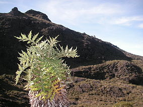
Location Costa Rica Nearest city San Isidro del General Coordinates 9°28′48″N 83°28′48″W / 9.48°N 83.48°WCoordinates: 9°28′48″N 83°28′48″W / 9.48°N 83.48°W Area 50849 Ha Established August 19, 1975 [1] Governing body National System of Conservation Areas (SINAC) Chirripó National Park is located in the middle portion of the Talamanca Range of Costa Rica, approximately 30 km northeast from the city of San Isidro del General. It protects a number of important ecosystems on the Costa Rican Pacific slope and is notable for including the largest extension of páramo vegetation in the country. Because of these conditions, the Chirripó National Park preserves a number of plants, animals, fungi and insects, some of which are under study by the scientific community. It is named for Cerro Chirripó, at 3820m (12,538 ft), the highest mointain in Costa Rica.[1]
Contents
Geography
With a particular climate that includes only two seasons, a dry one approximately from December to April and a wet one from May to November,[2] this national park is among the most exciting ones for locals and tourists from around the world. This is based on the fact that in order to get to the summit (Cerro Chirripó) the visitor has to walk along a 16 km uphill trail from the town of San Gerardo de Rivas to the park ranger's refuge in the Los Crestones sector and save energies for the next 5 km walk from here to the peak. Considering that Chirripó is the 38th most prominent peak in the world, this journey is a once in lifetime experience for most tourists.
 Overview of Valle de los Lagos, Chirripó National Park
This national park encompasses parts of three Provinces in Costa Rica - San Jose, Limón and Cartago, and contains five different ecosystems according to the Holdridge life zone classification system [3], being these: lowland tropical wet forest, premontane tropical wet forest, lower montane wet forest, montane wet forest and subalpine wet forest (paramo).
During the dry season the upper regions are susceptible to fires. The latest recorded events have occurred in 1953, 1958, 1976, 1977, 1981 and 1992. This last event, however, affected over 20 km² (5000 acres) of vegetation and forced the administration to close the park for four months.[4]
Las Nubes Centre for Neotropical Conservation and Research
 Fungi of Chirripo National Park
The Las Nubes Centre for Neotropical Conservation and Research is a research facility located at the southwest corner of the park and managed by York University of Toronto. The centre was given to the university as a gift by Woody Fisher in 1998.
References
- ^ McNeil, Jean (2002), The rough guide to Costa Rica, Rough Guides, p. 53, ISBN 1858287138
- ^ Lindsey, Alton A. & Sawyer, John O. (1971). Vegetation of the life zones in Costa Rica, Indiana Academy of Science, p. 214
- ^ Holdridge, L.R., Grenke, W.C., Hatheway, W.H., Liang, T & Tosi, J.A. 1971. Forest Environments in Tropical Life Zones: a Pilot Study. Oxford, Pergamon Press.
- ^ "sinaccr.net". http://www.sinaccr.net/aclap_chirripo_general.php. Retrieved 17March 2011.
External links
- Chirripó National Park at Costa Rica National Parks
National Parks of Costa Rica (by Conservation Area) Arenal Huetar Norte Arenal Tilaran Caribbean La Amistad Central Pacific Central Volcanic Guanacaste Osa Pacific La Amistad Tempisque Tortuguero Cocos Island Categories:- IUCN Category II
- National parks of Costa Rica
- Protected areas established in 1975


Wikimedia Foundation. 2010.