- Ardfert
Infobox Irish Place
name = Ardfert
gaeilge = Ard Fhearta
crest
motto =
map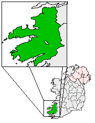
pin coords = left: 77px; top: 39px
north coord = 52.35 | west coord = 9.6833 | irish grid = Q782211
area = | elevation = 78 m
province =Munster
county =County Kerry
town pop = 691 | rural pop =
census yr = 2002
web = |Ardfert (Irish place name|Ard Fhearta|the hill of miracles) is a village in
County Kerry , Ireland. It us an attractive and popular residential location within easy commuting distance ofTralee which is only five miles away.Origin
The village's name signifies, according to Sir
James Ware , "a wonderful place on an eminence", or as some interpret it, "the hill of miracles." Ardfert has also been considered a corruption of Ard Ert, "the high place of Ert or Erc", so called after the 5th century Irish BishopSaint Erc , who made the place a bishop's seat.History & Heritage
Ardfert is a
parish in the Barony of Clanmaurice,County Kerry ,Ireland , anciently in the territory of Ui Fearba/Hy Ferba, of which the Leanes were once the Gaelic Lords, until theNormans came. Ardfert is the home of St. Brendan'sArdfert Cathedral , which was destroyed in the War of 1641, and the birth place ofSt. Brendan the Navigator , who was educated about the year 500 AD. He founded amonastery there in the 6th century, but both town and monastery were destroyed by fire in 1089, and again in 1151.The Norman influence can still be seen not only in the
architecture , but also in local families such as the Cantillons (Barons deBallyheigue ), and Fitzmaurices, and in place names, such as Ballintobeenig, a nearby townland below Mt. Crusline called afterSt. Aubin . The 1st Lord Kerry, Thomas FitzMaurice, founded aFranciscan friary there in 1253, and Nicholas, the 2nd Lord Kerry, built aleper house there in 1312. It was the seat of abishopric until 1660.The
Crusade rKnights Hospitaller of the Order of Saint John ofJerusalem (later known asKnights of Malta ), also had some rights in Ardfert, although there is a record of a dispute between them and the Franciscans in 1325 about the market cross andpillory . They had already been established in the area in c. 1200 when Meiler FitzHenry, grandson of KingHenry I of England , and Justiciar of Ireland under King John, established a preceptory at Rattoo under a Fra' William from Dublin [See pages 52 and 253, 254 and 256 of "Discovering Kerry - its History, Heritage and Topography", by T. J. Barrington, published by The Blackwater Press, Dublin, 1976. (ISBN 0 905471 00 8)] . Under the terms of a royal grant inletters patent ofJames I of England on 6 July 1612, theLord of Kerry (FitzMaurice) could hold courtsbaron and leet.The
Annals of the Kingdom of Ireland , recount how in 1601, PrinceHugh Roe O'Donnell , on his way to theBattle of Kinsale , sent some of his kinsmen troops there to reconquer Ardfert,Lixnaw , and Ballykeally for his ally FitzMaurice. En route, true to his family arms and Constantinian motto (In Hoc Signo Vinces ) and in anticipation of the battle to come atKinsale , he visited and venerated a relic of theTrue Cross (Holy rood ) on the Feast of St. Andrew, on November 30, 1601 atHoly Cross Abbey , nearThurles ,County Tipperary , which was a rallying point for the defence of religious freedom and for Irish sovereignty. From there he sent an expedition to Ardfert, to win a quick victory and successfully recover the territory of his ally, Fitzmaurice, Lord of Kerry, who had lost it and his 9-year old son, to Sir Charles Wilmot. The expedition captured Caislean Gearr (Short Castle, of which no trace remains), adjacent to the Cathedral in Ardfert. AnO'Donnell fromTyrconnell remained behind in stewardship to hold it, according to "The Life of Hugh Roe O'Donnell, Prince of Tyrconnell"written byA large tomb in the grounds of the cathedral was built much later by John O'Donnell (1803-1879), the most prominent descendant two centuries later, and whose own direct male descendant was the late
Patrick Denis O'Donnell (1922-2005), well-known Irish military historian. His son,Francis Martin O'Donnell , owns the summit overlooking Ardfert (Mt. Crusline, from where his ancestralO'Donnell of Tyrconnell , under authority of PrinceHugh Roe O'Donnell would have launched the battle to regain Ardfert for Lord Kerry in 1601), and succeeded him asSeneschal , or Lord Steward, ofTyrconnell , and to the Lordship ofFingal , and is aKnight of Malta . The family seat of John O'Donnell, at Tubrid, mentioned by Lewis in his Topographical Dictionary of 1837, passed through a female line to the O'Carrolls.In the early 1800s, the
Earl of Listowel (Hare) wasLord of the Manor and held court every three weeks in Ardfert, through an appointedSeneschal , having bought those rights from the Earl of Kerry, Fitzmaurice.The area is rich in terms of its archaeological heritage. The medieval cathedral, St. Brendan's, and associated churches, Temple na Hoe (Church of the young Virgin) and Temple na Griffin, have become a major tourist heritage attraction in the Kerry area due to their central location. The 13th Century Franciscan Friary to the north east of the village is of equal merit, but due to its peripheral location, its contribution to the character of the village is not as obvious. It was once an integral part of Ardfert Abbey - not an abbey at all but the name of the Talbot-Crosbie mansion destroyed by fire in 1922 by the IRA.
Five structures included on the Record of Protected Structures (RPS) are located in Ardfert; St Brendan’s Catholic Church (consecrated in 1855), the Old Gates of the Earl of
Glandore 's Demesne, the Talbot-Crosbie Memorial, the Ardfert Parish Room (now a site registered as derelict by Kerry County Council) and Brandon House. There are also many other structures within the village which are not included in the RPS, but are considered to be of considerable architectural and heritage value, such as the Ardfert Retreat Center. Of note are the surviving estate walls which contribute to the character and identity of the village. The following structures are of particular merit and should be considered for inclusion in the Record of Protected Structures:- Gate lodge adjacent to the Ardfert Retreat Centre; Gate Lodge at Skrillagh, Ardfert; Cut stone structures adjacent to St Brendan’s Church.Evolution and geography
From the seventeenth century (possibly 1639) until 1800 the area was a
borough constituency . The boroughcorporation (its local Council) elected two members of theIrish House of Commons . The borough was disenfranchised by theAct of Union 1800 and from 1801 the area was represented as part of thecounty constituency of Kerry. Ardfert lostborough status under section 13 of theMunicipal Corporations (Ireland) Act 1840 . It was one of fifty-eight borough corporations dissolved on25 October 1840 . At this time, about a half-mile east of the Cathedral, Ardfert Abbey was the home of the Crosbies,Baron Brandon , and contained the ruins of the old Franciscan Abbey. They also maintained a well-stocked deer-park, and extensive gardens.The village is located within an area of good agricultural land which is flat and low-lying. The main Tralee-
Ballyheigue road bisects the village in an east–west axis and road width restrictions on the western side of the village leads to traffic congestion. To the north of the village the Tyshe River traverses the village road network. The village settlement pattern is radial and dispersed and consists of a mixture of single site depth development along radial roads interspersed withhousing estate s. Within the core of the village there is a mix of dwelling types of various traditional designs. More modern design predominates in theone-off housing on the radial routes. The largely linear settlement form is undermining the traditionally compact and sustainable urban form. The development of a centralretail and social node has been constrained to some extent by need to protect historic buildings andmonuments within the village. The traditional urban form and structure which has defined the streetscape is being undermined by fragmented building lines and architectural design elements which do not relate in scale or character to existing development.Economy and demography
The
village offers a comprehensive range of localgoods and services . Despite its advantages, demand has been suppressed by a lack ofwastewater treatment capacity. There are, however, sizeable landbanks in core areas within the village to allow for sustainable growth. While Ardfert provides a very broad range of services, for a settlement of its size, serving the local community and rural hinterlands, recent developments have increased its role as adormitory suburb forTralee . Localemployment possibilities are limited with no major employer or industry. The village also functions as a local service centre for the surrounding agricultural hinterland. The village also acts as a convenience stop for tourist and local through traffic. The village is well served by social andretail services. The village core houses aPost Office , Garda station, health centre, garage, petrol station and a number of retail outlets andpublic house s. In addition there is aRoman Catholic Church, a school and acommunity centre with gym and launderette.Planning permission for residential development has recently been permitted on the existingGaelic Athletic Association (GAA) grounds, with replacement facilities planned elsewhere on the periphery of the village.The village is experiencing significant residential growth, and while there is already a significant level of service provision within the village, including a new modern medical centre, further parallel growth in retail, employment, civic and other services and facilities will be necessary if the independent character of the village is to be maintained. In particular growth in local employment opportunities will promote the sense of local community and identity, and balance the tendency towards its development as a
dormitory town forTralee .Ardfert has developed around a crossroads of local roads and the
Tralee -Ballyheigue regional road. There is therefore, a considerable level of through traffic, and its infrastructure needs to be better planned and developed. This situation is compounded by the quarry to the north east of the village which generates significant HGV traffic movements through the village. During the summer months the situation is exacerbated by through traffic to coastal locations. TheTralee -Ballyheigue Road at the northern end of the village is too narrow to allow traffic to flow freely and the consequent bottleneck delays traffic into and out of the village. The building line of existing development does not allow for the widening of the road. In order to reduce traffic congestion, through traffic must be diverted around the village. Existing footpaths are segmented and piecemeal and pavements are not provided throughout the entire plan area. The majority of the plan lands are within 800 metres or ten minutes walk of the village centre. There is therefore excellent potential to encourage pedestrian and cyclist activity.The population of Ardfert village was recorded as 596 persons in 2002 (Central Statistics Office), an increase of 3.8% on the previous recorded figure. Projected growth based on this intercensal percentage increase would result in a population increase of 64 persons over the next five years. It is, however, likely due to a number of factors that demand will be significantly higher over the next few years.
Transport
Ardfert railway station opened on
20 December 1880 , was closed to passenger traffic on4 February 1963 , and finally closed on2 June 1978 . [cite web | title=Ardfert station | work=Railscot - Irish Railways | url=http://www.railscot.co.uk/Ireland/Irish_railways.pdf | accessdate=2007-09-08|format=PDF]Gaelic football
Ardfert also has the distinction of winning the
All-Ireland Junior Club Football Championship inCroke Park on 19 February 2006 beatingLoughrea of Galway 1-07 (10pts) to 0-09. On winning the county Junior final 2005 Ardfert was promoted to the intermediate championship. Success followed later that year as they defeated Annascaul in theKerry Intermediate Football Championship final. The team's accomplishments were further cemented when they won the 2007 [All-Ireland Intermediate Club Football Championship, defeating Derry and Ulster Champions Eoghan Rua by a scoreline of 1-04 (7pts) to 0-05 on 10 March 2007 again in Croke Park. As of 10 March 2007 Ardfert have not lost a county or national championship fixture in three years.The team that lined out against Eoghan Rua are as follows : Dermot Dineen; M Maloney, C Flaherty, B Maloney; S Flaherty, E Corridan, F Wallace 0-2 (1f), B O’Flaherty, M Ferris; J Egan 1-0, E Ferris, J Best; S Griffin 0-2 (1f), S Wallace, D Wallace. Subs: Darren Dineen for J Best (53), J Dowling for M Ferris (60).
Future development
The village development strategy is to facilitate the continued development of Ardfert as an independent viable villageand to ensure that the nature and form of future development will enhance and protect its character and heritage. This will be achieved by:-
* Enhancing its function as a local service centre by encouraging additional commercial, civic and community facilities on mixed use sites within the village core.
* Encouraging a compact village structure to promote efficiency of service delivery.
* Identifying an area to act as a central focus and by developing an attractive public domain to facilitate community development.
* Facilitating the development of walking and cycling routes throughout the village and particularly from development areas to the village centre and service centres.
* Facilitating development that preserves and enhances the cultural, architectural and historic character of the village.Related historical references
*"Annals of the Kingdom of Ireland (Annála Ríoghachta Éireann) by the Four Masters", from the earliest period to the year 1616, compiled during the period 1632-1636 by Brother Michael O’Clery, translated and edited by John O'Donovan in 1856, and re-published in 1998 by De Burca, Dublin (Volume VI, page 2279).
*"The Life of Hugh Roe O'Donnell, Prince of Tyrconnell (Beatha Aodh Rua O Domhnaill)" by Lughaidh O'Cleirigh. translated with notes by Rev. Denis Murphy, S.J., M.R.I.A., and published by Sealy, Bryers, & Walker, Dublin, 1893 (pages 305-307); also later edition edited by Paul Walsh and Colm Ó Lochlainn. Irish Texts Society, vol. 42. Dublin: Educational Company of Ireland, 1948 (original Gaelic manuscript in the Royal Irish Academy in Dublin).
*"A Topographical Dictionary of Ireland" (Two Volumes), by Samuel Lewis, London, 1837 (see entry on "Ardfert" in Volume I, pages 47-50)
*"Discovering Kerry; its History, Heritage and Topography", by T.J. Barrington, Blackwater Press, Dublin, 1976 (pages 252-255).
*"Vanishing Kingdoms - The Irish Chiefs and Their Families", by Walter J. P. Curley (former US Ambassador to Ireland), with foreword by Charles Lysaght, published by The Lilliput Press, Dublin, 2004 [ISBN 1-84351-055-3 & ISBN 1-84351-056-1] . (Chapter on O'Donnell of Tyrconnell, page 59).References
ee also
*
Ardfert (constituency)
* List of abbeys and priories Ireland (County Kerry)
* List of towns in IrelandExternal links
* Ardfert on the map [http://www.kerrycoco.ie/ATLAS County Kerry Atlas]
* Future development plans for Ardfert [http://www.kerrycoco.ie/planning/hub/Ardfert%20Draft%201.pdf]
Wikimedia Foundation. 2010.