- Dunwich, Queensland
-
Dunwich
Queensland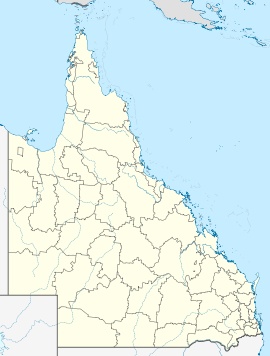
 Dunwich
Population: 804[1] Established: 1827 Postcode: 4183 Coordinates: 27°30′S 153°24′E / 27.5°S 153.4°ECoordinates: 27°30′S 153°24′E / 27.5°S 153.4°E Location: - 55 km (34 mi) E of Brisbane
- 15 km (9 mi) E of Cleveland, Queensland
LGA: Redland City State District: Cleveland Federal Division: Bowman Dunwich (pronounced /ˈdʌnɨtʃ/) is a small town on the western side of North Stradbroke Island in the Australian state of Queensland. The town is part of the Redland City local government area, based on the mainland in the Brisbane bayside suburb of Cleveland. Dunwich is one of three towns on North Stradbroke Island - the others being Amity Point and Point Lookout. At the 2006 census, Dunwich had a population of 804.[1]
Vehicular ferries which cross Moreton Bay link the mainland with North Stradbroke Island dock at Dunwich. Mining companies have also extensive barge docking and loading facilities at Dunwich.
The first settlement at Dunwich was established in 1827 as pilot station and military post.[2] It was supposed to be a good place to discharge cargo from visiting ships that traveled through the South Passage. However cargo was lost in bad weather and local aborigines were hostile so the post was disbanded in 1831.[2]
The settlement also acted as a leper colony before this facility was moved to nearby Peel Island.[citation needed] A quarantine station opened in 1850, although this was eventually moved to the more isolated St Helena Island in Moreton Bay. The station was converted into a nursing home for the elderly and infirmed, one of Queensland's first such facilities. The home was moved to Sandgate in 1946. The main cemetery on the island is found in this small town and contains the graves of over 10 000 people, most of which are unmarked. Other small cemeteries were established for the indigenous community and the leper colony.
Some of the remaining buildings from the Stradbroke Island Benevolent Asylum now form part of the North Stradbroke Island Historical Museum, located in Welsby Street, Dunwich. A convict built causeway also remains, although it has been expanded to accommodate modern ships.[2]
See also
- Redland Shire
- South East Queensland
References
- ^ a b Australian Bureau of Statistics (25 October 2007). "Dunwich (L) (Urban Centre/Locality)". 2006 Census QuickStats. http://www.censusdata.abs.gov.au/ABSNavigation/prenav/LocationSearch?collection=Census&period=2006&areacode=UCL318200&producttype=QuickStats&breadcrumb=PL&action=401. Retrieved 2008-01-27.
- ^ a b c Hogan, Janet (1982). Living History of Brisbane. Spring Hill, Queensland: Boolarang Publications. pp. 23. ISBN 0908175418.
External links
- Redlands Tourism
- North Stradbroke Island page
- State Library of Qld image of Stradbroke Island Benevolent Asylum ca. 1885
Suburbs in Redland City | South East Queensland Alexandra Hills · Amity Point · Birkdale · Capalaba · Cleveland · Coochiemudlo Island · Dunwich · Karragarra Island · Lamb Island · Macleay Island · Mount Cotton · North Stradbroke Island · Ormiston · Point Lookout · Redland Bay · Russell Island · Sheldon · Thorneside · Thornlands · Victoria Point · Wellington Point
Main Article: Local Government Areas of QueenslandCategories:- Towns in Queensland
- Coastal towns in Queensland
- Populated places established in 1827
- Suburbs of Redland City

Wikimedia Foundation. 2010.