- Dorum
-
Dorum 

 DorumLocation of Dorum within Cuxhaven district
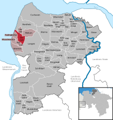

Coordinates 53°40′28″N 8°30′57″E / 53.67444°N 8.51583°ECoordinates: 53°40′28″N 8°30′57″E / 53.67444°N 8.51583°E Administration Country Germany State Lower Saxony District Cuxhaven Municipal assoc. Land Wursten Local subdivisions Dorum - Ort, Dorum-Neufeld Mayor Klaus Seier (CDU) Basic statistics Area 24.32 km2 (9.39 sq mi) Elevation 2 m (7 ft) Population 3,654 (31 December 2010)[1] - Density 150 /km2 (389 /sq mi) Other information Time zone CET/CEST (UTC+1/+2) Licence plate CUX Postal code 27632 Area codes 04742 oder 04741 Website www.dorum.de  Sunset in Dorum with pharos "Obereversand"
Dorum is a municipality in the district of Cuxhaven, in Lower Saxony, Germany.
The Land of Wursten, whatever a rather autonomous farmers' republic including Dorum, had long been claimed by the Prince-Archbishopric of Bremen, until in 1524 it could be definitely be subjected. In 1648 the Prince-Archbishopric was transformed into the Duchy of Bremen, which was first ruled in personal union by the Swedish and from 1715 on by the Hanoverian Crown. In 1823 the Duchy was abolished and its territory became part of the Stade Region.
Armstorf · Bad Bederkesa · Belum · Beverstedt · Bramstedt · Bülkau · Cadenberge · Cappel · Cuxhaven · Dorum · Drangstedt · Driftsethe · Elmlohe · Flögeln · Geversdorf · Hagen im Bremischen · Hechthausen · Hemmoor · Hollnseth · Ihlienworth · Köhlen · Kührstedt · Lamstedt · Langen · Lintig · Loxstedt · Midlum · Misselwarden · Mittelstenahe · Mulsum · Neuenkirchen · Neuhaus · Nordholz · Nordleda · Oberndorf · Odisheim · Osten · Osterbruch · Otterndorf · Padingbüttel · Ringstedt · Sandstedt · Schiffdorf · Steinau · Stinstedt · Uthlede · Wanna · Wingst · Wremen · Wulsbüttel

References
- ^ "Bevölkerungsfortschreibung" (in German). Landesbetrieb für Statistik und Kommunikationstechnologie Niedersachsen. 31 December 2009. http://www1.nls.niedersachsen.de/statistik/html/parametereingabe.asp?DT=K1000014&CM=Bev%F6lkerungsfortschreibung.
Categories:- Municipalities in Lower Saxony
- Lüneburg region geography stubs


Wikimedia Foundation. 2010.