Cippenham Moat

Cippenham Moat
Cippenham Moat is located in Berkshire
{{{alt}}}
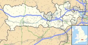
Map showing the location of Cippenham Moat within Berkshire.

Cippenham Moat refers to the remains of a 13th Century Royal Palace created by King Henry III, located in the Cippenham suburb of Slough, in Berkshire. The area where the Palace once stood is still referred to and marked on maps as Cippenham Moat.[1]

Richard, 1st Earl of Cornwall - brother to Henry III - had his honeymoon here, and later created a deer park. By 1575, however, Saxton's map shows the parks at Windsor and Langley, but not Cippenham.

It was rediscovered by farmers in early Victorian times and is now a listed monument.

Notes and references

Coordinates: 51°30′32″N 0°37′47″W / 51.5089°N 0.6296°W / 51.5089; -0.6296


Wikimedia Foundation. 2010.

Игры ⚽ Нужно сделать НИР?

Look at other dictionaries:

  • Cippenham — Coordinates: 51°30′57″N 0°38′19″W / 51.5159°N 0.6387°W / 51.5159; 0.6387 …   Wikipedia

  • Henry III of England — Henry III Oil painting of Henry III by unknown artist, ca. 1620, later incorrectly inscribed Eduardus . King of England (more...) Reign …   Wikipedia

  • History of Slough — Slough (pronEng|ˈslaʊ) is a town and unitary authority (Borough of Slough) in the English county of Berkshire (formerly in Buckinghamshire), just to the west of Greater London. The town developed in the nineteenth and twentieth centuries from a… …   Wikipedia

  • Windsor Meadows — is a housing estate in the suburb of Cippenham, Slough, Berkshire.The estate was built in the 1980 s, taking over most of the land owned by Cippenham Court Farm.The barn is now a pub restaurant called The Long Barn .The area includes the famous… …   Wikipedia

  • Princes Risborough — Coordinates: 51°43′26″N 0°50′04″W / 51.723978°N 0.834418°W / 51.723978; 0.834418 …   Wikipedia

Share the article and excerpts

Direct link
Do a right-click on the link above
and select “Copy Link”