- Méricourt, Pas-de-Calais
-
Méricourt

 MéricourtLocation within Nord-Pas-de-Calais region
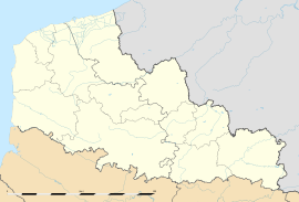 Méricourt
Administration Country France Region Nord-Pas-de-Calais Department Pas-de-Calais Arrondissement Lens Canton Avion & Rouvroy Intercommunality Communaupole de Lens-Liévin Mayor Bernard Baude
(2008–2014)Statistics Elevation 31–63 m (102–207 ft)
(avg. 55 m/180 ft)Land area1 7.53 km2 (2.91 sq mi) Population2 11,938 (2006) - Density 1,585 /km2 (4,110 /sq mi) INSEE/Postal code 62570/ 62680 1 French Land Register data, which excludes lakes, ponds, glaciers > 1 km² (0.386 sq mi or 247 acres) and river estuaries. 2 Population without double counting: residents of multiple communes (e.g., students and military personnel) only counted once. Coordinates: 50°24′11″N 2°52′00″E / 50.4030555556°N 2.86666666667°E
Méricourt is a commune in the Pas-de-Calais department in the Nord-Pas-de-Calais region of France.
Contents
Geography
Méricourt is a former coal mining town, nowadays a farming and light industrial town, 3 miles (4.8 km) southeast of Lens, at the junction of the D33, D40 and the D262 roads. Rare for a small town, the commune is split between the two cantons of Avion & Rouvroy.
History
The history of the region remains marked by the Courrières mine disaster, which left 1,099 dead on 10 March 1906. The communes affected were Méricourt, Billy-Montigny, Noyelles-sous-Lens and Sallaumines.
It was at Méricourt that the memorial to the mining disaster was erected. Since 2006, the memorial has also included an overground pathway retracing the route underground of the survivors who managed to get out of the galleries about three weeks after the collapse and resulting firedamp and dust.
Population
Population history 1962 1968 1975 1982 1990 1999 2006 13,200 13,416 13,806 13,273 12,330 11,723 11,938 Census count starting from 1962: Population without duplicates Places of interest
- The church of St.Martin, rebuilt along with most of the town, after the First World War.
- The church of St.Barbe, dating from the nineteenth century.
- Vestiges of an old chateau.
- The memorials.
 The memorial to the dead miners (le « silo »)
 ”Survivors Way” « Parcours des rescapés » that links the necropolis of Méricourt to pit no. 2 at Billy-Montigny
See also
References
External links
- Official town website (French)
- Méricourt on the Quid website (French)
Categories:- Communes of Pas-de-Calais
- Pas-de-Calais geography stubs


Wikimedia Foundation. 2010.