- Overbrook Farms, Philadelphia, Pennsylvania
-
Overbrook Farms


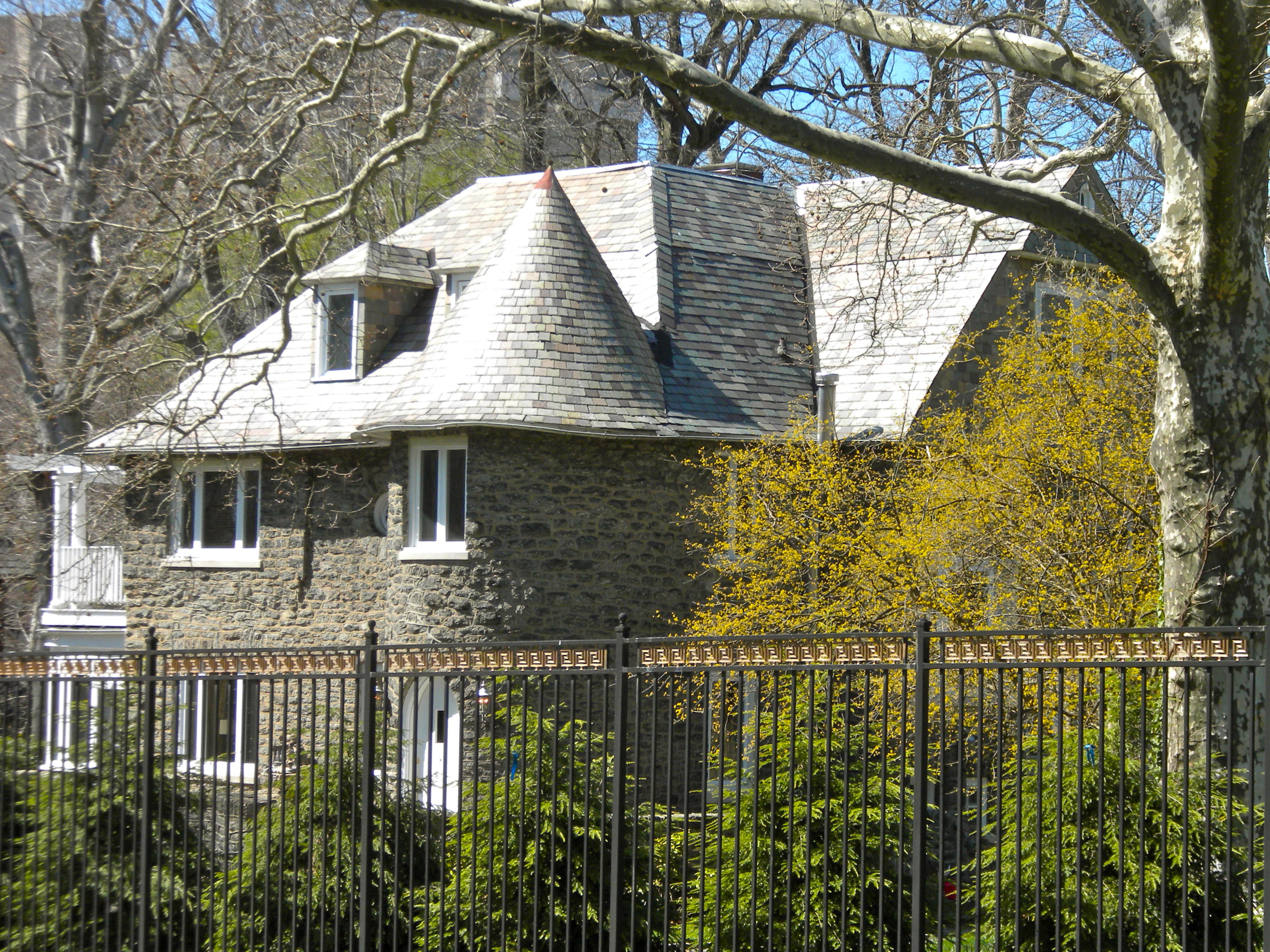
Location: Roughly bounded by City Line Ave., 58th St., Woodbine Ave. and 64th St., Philadelphia, Pennsylvania Coordinates: 39°59′11″N 75°15′13″W / 39.98639°N 75.25361°WCoordinates: 39°59′11″N 75°15′13″W / 39.98639°N 75.25361°W Area: 168 acres (68 ha) Built: 1893 Architect: Keen & Mead et al. Architectural style: Late 19th and 20th Century Revivals, Late Victorian Governing body: Private NRHP Reference#: 85000690[1] Added to NRHP: March 21, 1985  House on Overbrook Avenue
Overbrook Farms is a neighborhood on the western edge of the West Philadelphia section of Philadelphia, Pennsylvania, United States. Roughly bounded by City Avenue (US Route 1), 58th Street, Woodbine Avenue, and 66th Street at Morris Park. The neighborhood is bisected by Lancaster Avenue (Route 30) and the original Pennsylvania Railroad "main line" which today is used by Amtrak and SEPTA's Paoli/Thorndale Line. The historic district description and statement of significance can be found at [1]. Overbrook Farms, Its Historical Background, Growth and Community Life by Tello J. d'Apery, M.D. [the Magee Press, 1936] also provides a complete history of the area.
This region of Philadelphia and its suburbs were originally settled by Welsh immigrants who purchased land from William Penn. Two of these farms contributed land for the Overbrook Farms neighborhood. The neighborhood is often incorrectly considered to be a sub-section of the larger and densely developed Overbrook neighborhood, yet Overbrook Farms was founded first in 1892 as the first planned community on the Main Line of the Pennsylvania Railroad. The Overbrook Farms Company was the neighborhood's developer with links to directors of the Girard and Drexel Banks and the Pennsylvania Railroad. This planned community includes some of the first residential projects of the first graduating class of the University of Pennsylvania's architectural program.
Overbrook Farms maintains the oldest continually operating neighborhood association in America, the Overbrook Farms Club (OFC). OFC sponsors an annual house tour each Spring.
There is a more recent development of smaller homes with modern incursions, called Greenhill Farms and is not on the Historic Register. This development extends from 66th St. up to 72nd Street. It is bordered on three sides by Morris Park and on the west by City Avenue and includes some original mansions built on Wistar Morris' gentleman's farm.
Public libraries
Free Library of Philadelphia operates the Wynnefield Branch [2].
References
- ^ "National Register Information System". National Register of Historic Places. National Park Service. 2007-01-23. http://nrhp.focus.nps.gov/natreg/docs/All_Data.html.
External links
- Overbrook Farms history Overbrook Farms its historical background, growth and community life. This entire book is available free for download from Penn State's Digital Bookshelf.
Neighborhoods of the West Philadelphia section of Philadelphia, Pennsylvania Belmont • Belmont Village • Carroll Park • Cathedral Park • Cedar Park • Cobbs Creek • Dunlap • Garden Court • Haddington • Haverford North • Mantua • Mill Creek • Overbrook • Overbrook Farms • Overbrook Park • Parkside • Powelton Village • Saunders Park • Spruce Hill • Squirrel Hill • University City • Walnut Hill • Woodland Terrace • Wynnefield • Wynnefield Heights
 Categories:
- Historic districts in Pennsylvania
- Neighborhoods in Philadelphia, Pennsylvania
- National Register of Historic Places in Philadelphia, Pennsylvania
- Houses on the National Register of Historic Places in Pennsylvania
- Buildings and structures completed in 1893
- Historic districts in Philadelphia, Pennsylvania
- Philadelphia, Pennsylvania stubs
- Pennsylvania Registered Historic Place stubs


Wikimedia Foundation. 2010.