- Cockaponset State Forest
-
Cockaponset State Forest 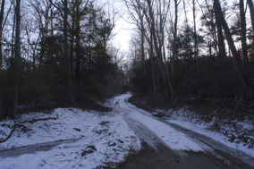
Road to Chester Swamp.Map of Connecticut
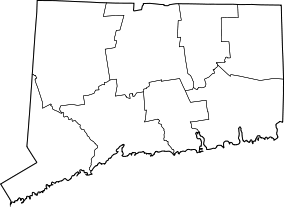
Location Middlesex County Nearest city Haddam, CT Coordinates 41°25′N 72°31′W / 41.417°N 72.517°WCoordinates: 41°25′N 72°31′W / 41.417°N 72.517°W Area 16,000 acres (65 km²) Established 1926 Governing body Connecticut Department of Energy and Environmental Protection (CT DEEP)
Cockaponset State Forest is the second largest forest in the Connecticut state forest system, encompassing over 16,000 acres (65 km²) of land. Most of the land is in Middlesex County though some parcels lie in New Haven County. The forest is disjointed, and comprises land in the towns of Haddam, Chester, Deep River, Killingworth, Durham, Guilford, Madison, Clinton, Westbrook, Middletown and Middlefield. The Chester Cedar Swamp portion of the forest was declared a National Natural Landmark in May 1973[1]The forest is named after a Native American chief buried in Haddam.
Contents
Chester Cedar Swamp
A portion of the forest is known as the Chester Cedar Swamp, which along with Pachaug-Great Meadow Swamp is one of the finest remaining examples of an Atlantic white cedar forest.[1] It was declared a National Natural Landmark. This type of forest is at risk and being succeeded by hemlock.[2]
Hiking trails
The CT DEP manages a 20-mile (32 km) trail system based around Pattaconk Reservoir Recreation Area near Chester, CT. Some trails have been designated for footpath only, while others are open to horses and mountain bikes. The centerpiece for this area is the scenic Pattaconk Lake which is a hotbed for swimming, fishing, and paddling. Even though the CT DEP has maps detailing only 20 miles (32 km) of trails, there are over 100 miles (160 km) of trails within the greater Cockaponset State Forest. According to the headquarters at Chatfield Hollow State Park, many of these unmarked trails have an undesignated status, which means that the CT DEP has either not yet decided their use or are within an area earmarked for logging in the future. These undesignated trails are currently open to most users willing to respect low-impact travel.
Pine Ledge
Pine Ledge is a popular rock climbing destination within Cockaponset State Forest located about a half mile west of Deep River, Connecticut. The rocky cliff is as high as 60 feet (18 m) at its southern end and extends for about a half mile north. The larger cliff faces are primarily used with top-roping techniques and there are several large bouldering rocks. The locals have also adopted the name, "Pine Ledge," to describe the surrounding section of Cockaponset State Forest where the Pine Ledge cliff resides.
At this time, the access roads are somewhat rugged and may become thick with mud after a heavy rain or during the spring melt. However, there are hardly any large rocks and few bumps, and the road is usually pretty wide. Even though the use of all-terrain-vehicles has not been officially designated, the greater Pine Ledge area has become very popular among local riders. Jeeps and 4X4 off-road vehicles have also utilized some of the old abandoned access roads as trails. There are foot paths through dense mountain laurel throughout the Pine Ledge rock climbing area as access to the more remote cliff edges.
See also
References
- ^ a b "National Natural Landmark summary". National Park Service. February 5, 2004. http://www.nature.nps.gov/nnl/Registry/USA_Map/States/Connecticut/NNL/CCS/index.cfm. Retrieved 2009-01-10.
- ^ "CONNECTICUT’S COMPREHENSIVE WILDLIFE CONSERVATION STRATEGY". Connecticut Department of Environmental Protection. October 1, 2005. pp. 4–22,4–23. ftp://ftp.state.ct.us/pub/dep/wildlife/cwcs/CWCSCh4.pdf. Retrieved 2009-01-10.
External links
Protected areas of Connecticut National Park Service National Wildlife Refuges Silvio O. Conte • Stewart B. McKinney National Wildlife Refuge
National Trails State Parks Airline • Beckley Iron Furnace Industrial Monument • Bigelow Hollow • Black Rock • Bluff Point • Burr Pond • Camp Columbia • Campbell Falls • Chatfield Hollow • Collis P. Huntington • Connecticut Valley Railroad • Day Pond • Dennis Hill • Devil's Hopyard • Dinosaur • Fort Griswold Battlefield • Fort Trumbull • Gardner Lake • Gay City • George W. Seymour • Gillette Castle • Haddam Meadows • Haley Farm • Hammonasset Beach • Hampton Beach • Harkness Memorial • Haystack Mountain • Hop River State Park Trail • Hopeville Pond • Housatonic Meadows • Hurd • Indian Well • John A. Minetto • Kent Falls • Kettletown • Lake Waramaug • Larkin State Park Trail • Levy • Lovers Leap • Macedonia Brook • Mansfield Hollow • Mashamoquet Brook • Millers Pond • Mohawk Mountain • Moosup Valley State Park Trail • Mount Tom • Old Furnace • Osbornedale • Penwood • Putnam Memorial • Quaddick • Quinnipiac River • River Highlands • Rocky Neck • Selden Neck • Seth Low Pierrepont • Sherwood Island • Silver Sands • Sleeping Giant • Southford Falls • Squantz Pond • Stratton Brook • Talcott Mountain • Wadsworth Falls • West Rock Ridge • Wharton Brook • Windsor Locks Canal State Park Trail
State Forests Algonquin • American Legion • Centennial Watershed • Cockaponset • Enders • James L. Goodwin • Housatonic • Massacoe • Mattatuck • Meshomasic • Mohawk • Mohegan • Nassahegon • Natchaug • Nathan Hale • Nehantic • Nepaug • Nipmuck • Nye-Holman • Pachaug • Paugnut • People's • Pootatuck • Quaddick • Salmon River • Shenipsit • Topsmead • Tunxis • Wyantenock
Connecticut Department of Environmental Protection (web)Categories:- Connecticut state forests
- Parks in Middlesex County, Connecticut
- Hiking trails in Connecticut
- Climbing areas of the United States
- Middlefield, Connecticut
- Middletown, Connecticut
- Madison, Connecticut
- National Natural Landmarks in Connecticut
- Protected areas established in 1926


Wikimedia Foundation. 2010.