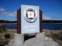
Discovery Island Marine Provincial Park
- Discovery Island Marine Provincial Park
-

The map on display at the campground.

The view from the campground.
Discovery Island Marine Provincial Park is located about two nautical miles east of Oak Bay. It is about a mile long and one-half mile wide and looks out into the Juan de Fuca Strait. Discovery Island Marine Provincial Park is only accessible by boat and is popular with kayakers the nearest marina and official anchorage is located in Oak Bay and the nearest launching ramp is located at cattle point. On the east side of the island on Pandora Hill there is a Lighthouse which has been automated for the past several years Pandora Hill is also one of the turning points for the US and Canadian border. The northern portion of Discovery Island is a First Nations reserve. And southwest of Pandora Hill campers can set up a tent (5 dollars per a person per a night). There is a pit toilet and picnic tables however, there is no drinking water on the island and is a pack in pack out campsite. Rudlin Bay is the main access to the campground which is filled with dangerous rocks as well as being exposed to the southeast however it is possible for a small boat to temporarily anchor there however there is no safe overnight anchorage. Campfires are not permitted on Discovery Island.
References
See also
External links
Coordinates: 48°25′N 123°14′W / 48.417°N 123.233°W / 48.417; -123.233 (Discovery Island Marine Provincial Park)
Wikimedia Foundation.
2010.
Look at other dictionaries:
Newcastle Island Marine Provincial Park — Newcastle Island Aerial shot of Nanaimo and surrounding ar … Wikipedia
Musket Island Marine Provincial Park — is a provincial park in British Columbia, Canada, located on the west side of Nelson Island, at the mouth of Jervis Inlet and near Earl s Cove in the Sunshine Coast region. References Musket Island Marine Park . BC Geographical Names. http://apps … Wikipedia
Discovery Island Light — … Wikipedia
Octopus Islands Marine Provincial Park — Octopus Island sign Octopus Islands Marine Provincial Park is a provincial park in British Columbia, Canada. It is located between Quadra Island and Maurelle Island in Okisollo Channel. External links … Wikipedia
Discovery Island (British Columbia) — This article is about the small island near Victoria, B.C.. For other islands with a similar name, see Discovery Island (disambiguation) … Wikipedia
Discovery Island Lighthouse — In 1886 the Discovery Island Lighthouse was was built on Pandora Hill which is the highest point on the island. The government appointed an old man Richard Brinn to be the first lighthouse keeper. His daughter Mary Ann Croft assisted him. In fact … Wikipedia
Provincial Parks in British Columbia — Karte der Provincial Parks in British Columbia Die kanadische Provinz British Columbia unterhält 620 Provincial Parks (Stand: November 2010). Damit besitzt die Provinz nach den kanadischen Nationalparks das größte Parksystem des Landes. Über 13,5 … Deutsch Wikipedia
List of British Columbia Provincial Parks — The following is a list of all British Columbia land currently managed by [http://www.env.gov.bc.ca/bcparks BC Parks] . Any parks that are closed are not currently listed.There were a number of provincial parks, protected areas and ecological… … Wikipedia
Dinosaur Provincial Park — Chasmosaurus bellis found in park and shown at Royal Tyrrell Museum of Palaeontology Location … Wikipedia
Galiano Island — Swiikw Hul q umín um Island View from Mount Galiano … Wikipedia