- Orlestone
-
Coordinates: 51°03′56″N 0°51′45″E / 51.0656°N 0.8626°E
Orlestone 
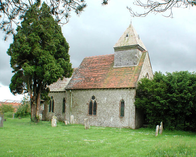
St Mary the Virgin church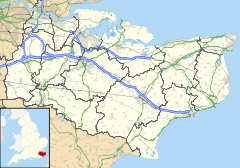
 Orlestone
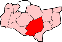
Orlestone shown within KentPopulation 1,281 [1] OS grid reference TR005335 Parish Orlestone District Ashford Shire county Kent Region South East Country England Sovereign state United Kingdom Post town TONBRIDGE Postcode district TN26 Dialling code 01233 Police Kent Fire Kent Ambulance South East Coast EU Parliament South East England UK Parliament Ashford List of places: UK • England • Kent Orlestone is a civil parish in Ashford District, Kent, England, with a population of 1,500. The centre of the parish is Hamstreet village which falls partly within the parish of Warehorne due to the ancient parish boundary. Hamstreet is bypassed by the A2070 road, six miles south of Ashford.
Orlestone itself is a small hamlet with just a handful of houses and the medieval parish church of St Mary the Virgin, parts of which date to the 11th century. Much of the population moved to Hamstreet (originally known as Ham) when the Ashford to Hastings railway opened in 1853; there was also a better source of water at the newer place.
Today, the name Orlestone lives on in the Orlestone Forest (a large area of public woodland), and a number of buildings such as Orlestone Grange and Orlestone Riding Centre (near Shadoxhurst). Also a new housing estate in Hamstreet (built in 2006) was named Orlestone View to commemorate the parish name.
References
- ^ Ashford Borough Council Census 2001
External links
Towns and villages in the Ashford district of Kent, England  Aldington · Aldington Frith · Anvil Green · Appledore · Appledore Heath · Ashford · Bagham · Bethersden · Biddenden · Bilsington · Bilting · Bockhanger · Bodsham · Bonnington · Boughton Aluph · Boughton Corner · Boughton Lees · Brabourne · Brabourne Lees · Brattle · Bromley Green · Brook · Challock · Charing · Chilham · Chilmington Green · Crundale · Eastwell · Ebony · Egerton · Godinton · Godmersham · Great Chart · Hamstreet · Hastingleigh · High Halden · Hinxhill · Hothfield · Kenardington · Kennington · Kingsnorth · Leigh Green · Little Chart · Mersham · Molash · Newenden · Newtown · Orlestone · Pluckley · Reading Street · Rolvenden · Rolvenden Layne · Ruckinge · St Michaels · Sevington · Shadoxhurst · Small Hythe · Smarden · Smeeth · Stanhope · Stone in Oxney · Stubbs Cross · Tenterden · Warehorne · Westwell · Westwell Leacon · Willesborough · Wittersham · Woodchurch · Woolpack Corner · Wye
List of places in Kent Categories:- Ashford, Kent
- Villages in Kent
- Civil parishes in Ashford, Kent
- Kent geography stubs

Wikimedia Foundation. 2010.