- Lower East Side
-
Lower East Side Historic District
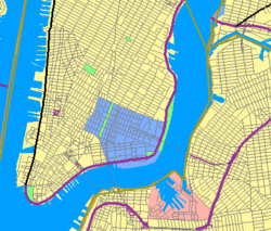 Neighborhood location in Lower Manhattan
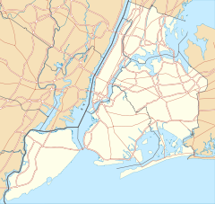

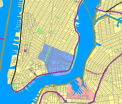
Location: Roughly bounded by Allen St., E. Houston, Essex St., Canal St., Eldridge St., E. Broadway, South Street and Grand St., New York, New York (original)
Roughly along Division, Rutger, Madison, Henry, Grand Sts. (increase)Coordinates: 40°43′2″N 73°59′23″W / 40.71722°N 73.98972°WCoordinates: 40°43′2″N 73°59′23″W / 40.71722°N 73.98972°W Built: 1867 Architect: Herter Brothers; Scneider and Herter, et. al. Architectural style: Greek Revival, Italianate Governing body: Local (original)
U.S. Postal Service (increase)NRHP Reference#: 00001015 (original)
04000297 (increase)Added to NRHP: September 7, 2000 (original)
May 2, 2006 (increase)[1]The Lower East Side, LES, is a neighborhood in the southeastern part of the New York City borough of Manhattan. It is roughly bounded by Allen Street, East Houston Street, Essex Street, Canal Street, Eldridge Street, East Broadway, and Grand Street.
It was traditionally an immigrant, working class neighborhood. But it has undergone rapid gentrification in recent years, prompting The National Trust for Historic Preservation to place the neighborhood on their list of America's Most Endangered Places.[2] It is now home to upscale boutiques, and to trendy dining establishments along its Clinton Street restaurant row.
Contents
Boundaries
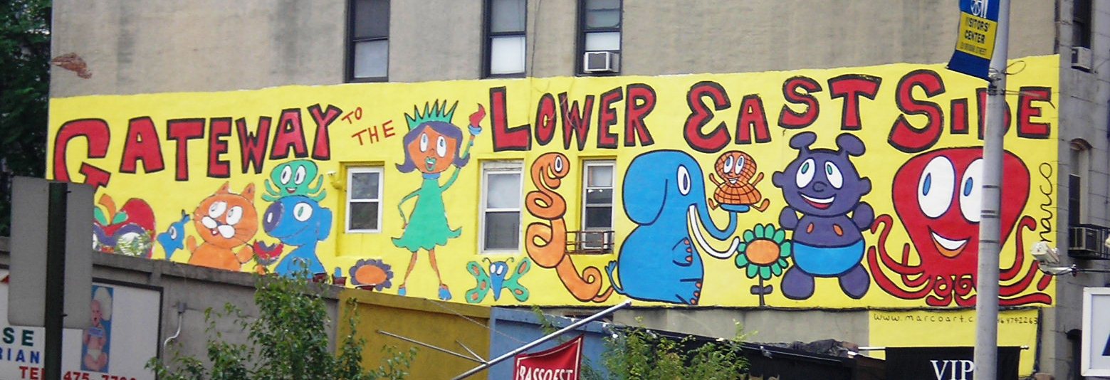
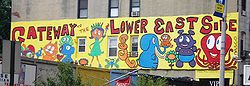 Mural at the intersection of Orchard and Houston Streets, by artist Marco
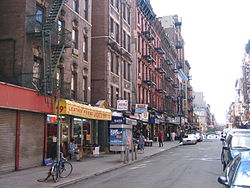 The corner of Orchard and Rivington Streets, Lower East Side (2005)
Current boundaries
The Lower East side, LES, is bordered in the south and west by Chinatown (which extends north to roughly Grand Street), in the west by NoLIta and in the north by East Village.[3][4]
Politically it's located in New York's 8th, 12th and 14th congressional districts, the New York State Assembly's 64th district, the New York State Senate's 25th district, and New York City Council's 1st and 2nd district.
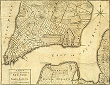
Historical boundaries
Originally, "Lower East Side", LES, referred to the area alongside the East River from about the Manhattan Bridge and Canal Street up to 14th Street, and roughly bounded on the west by Broadway. It included areas known today as East Village, Alphabet City, Chinatown, Bowery, Little Italy, and NoLIta.
The exact western and southern boundaries of the neighborhood are a matter of perspective – New York natives and long-time neighborhood residents, especially the Puerto Rican and black community, and the Jewish community, don't have East Village in their vocabulary, and refer to it as the Lower East Side. The so-called debate about naming conventions typically only applies to the post-gentrification crowd. Most recent arrivals to the area, including new visitors and residents prefer to call the area north of Houston Street the East Village – a name not coined until around 1960.[citation needed]
Although the term today refers to the area bounded to the north by East Houston Street, parts of the East Village are still known as Loisaida, a Latino pronunciation of "Lower East Side." Avenue C is known directly as "Loisaida" and is home to the Loisaida Festival every summer.[5]
Delancey farm
The pre-Revolutionary farm of James Delancey to the east of the post road leading from the city (The Bowery) survives in the name of Delancey Street and, dimly, in Orchard Street. On the modern map of Manhattan the Delancey farm[6] is represented in the grid of streets from Division Street north to Houston Street.[7] In response to the pressure of a growing city, Delancey began to survey streets in the southern part of the "West Farm"[8] in the 1760s. A spacious projected Delancey Square intended to cover the area within today's Eldridge, Essex, Hester and Broome Streets, was eliminated when the Loyalist Delanceys' property was confiscated after the Revolution. The city Commissioners of Forfeiture eliminated the aristocratic planned square for a grid, effacing Delancey's vision of a New York laid out like the West End of London and establishing the resolutely democratic nature of the neighborhood forever.
Corlear's Hook
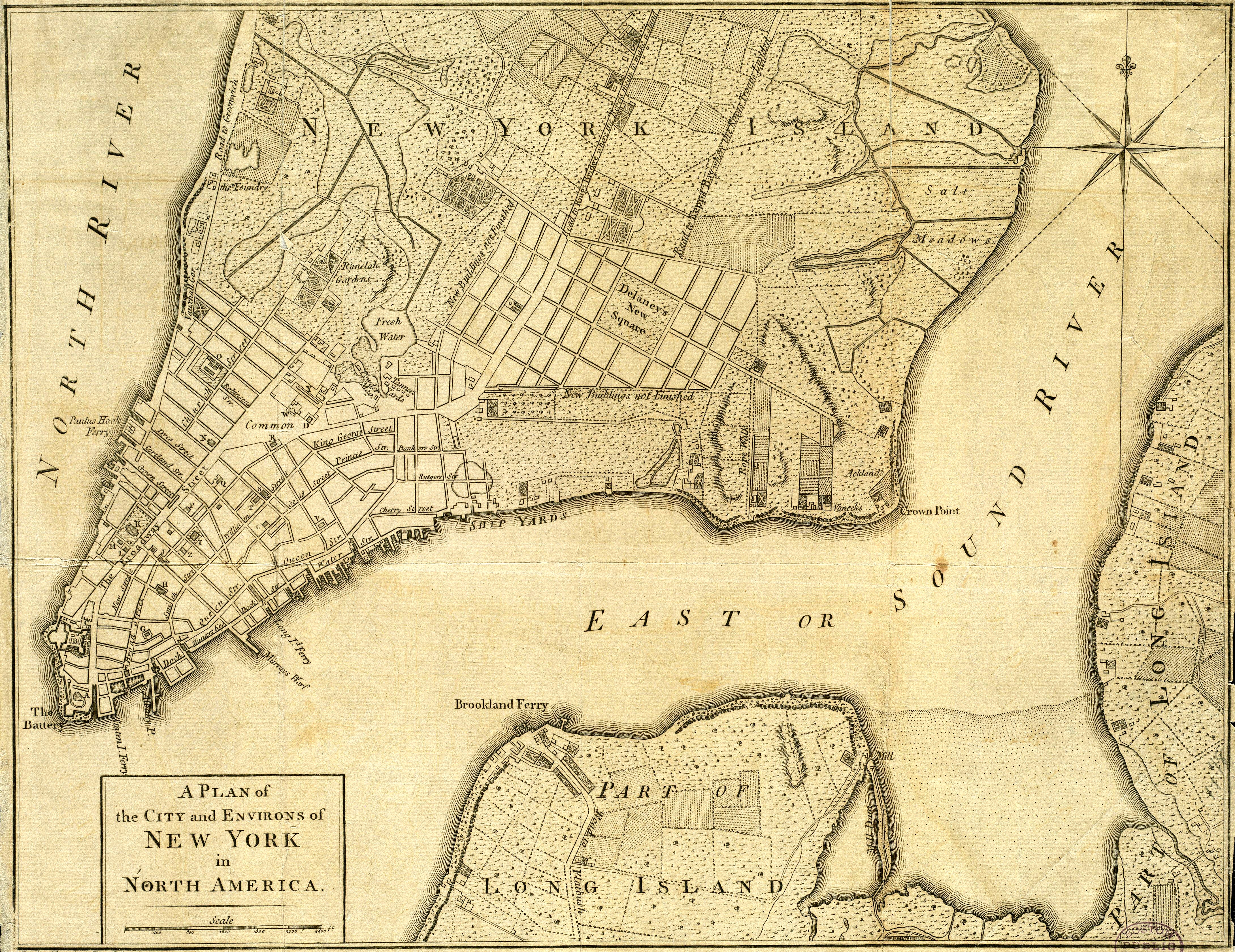
 Corlaers Hook is "Crown Point" in this British map of 1776; "Delaney's [sic] New Square" was never built
This point of land on the East River was also called Corlaers Hook under Dutch and British rule, and briefly Crown Point during British occupation during the Revolution. It was named after the schoolmaster Jacobus van Corlaer, who settled on this "plantation" that in 1638 was called by a Europeanized version of its Lenape name, Nechtans[9] or Nechtanc.[10] Corlaer sold the plantation to Wilhelmus Hendrickse Beekman (1623–1707) founder of the Beekman family of New York; his son Gerardus Beekman was christened at the plantation, August 17, 1653. The projection into the East River that retained Corlaer's name was an important landmark for navigators for 300 years. On older maps and documents it is usually spelled 'Corlaers' Hook, but since the early 19th century the spelling has been anglicized to Corlears. The rough unplanned settlement that developed at Corlaer's Hook under the British occupation of New York during the Revolution was separated from the densely populated city by rough hills of glacial till: "this region lay beyond the city proper, from which it was separated by high, uncultivated, and rough hills", observers recalled in 1843[11] As early as 1816 Corlaer's Hook was notorious for streetwalkers, "a resort for the lewd and abandoned of both sexes", and in 1821 its "streets abounding every night with preconcerted groups of thieves and prostitutes" were noted by the "Christian Herald"[12] In the course of the 19th century they came to be called hookers. In the summer of cholera in New York, 1832, a two-storey wooden workshop was commandeered to serve as a makeshift cholera hospital; between July 18 and September 15 when the hospital was closed, as the cholera wound down, 281 patients were admitted, both black and white, of whom 93 died.[13]
The original location of Corlears Hook is now obscured by shoreline landfill.[14] It was near the east end of the present pedestrian bridge over the FDR Drive near Cherry Street. The name is preserved in Corlear's Hook Park at the intersection of Jackson and Cherry Streets along the East River Drive.[15]
The Lower East Side as an immigrant neighborhood
 Katz's Deli, symbol of the neighborhood's Jewish history, is dwarfed by modern development
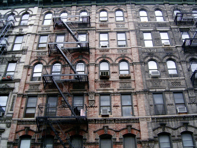
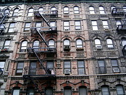 Tenement buildings on the Lower East Side.
One of the oldest neighborhoods of the city, the Lower East Side has long been a lower-class worker neighborhood and often a poor and ethnically diverse section of New York. As well as Irish, Italians, Poles, Ukrainians, and other ethnic groups, it once had a sizeable German population and known as Little Germany (Kleindeutschland). Today it is a predominantly Puerto Rican and Dominican community, and in the process of gentrification (as documented by the portraits of its residents in the Clinton+Rivington chapter of The Corners Project.)[16]
The Lower East Side is perhaps best known as having once been a center of Jewish culture. In her 2000 book Lower East Side memories: A Jewish place in America, Hasia Diner explains that the Lower East Side is especially remembered as a place of Jewish beginnings in contemporary American Jewish culture.[17] Vestiges of the area's Jewish heritage exist in shops on Hester Street and Essex Street and on Grand Street near Pike. There is still an Orthodox Jewish community with yeshiva day schools and a mikvah. A few Judaica shops can be found along Essex Street and a few Jewish scribes and variety stores. Some kosher delis and bakeries as well as a few "kosher style" delis, including the famous Katz's Deli, are located in the neighborhood. Downtown Second Avenue on the Lower East Side was the home to many Yiddish theatre productions during the early part of the 20th century, and Second Avenue came to be known as 'Yiddish Broadway', though most of the theaters are gone. Songwriter Irving Berlin, actor John Garfield and singer Eddie Cantor grew up here. More recently, it has been settled by immigrants, primarily from Latin America.
In what is now the East Village, the earlier population of Poles and Ukrainians has been largely supplanted with newer immigrants, and the arrival of large numbers of Japanese people over the last fifteen years or so has led to the proliferation of Japanese restaurants and specialty food markets. There is also a notable population of Bangladeshis and other immigrants from Muslim countries, many of whom are congregants of the small Madina Masjid (Mosque), located on First Avenue and 11th Street.
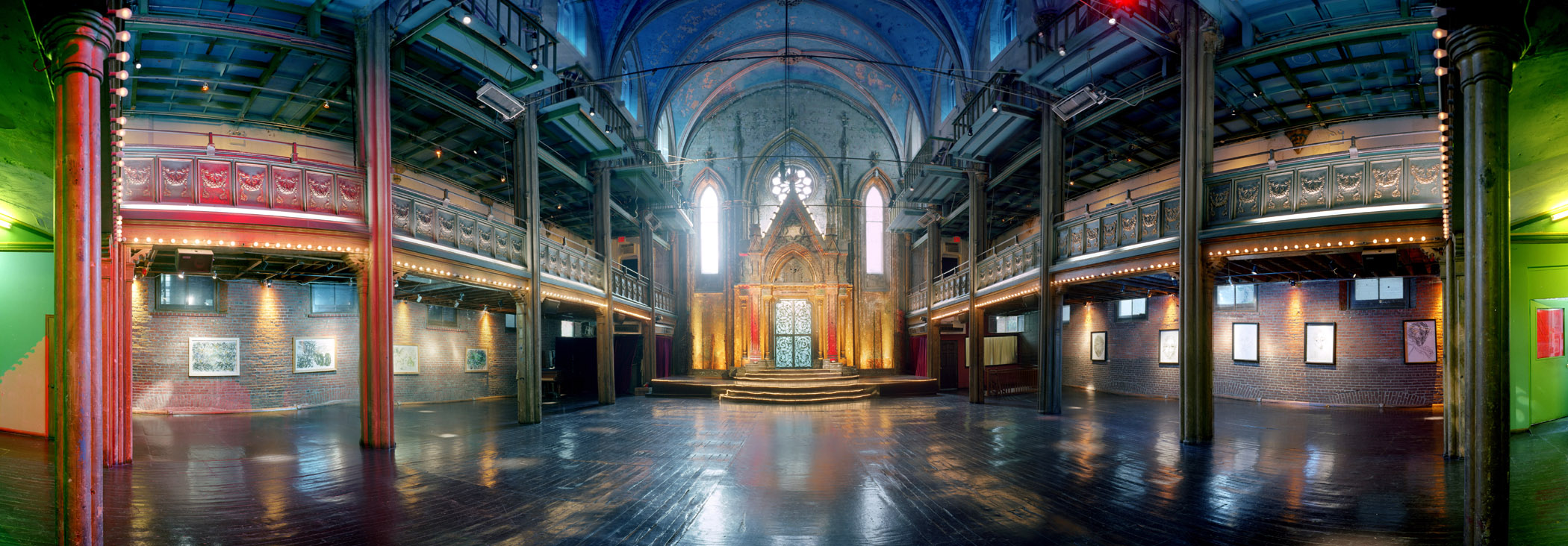
The neighborhood also presents many historic synagogues, such as the Bialystoker Synagogue,[18] Beth Hamedrash Hagadol, the Eldridge Street Synagogue,[19] Kehila Kedosha Janina (the only Greek synagogue in the Western Hemisphere),[20] the Angel Orensanz Center, the fourth oldest synagogue building in the United States, and various smaller synagogues along East Broadway. Another landmark, the First Roumanian-American congregation (the Rivington Street synagogue) partially collapsed in 2006, and was subsequently demolished. In addition, there is a major Hare Krishna temple and several Buddhist houses of worship.
The Bowery, named by the Dutch settlers de Bouwerij(Farm), is the home of the Christian Herald Association's faith-based organization known as The Bowery Mission, historically serving the down-and-out since it was founded in 1879. Another notable landmark on the Bowery was CBGB, a nightclub that presented live music—including some of the most famous figures in rock 'n roll like Ramones and Blondie—from 1973 until it closed on October 15, 2006. A bit further north and east is McSorley's Old Ale House, a well known Irish bar that opened its doors in 1854.
Incoming Chinese people have also made their mark on the Lower East Side in recent decades. The part of the neighborhood south of Delancey Street and west of Allen Street has in large measure become part of Chinatown, and Grand Street is one of the major business and shopping streets of Chinatown. Also contained within the neighborhood are strips of lighting and restaurant supply shops on the Bowery.
The Jewish Lower East Side
While the Lower East Side has seen a series of immigrant communities pass through, American Jews relate to the neighborhood in a particularly strong manner, much as Chinatown in San Francisco holds a special place in the imagination of Chinese Americans, and Astoria in the hearts of Greek Americans. In the late twentieth century, the strong pull of the Lower East Side on the imagination of American Jews led to the preservation of a number of buildings associated with the Jewish immigrant community.[21][22][23]
Landmarks of the Jewish Lower East Side
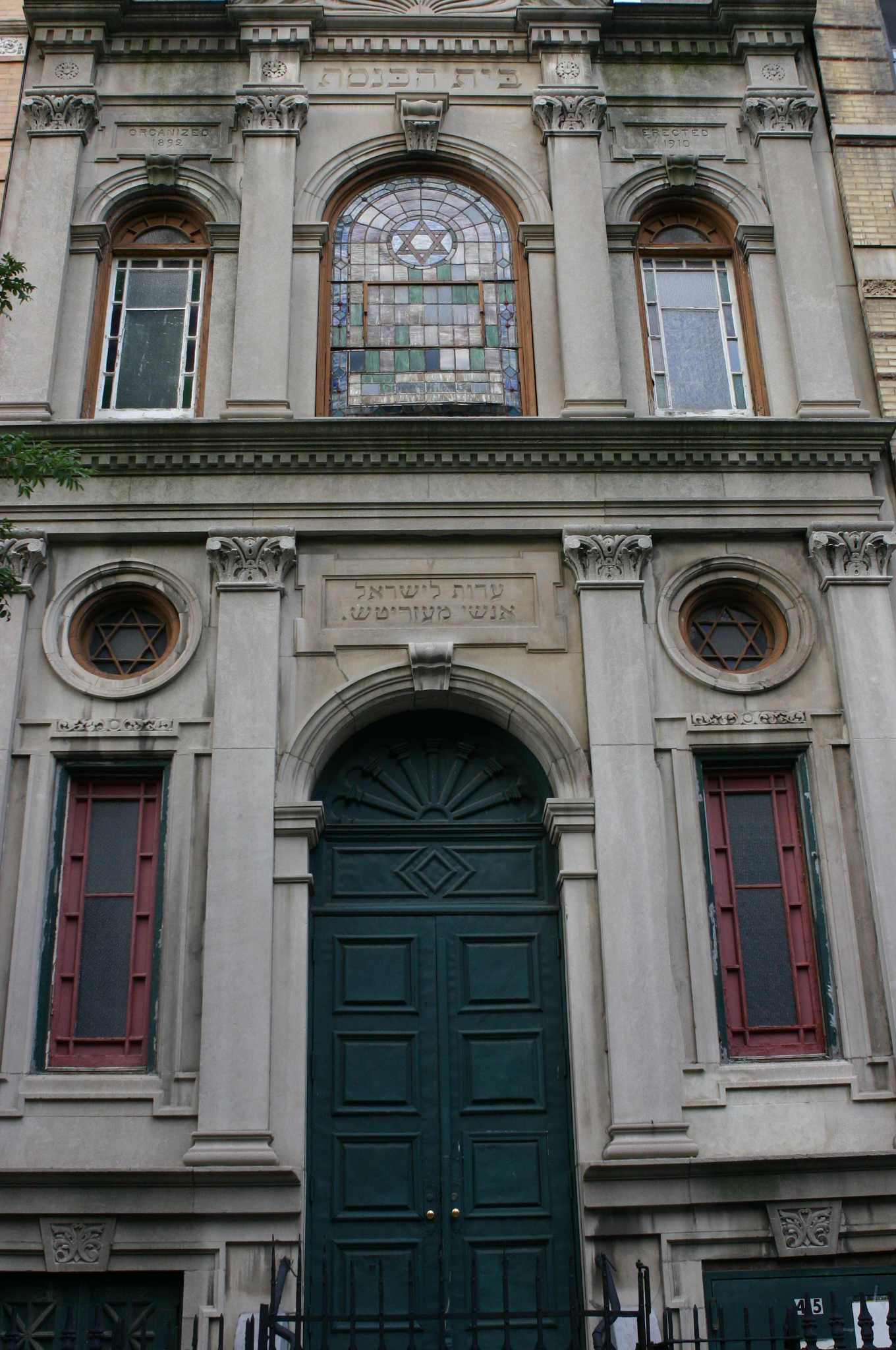
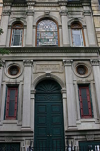 Meseritz Synagogue
- The Educational Alliance Settlement house – 175 East Broadway at Jefferson Street
- Henry Street Settlement – 263–267 Henry Street and 466 Grand Street
- University Settlement House 184 Eldridge Street
- Katz's Deli – 205 E. Houston Street
- Guss' Pickles – 87 Orchard Street
- Kossar's Bialys – 367 Grand Street
- Gertle's Bake Shop – 53 Hester Street- Moved to Brooklyn, opened as a Catering business
- Knickerbocker Village – 10 Monroe Street
- Streit Matzo Co. – 150 Rivington Street
- Yonah Shimmel's Knish Bakery – 137 E. Houston Street
- Russ & Daughters – 179 E. Houston Street
- Schapiro's Kosher Wine – Essex Street Market
Synagogues
- Bialystoker Synagogue – 7–11 Willet Street
- Beth Hamedrash Hagadol – 60–64 Norfolk Street
- Eldridge Street Synagogue – 12 Eldridge Street
- Kehila Kedosha Janina – 280 Broome Street
- Angel Orensanz Center – the fourth-oldest synagogue building in the United States.
- Congregation Chasam Sopher
- Meseritz Synagogue
- Stanton Street Synagogue
- Boyaner kloiz at 247 East Broadway, opened in 1928 by the Boyaner Rebbe of New York
East Village split and gentrification
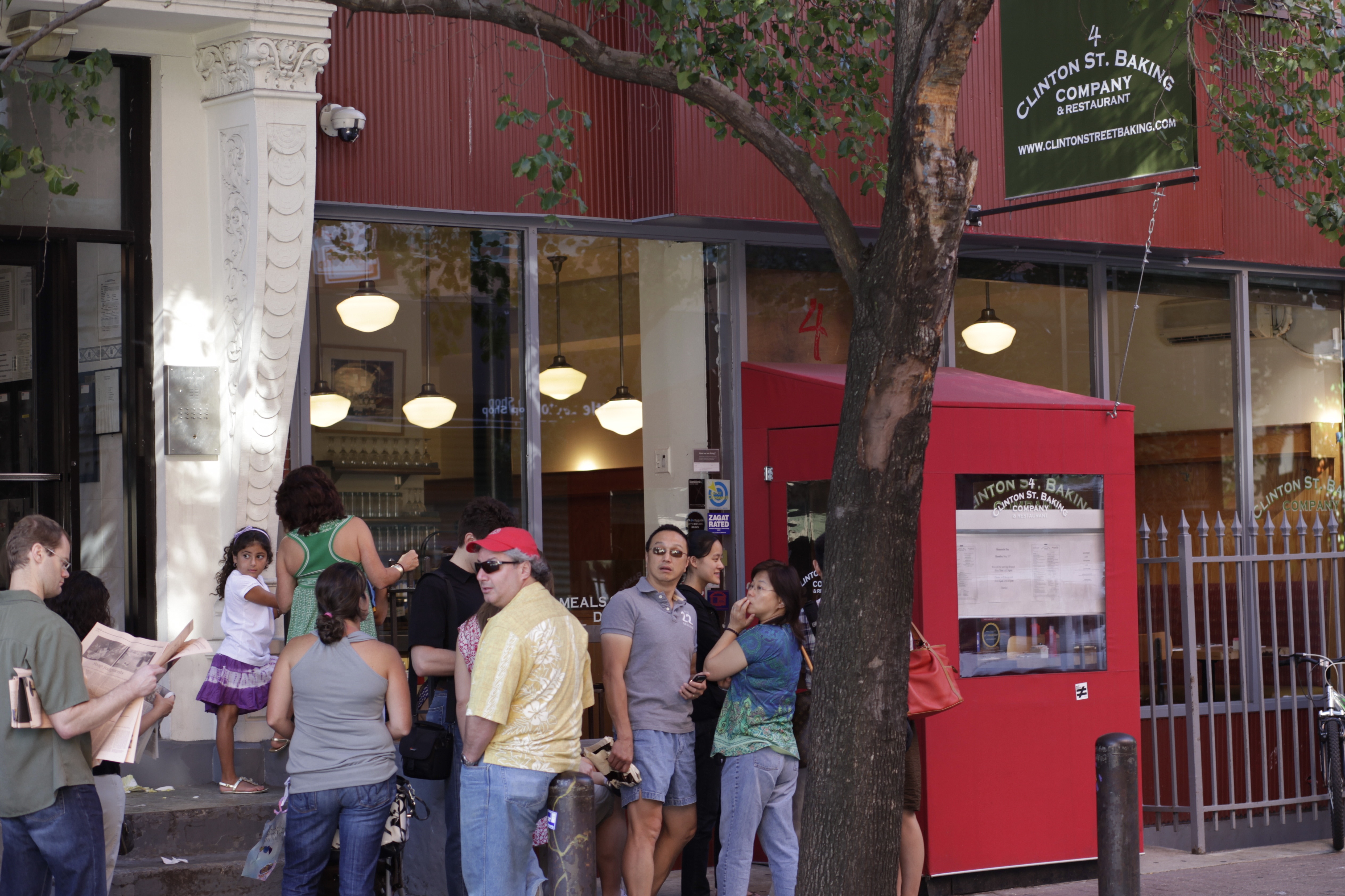
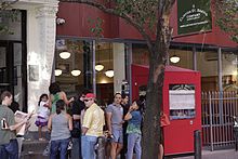 Line of patrons at the Clinton St. Baking Company & Restaurant in 2010
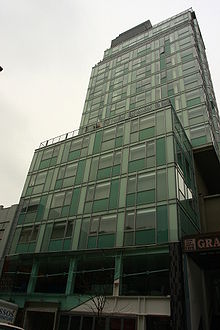 The Hotel on Rivington was completed in 2005
The East Village was once considered the Lower East Side's northwest corner. However, in the 1960s, the demographics of the area above Houston Street began to change, as hippies, musicians and artists moved in. Newcomers and real estate brokers popularized the East Village name, and the term was adopted by the popular media by the mid-1960s. As the East Village developed a culture separate from the rest of the Lower East Side, the two areas came to be seen as two separate neighborhoods rather than the former being part of the latter.[24][25]
In the early 2000s, the gentrification of the East Village spread to the Lower East Side, making it one of the trendiest neighborhoods in Manhattan. Orchard Street, despite its "Bargain District" moniker, is now lined with upscale and boutiques.
Similarly, trendy restaurants, including Clinton St. Baking Company & Restaurant, wd~50, Cube 63, and Falai are found on a stretch of tree-lined Clinton Street that The New York Magazine described as the "hippest restaurant row" in the Lower East Side.[26][27]
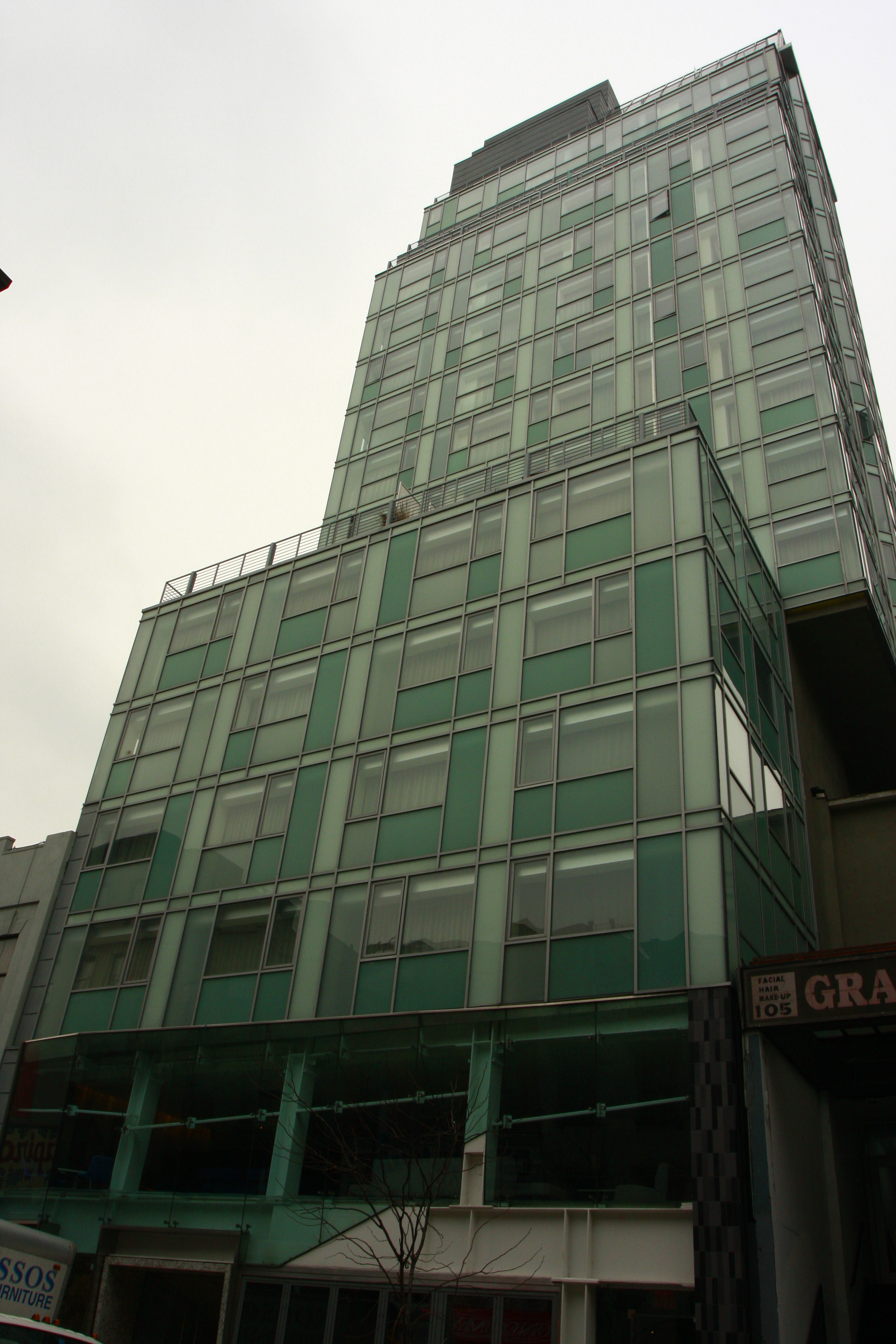
In 2006, a 32-unit, 16 story luxury condominium was completed on Norfolk just north of Delancey, the design of which starkly contrasts with the surrounding neighborhood. Following the construction of the Hotel on Rivington one block away, several luxury condominiums around Houston, and the New Museum on the Bowery this new wave of construction is another sign that the gentrification cycle is entering a high-luxury phase similar to SoHo and Nolita in the previous decade.
More recently, the gentrification that was previously confined to north of Delancey Street continued south. Several restaurants, bars, and galleries opened below Delancey Street after 2005, especially around the intersection of Broome and Orchard Streets. The neighborhood's second boutique hotel, Blue Moon Hotel, opened on Orchard Street just south of Delancey Street in early 2006. However, unlike The Hotel on Rivington, the Blue Moon used an existing tenement building, and its exterior is almost identical to neighboring buildings.
Education
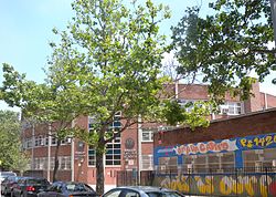 PS 142 on Attorney Street
Among the public elementary and middle schools are charter schools, including Girls Prep for girls with a goal of graduating from college.
Lower East Side Preparatory High School is a second-chance school that enables students, aged 17–21, to obtain their high school diplomas. It is a bilingual Chinese-English school with a high proportion of Asian students.
Art scene
The neighborhood has become home to numerous contemporary art galleries. One of the very first was ABC No Rio.[28] Begun by a group of Colab no wave artists (some living on Ludlow Street), ABC No Rio opened an outsider gallery space that invited community participation and encouraged the widespread production of art. Taking an activist approach to art that grew out of The Real Estate Show (the take over of an abandoned building by artists to open an outsider gallery only to have it chained closed by the police) ABC No Rio kept its sense of activism, community, and outsiderness. The product of this open, expansive approach to art was a space for creating new works that did not have links to the art market place and that were able to explore new artistic possibilities.
Other outsider galleries sprung up throughout the Lower East Side and East Village, Manhattan-some 200 at the height of the scene in the 1980s. In December 2007, the New Museum relocated to a brand-new, critically acclaimed building on the Bowery at Prince. A growing number of galleries are opening in the Bowery neighborhood to be in close proximity to the museum.
Nightlife and live music
As the neighborhood gentrified and has become safer at night, it has become a popular late night destination.[citation needed] Orchard, Ludlow and Essex between Rivington Street and Stanton Street have become especially packed at night, and the resulting noise is a cause of tension between bar owners and longtime residents.[29] [30]
Also, the Lower East Side is home to many live music venues. Punk bands play at C-Squat[citation needed] and alternative rock bands play at Bowery Ballroom on Delancey Street and Mercury Lounge on East Houston Street, while lesser known bands played at Tonic (which closed on April 13, 2007) on Norfolk Street and Rothko (now closed) on Suffolk Street.[citation needed] There are also bars that offer performance space, such as Pianos, the Living Room and Cake Shop on Ludlow Street and Arlene's Grocery on Stanton Street.
In popular culture
- Children's literature
- All-of-a-Kind Family by Sydney Taylor
- The House on the Roof; A Sukkot Story by David A. Adler
- Rebecca Rubin, a character in the American Girl doll and book series,
is a Jewish girl growing up in an immigrant family in 1914.[31]
- Rebecca Rubin, a character in the American Girl doll and book series,
- Novels
- Low Life by Luc Sante
- Bread Givers by Anzia Yezierska
- Lush Life by Richard Price
- Ragtime by E. L. Doctorow
- Songs
- L.E.S by Childish Gambino (aka Donald Glover)
- Lower East Side by David Peel (Regarded to be the first punk song)
- "Alleged" by UNSANE
- "L.E.S. Artistes" by Santigold
- "Living in L.E.S." by INDK
- "In the Flesh" by Blondie
- Nova Slum Goddess by the Fugs
- "Marry the Night" by Lady Gaga
- "The Luckiest Guy On The Lower East Side" by The Magnetic Fields
- "Lower East Side Crew" by Warzone
- "Ludlow St" by Julian Casablancas
- "Ludlow Street" by Suzanne Vega
- "For My Family" by Agnostic Front
- "Clinton St Girl" by Wakey!Wakey!
- "What's My Name" by Rihanna ft. Drake
- "East Side Beat" by The Toasters
- "New York City is Dead" Lower East Side Stitches
- "Heavy Metal Lover" by Lady Gaga
- Bands
- David Peel & the Lower East Side Band an early punk band
- Gogol Bordello A critically acclaimed gypsy punk band from the area.
- The Holy Modal Rounders an influential freak-folk band in the '60s
- Nausea a seminal crust punk band in the late '80s and early '90s.
- Lower East Side Stitches 90's Punk Rock in the vein of The Dead Boys.
- Plays
- Secret History of the Lower East Side by Alice Tuan
- Films
- Sex and the City
- Downtown 81
- I Am Legend
- P.S. I Love You
- Cloverfield
- Crossing Delancey
- Die Hard With A Vengeance
- His People
- Date Night
- The Naked City
- The Night They Raided Minsky's
- The Italian
- Lucky Number Slevin
- Frogs for Snakes
- Mixed Blood
- Batteries Not Included
- Once Upon a Time in America [1984 film]
- Raising Victor Vargas
- Hester Street
- Beautiful Losers (film)
- NYPD Blue (TV)
- When Harry Met Sally
- Rent (film)
- Nick and Nora's Infinite Playlist (film)
- Television
- How To Make It In America
- Video games
See also
- Alife Rivington Club
- Cooperative Village
- Grand Street Settlement
- East Side (Manhattan)
- East Side Hebrew Institute (ESHI)
- First Houses
- Henry Street Settlement
- Lower East Side Conservancy
- Lower East Side Tenement Museum
- Moshe Feinstein
- Ray's Candy Store
- Tompkins Square Park
- University Settlement House
Notes
- ^ "National Register Information System". National Register of Historic Places. National Park Service. 2008-04-15. http://nrhp.focus.nps.gov/natreg/docs/All_Data.html.
- ^ "Threats to history seen in budget cuts, bulldozers – Yahoo! News". News.yahoo.com. http://news.yahoo.com/s/ap_travel/20080521/ap_tr_ge/travel_yesterday_s_places_endangered_places. Retrieved March 16, 2010.
- ^ Virshup, Amy. "New York Nabes". The New York Times. http://www.nytimes.com/fodors/top/features/travel/destinations/unitedstates/newyork/newyorkcity/fdrs_feat_111_13.html. Retrieved January 13, 2007.
- ^ McEvers, Kelly (March 2, 2005). "Close-Up on the Lower East Side". Village Voice. http://www.villagevoice.com/nyclife/0510,mcevers,61581,15.html. Retrieved January 13, 2007.
- ^ http://loisaidainc.org
- ^ The Delancey town house later became Fraunces Tavern.
- ^ "Gilbert Tauber, "Old Streets of New York: Delancey Farm grid"". Oldstreets.com. http://www.oldstreets.com/index.asp?title=Delancey%20Farm%20Grid. Retrieved May 14, 2011.
- ^ The division between the "West Farm" and the "East farm" ran approximately along today's Clinton Street, according to Eric Homberger, The Historical Atlas of New York City: a visual celebration of nearly 400 years 2005:60–61.
- ^ Edward Van Winkle, Joan Vinckeboons, Kiliaen van Rensselaer, Manhattan, 1624–1639 1916:13; Jacob, whose name was anglicised as "van Curler", leased it to William Hendriesen and Gysbert Cornelisson in September 1640; date given as "prior to 1640": "Corlears Park". Nycgovparks.org. November 17, 2001. http://www.nycgovparks.org/sub_your_park/historical_signs/hs_historical_sign.php?id=11976. Retrieved March 16, 2010.
- ^ Nechtanc, in K. Scott and K. Stryker-Rodda, eds. New YorkHistorical Manuscripts: Dutch, vol. 1 (Baltimore) 1974 and R.S. Grumet, Native American Place-Names in New York City (New York) 1981, both noted in Eric W. Sanderson, Mannahatta: A Natural History of New York City 2009:262.
- ^ Edwin Francis Hatfield, Samuel Hanson Cox, Patient Continuance in Well-doing: a memoir of Elihu W. Baldwin, 1843:183.
- ^ Edwin Francis Hatfield, Samuel Hanson Cox, Patient Continuance in Well-doing: a memoir of Elihu W. Baldwin, 1843:183f.
- ^ Samuel Akerley, MD (Dudley Atkins, ed.) Reports of Hospital Physicians: and other documents in relation to the epidemic cholera (New York: Board of Health)1832:112-49.
- ^ "Gilbert Tauber, "Old Streets of New York: Corlaers or Corlears Hook"". Oldstreets.com. http://www.oldstreets.com/index.asp?title=Corlaers%20or%20Corlears%20Hook. Retrieved May 14, 2011.
- ^ NYC Department of Parks historical sign: Corlear's hook Park.
- ^ The Corners Project, http://www.thecornersproject.com/
- ^ See also Diner, Hasia; Shandler, Jeffrey; Wenger, Beth, eds. (2000), Remembering the Lower East Side. American Jewish reflections, Bloomington: Indiana University Press, ISBN 0253337887 or Pohl, Jana (2006), "'Only darkness in the Goldeneh Medina?' Die Lower East Side in der US-amerikanischen Kinder- und Jugendliteratur", Zeitschrift für Religions- und Geistesgeschichte 58 (3): 227–242, doi:10.1163/157007306777834546
- ^ Bialystoker Synagogue, http://www.bialystoker.org/
- ^ Eldridge Street Synagogue, http://www.eldridgestreet.org/
- ^ Kehila Kedosha Janina, http://www.kkjsm.org/
- ^ Lower East Side Jewish Conservancy, http://www.nycjewishtours.org/index.htm
- ^ Wolfe, Gerald (1975), New York, a Guide to the Metropolis, New York: New York University Press, pp. 89–106, ISBN 0814791603
- ^ Diner, Hasia (2000), The Lower East Side Memories: The Jewish Place in America, Princeton: Princeton University Press, ISBN 0691007470
- ^ Mele, Christopher; Kurt Reymers, Daniel Webb. "Selling the Lower East Side – Geography Page". Selling the Lower East Side. http://www.upress.umn.edu/sles/sles-maps.html. Retrieved January 17, 2007.
- ^ Mele, Christopher; Kurt Reymers, Daniel Webb. "The 1960s Counterculture and the Invention of the "East Village"". Selling the Lower East Side. http://www.upress.umn.edu/sles/chapter5/ch5-1.html. Retrieved January 17, 2007.
- ^ "Best Pancakes – Best of New York 2005". New York Magazine. May 21, 2005. http://nymag.com/nymetro/bony/food/2005/11328/. Retrieved May 12, 2011.
- ^ Eric Asimov (April 10, 2002). "And to Think that I Ate it on Clinton Street". The New York Times. http://www.nytimes.com/2002/04/10/dining/and-to-think-that-i-ate-it-on-clinton-street.html?pagewanted=all&src=pm. Retrieved May 12, 2011.
- ^ Carlo McCormick, "The Downtown Book: The New York Art Scene, 1974–1984"
- ^ Salkin, Allen (June 3, 2007). "Lower East Side Is Under a Groove". The New York Times. http://www.nytimes.com/2007/06/03/fashion/03misrahi.html?scp=33&sq=lower%20east%20side%20noise&st=cse.
- ^ "As Noise Rules Take Effect, the City’s Beat Mostly Goes On". The New York Times. http://www.nytimes.com/2007/07/02/nyregion/02noise.html?scp=1&sq=lower%20east%20side%20noise&st=cse.
- ^ The new American Girl doll: She’s Jewish, she’s poor and her name is Rebecca By Sue Fishkoff · May 22, 2009 [1]
External links
- Lower East Side – Neighborhood Profile
- A Jewish Tour of the Lower East Side, New York magazine
- Photographs of the Lower East Side and East Village in 1980 and 2010
- Lower East Side travel guide from Wikitravel
Categories:- Historic districts in New York City
- Lower East Side
- Neighborhoods in Manhattan
- United States places with Orthodox Jewish communities
- Yiddish theatre
- Jews and Judaism in New York City
- Populated places in the United States with Hispanic majority populations
- Historic Jewish communities
- National Register of Historic Places in Manhattan


Wikimedia Foundation. 2010.