- Chapada dos Veadeiros National Park
-
Cerrado Protected Areas: Chapada dos Veadeiros and Emas National Parks * UNESCO World Heritage Site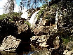
Country Brazil Type Natural Criteria ix, x Reference 1035 Region ** Latin America and the Caribbean Inscription history Inscription 2001 (25th Session) 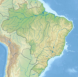
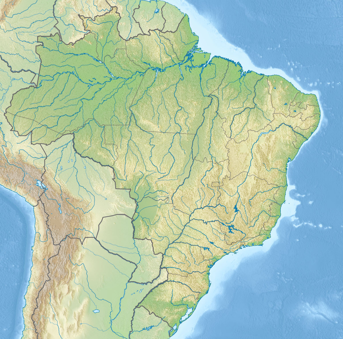
 Location of Chapada dos Veadeiros National Park in Brazil
* Name as inscribed on World Heritage List
** Region as classified by UNESCOBrazil's Chapada dos Veadeiros National Park is located in the Chapada dos Veadeiros, an ancient plateau with an estimated age of 1.8 billion years[1]. Based in the Brazilian state of Goias, the Park was created on January 11, 1961 by President Juscelino Kubitscheck, and listed as a World Heritage Site by Unesco in 2001. It occupies an area of 655 square kilometres and is maintained by IBAMA.
Contents
Geography
Climate
The average yearly temperature is 24-26 degrees Celsius, ranging from a minimum of 4-8 degrees Celsius and reaching a maximum of 40-42 degrees Celsius.
Altitude
With altitudes between 600 and 1650 meters, it is the highest plain in Central Brazil. The highest point of the park and of the state of Goiás is Serra da Santana, at 1691 meters above sea level.[2]
Rock formations
Its rock formations are one of the oldest on the planet. There are quartz with outcrops of crystals. These rocks are exported and appreciated in Japan and England, where for some decades they were used for industrial work. Nowadays therapists and nature lovers seek energies and the power to cure from the crystals and from places like Alto Paraiso. Rock crystals are present in the soil of the rich Cerrado, or open pasture. Forest growth is also still found in the region, where more than 25 species of orchids can be found, besides other Brazilian species such as Pau d'Arco Roxo, Copaíba (Copa Tree), Aroeira (California pepper tree), Tamanqueira (Cork Tree), Jerivá (a variety of Palm Tree), Buritis (Wine-palm) and Babaçu (Babassu). The main river in the park is the Rio Preto, a tributary of the Tocantins River. Along its course, there are many waterfalls, such as the Rio Preto Falls (120 meters high, 80 meters at the base) and the Cariocas Falls. The canyons are just as beautiful, with walls of up to 40 meters high and valleys of up to 300 meters.
List of waterfalls
In the National Park there are the 120 m Waterfall, the 80 m Waterfall, the Corredeiras, Cannyon I, Cannyon II, the Carioquinhas Waterfall and the Jardim de Maitréya. In properties with controlled access: Águas Quentes, Morada do Sol, Banho das Crianças and Vale das Andorinhas, Salto do Raizama and Cannyon do Rio São Miguel, Vale da lua, Cachoeiras Almécegas I and Almécegas II, Cachoeira de São Bento, Cataratas do Rio dos Couros, Cachoeira do Rio Cristal, Cachoeira dos Anjos e dos Arcanjos, Água Fria, Cachoeira do Rio das Almas, Poço Encantado, Sertão Zen, Cachoeira do Rio Macaco, Território Kalunga, Lago Serra da Mesa, Bocaina do Faria, Cachoeira das Neves, Mirante do Pouso Alto, Alpes Goianos, Cachoeira do Santana, Cachoeira da Ave Maria, Morada do Sol, Pedra Escrita, Cachoeira das Pedras Bonitas, and Ponte de Pedra.
The local fauna
The rich fauna of the region includes species threatened by extinction such as the pampas deer (locally known as veado campeiro), marsh deer (cervo do pantanal), maned wolves (lobo guará), jaguar, and others like the rhea (ema), seriema, tapeti, giant armadillo (tatu canastra), anteater (tamanduá), capybara (capivara), tapir (anta), green-beaked toucan (tucano de bico verde), black vulture (urubu), and the king vulture (urubu rei).
Many endangered species are found within the park's boundaries, such as the maned wolf, capybaras, rheas and others.
-

Vegetation and relief (photographed by Leonardo C. Fleck)
-

Waterfall (photographed by Leonardo C. Fleck)
-

Moon Valley formation (Vale da Lua) (photographed by Leonardo C. Fleck)
-

Waterfall (photographed by Leonardo C. Fleck)
See also
References
- ^ Pinto, Fernanda Iema. "Chapada dos Veadeiros" (in Portuguese). Folha Online. http://www1.folha.uol.com.br/folha/turismo/americadosul/brasil-chapada_dos_veadeiros.shtml. Retrieved 2007-02-19.
- ^ "Chapada dos Veadeiros-Pico 1691, Brazil". Peakbagger.com. http://www.peakbagger.com/peak.aspx?pid=8742.
External links
 Media related to Chapada dos Veadeiros National Park at Wikimedia Commons
- Complete and updated info about Chapada dos Veadeiros in 42 languages
- website with turistic info about Chapada dos Veadeiros
- Chapada dos Veadeiros in Portuguese
- Chapada dos Veadeiros in English
- Info on the Chapada
- Chapada dos Veadeiros at Webventure
- Brazil Ministry of the Environment page about the park
- Brazil Ministry of the Environment technical details about the park
- Traveller review in the Seattle Times of an adventure holiday with Travessia
- Travessia Eco Tourism Company in Chapada dos Veadeiros
Coordinates: 14°05′S 47°40′W / 14.083°S 47.667°W
World Heritage Sites in Brazil North 
Northeast Brazilian Atlantic Islands: Fernando de Noronha and Atol das Rocas Reserves · Discovery Coast Atlantic Forest Reserves1 · Historic Centre of São Luís · Historic Centre of Salvador da Bahia · Historic Centre of the Town of Olinda · Serra da Capivara National Park
Central-West Brasília · Cerrado Protected Areas: Chapada dos Veadeiros and Emas National Park · Historic Centre of the Town of Goiás · Pantanal Conservation Area
Southeast Atlantic Forest South-East Reserves1 · Discovery Coast Atlantic Forest Reserves1 · Historic Centre of the Town of Diamantina · Historic Town of Ouro Preto · Sanctuary of Bom Jesus do Congonhas
South Atlantic Forest South-East Reserves1 · Iguaçu National Park · Jesuit Missions of the Guaranis2: Ruins of São Miguel das Missões
1 Shared with other region/s · 2 Shared with Argentina Highest Points of Brazilian states Acre • Alagoas • Amapá • Amazonas • Bahia • Ceará • Distrito Federal • Espírito Santo • Goiás • Maranhão • Mato Grosso • Mato Grosso do Sul • Minas Gerais • Pará • Paraíba • Paraná • Pernambuco • Piauí • Rio de Janeiro • Rio Grande do Norte • Rio Grande do Sul • Rondônia • Roraima • Santa Catarina • São Paulo • Sergipe • Tocantins
Categories:- Highest points of Brazilian states
- National parks of Brazil
- World Heritage Sites in Brazil
- Goiás
- Protected areas established in 1961
-


Wikimedia Foundation. 2010.