Circus (building)

Circus (building)
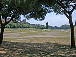
The site of the former Circus Maximus in modern-day Rome

The Roman circus (from Latin, "circle") was a large open-air venue used for public events in the ancient Roman Empire. The circuses were similar to the ancient Greek hippodromes, although serving varying purposes. Along with theatres and amphitheatres, Circuses were one of the main entertainment sites of the time. Circuses were venues for chariot races, horse races, and performances that commemorated important events of the empire were performed there. For events that involved re-enactments of naval battles, the circus was flooded with water.

Contents

Architectural design

Floorplan of Circus Maximus. This design is typical of Roman circuses.

The performance space of the Roman circus was, despite its name, an oblong rectangle of two linear sections of a race track separated by a median strip running along the length in the middle of the space, and capped at both ends with two semicircular sections connecting the linear sections, creating a circuit for the races. The strip was called the spina and usually featured ornate columns, statues and commemorative obelisks. Much like the amphitheatre, the performance surface of the circus was mostly surrounded by ascending seating, though there were sometimes interruptions in the seating at one or both ends of the circus.

There are similar buildings, called stadia, which were used for Greek style athletics. These buildings were similar in design but typically smaller than circuses; however, the distinction is not always clear. An example of this type is the Stadium of Domitian.

List of Roman circuses

City
(Roman name)
City
(modern name)
Country Coordinates Notes
References
Images
Auzia Algeria [1]
Saldae Béjaïa Algeria [1]
Colonia Claudia Caesarea Cherchell Algeria 36°36′04″N 2°11′09″E / 36.601°N 2.18586°E / 36.601; 2.18586 (Colonia Claudia Caesarea (Cherchell)) [1]
Sétif Algeria [1]
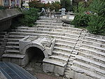
Trimontium Plovdiv Bulgaria 42°08′51″N 24°44′53″E / 42.147477°N 24.748068°E / 42.147477; 24.748068 (Trimontium (Plovdiv)) Plovdiv Roman Stadium
Plowdiw - Römisches Stadion.jpg
Camulodunum Colchester England [1]
Alexandria Alexandria Egypt [1]
Antinopolis Egypt 27°48′36.33″N 30°53′7.81″E / 27.8100917°N 30.8855028°E / 27.8100917; 30.8855028 (Antinopolis) [1]
Oxyrhynchus Egypt [1]
Arelate Arles France 43°40′24″N 4°37′07″E / 43.6734°N 4.61855°E / 43.6734; 4.61855 (Arelate (Arles)) [1]
Lugdunum Lyon France [2]
Mediolanum Santonum Saintes France [1]
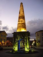
Vienna Vienne France 45°30′59″N 4°52′06″E / 45.516492°N 4.868196°E / 45.516492; 4.868196 (Vienna (Vienne)) [1]
Pyramide.nuit.jpg
Augusta Treverorum Trier Germany [1]
Corinth Corinth Greece Disputed.
Gortyn Gortyn Greece 35°03′07″N 24°57′04″E / 35.052057°N 24.951119°E / 35.052057; 24.951119 (Gortyn) [2] [2]
Nicopolis Greece 39°01′25″N 20°44′05″E / 39.023563°N 20.734805°E / 39.023563; 20.734805 (Nikopolis) Referred to as a stadium.
Thessalonica Thessaloniki Greece [1]
Caesarea Maritima Israel 32°29′55″N 34°53′26″E / 32.4986°N 34.8906°E / 32.4986; 34.8906 (Caesarea Maritima) On the coast.[1]
Caesarea Palaestina.jpg
Caesarea Maritima Israel 32°29′55″N 34°53′55″E / 32.4986°N 34.8986°E / 32.4986; 34.8986 (Caesarea Maritima) Further inland.
Aquileia Italy [1]
Bovillae Italy 41°45′48″N 12°37′06″E / 41.763424°N 12.618457°E / 41.763424; 12.618457 (Bovillae) [3] [1]
Mediolanum Milan Italy 45°27′55″N 9°10′44″E / 45.465217°N 9.178902°E / 45.465217; 9.178902 (Mediolanum (Milan)) [2]
Montaperti Italy 43°18′22″N 11°27′19″E / 43.306152°N 11.455258°E / 43.306152; 11.455258 ((Montaperti)) Field lines of circus or stadium clearly visible
Roma Rome Italy 41°53′10″N 12°29′07″E / 41.886016°N 12.485404°E / 41.886016; 12.485404 (Circus_Maximus, Rome) Circus Maximus
RomaCircoMassimoDaNord1.JPG
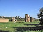
Roma Rome Italy 41°51′17″N 12°31′21″E / 41.854645°N 12.522411°E / 41.854645; 12.522411 (Circus of Maxentius, Rome) Circus of Maxentius
Roma Appia Antica - Circo di Massenzio Torri.JPG
Roma Rome Italy Circus of Nero [1]
Roma Rome Italy Circus Flaminius [1]
Roma Rome Italy Circus Varianus [1]
Gadara Umm Qais Jordan [1]
Gerasa Jerash Jordan 32°16′25″N 35°53′27″E / 32.273655°N 35.890730°E / 32.273655; 35.890730 (Gerasa) [1]
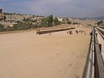
Hippodrome-Jerash.JPG
Colonia Iulia Augusta Felix Berytus Beirut Lebanon [1]
Tyre Lebanon 33°16′04″N 35°12′33″E / 33.267700°N 35.209275°E / 33.267700; 35.209275 (Tyre) [1]
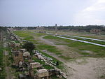
Al-Bass Arch Site Hippodrome.JPG
Cyrene Libya 32°49′20″N 21°51′51″E / 32.822221°N 21.864104°E / 32.822221; 21.864104 (Cyrene) [1]
Leptis Magna Libya 32°37′59″N 14°18′38″E / 32.633056°N 14.310547°E / 32.633056; 14.310547 (Leptis Magna) [1]
Miróbriga Portugal 38°00′08″N 8°41′02″W / 38.002318°N 8.683770°W / 38.002318; -8.683770 (Mirobriga) near Santiago do Cacém [2]
Tavira Portugal [1]
Aeminium Coimbra Portugal [citation needed]
Olissipona Lisbon Portugal 38°42′50″N 9°08′21″W / 38.713788°N 9.139192°W / 38.713788; -9.139192 (Olissipona (Lisbon)) in what is today the 'Rossio'[citation needed]
Sirmium Sremska Mitrovica Serbia [1]
Calagurris Calahorra Spain 42°18′17″N 1°57′47″W / 42.304811°N 1.963025°W / 42.304811; -1.963025 (Calagurris (Calahorra)) [1]
Corduba Córdoba Spain [citation needed]
Capera Spain [1]
Italica Spain [1]
Emerita Augusta Mérida Spain 38°55′11″N 6°19′56″W / 38.919663°N 6.332173°W / 38.919663; -6.332173 (Mérida) Circus Maximus[1]
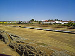
Circo romano de Mérida.jpg
Saguntum Sagunto Spain 39°40′53″N 0°16′32″W / 39.681294°N 0.275595°W / 39.681294; -0.275595 (Saguntum (Sagunto)) [1]
Tarraco Tarragona Spain 41°06′59″N 1°15′24″E / 41.116431°N 1.256646°E / 41.116431; 1.256646 (Tarraco (Tarragona)) [1]
Toletum Toledo Spain 39°51′49″N 4°01′48″W / 39.863689°N 4.029978°W / 39.863689; -4.029978 (Toledo) [1]
Zafra Spain [1]
Nova Trajana Bostra Bosra Syria 32°30′54″N 36°28′48″E / 32.5149°N 36.4799°E / 32.5149; 36.4799 (Bostra) Image:Bostra map of Roman city.jpg [1]
Laodicea ad Mare Latakia Syria [1]
Carthago Carthage Tunisia 36°51′05″N 10°18′54″E / 36.851388°N 10.314958°E / 36.851388; 10.314958 (Carthago (Carthage)) [1]
Hadrumentum Sousse Tunisia [1]
Municipium Aurelium Commodum Henchir Bou Cha Tunisia [1]
Henchir Esch Schorr Tunisia [1]
Thugga Tunisia 36°25′35″N 9°12′58″E / 36.4265°N 9.2161°E / 36.4265; 9.2161 ((Thugga)) [2]
Thysdrus El Djem Tunisia 35°18′07″N 10°41′37″E / 35.301944°N 10.693480°E / 35.301944; 10.693480 (Thysdrus (El Djem)) [1]
Utica Tunisia 37°03′04″N 10°03′47″E / 37.051230°N 10.063141°E / 37.051230; 10.063141 (Utica) [1]
Antioch Antakya Turkey Map [1]
Byzantium Istanbul Turkey 41°00′24″N 28°58′33″E / 41.006548°N 28.975961°E / 41.006548; 28.975961 (Byzantium) Hippodrome of Constantinople

Built under Septimius Severus, a Roman.

Laodicea on the Lycus Turkey 37°49′52″N 29°06′16″E / 37.831074°N 29.104478°E / 37.831074; 29.104478 (Laodicea) Referred to as a stadium.
Nicomedia İzmit Turkey [1]

See also

References

  1. ^ a b c d e f g h i j k l m n o p q r s t u v w x y z aa ab ac ad ae af ag ah ai aj ak al am an ao ap aq ar John H. Humphrey: Roman Circuses: Arenas for Chariot Racing. University of California Press, Berkeley and Los Angeles 1986, ISBN 0-520-04921-7
  2. ^ a b c d e Raymond G. Chase: Ancient Hellenistic and Roman amphitheatres, stadiums, and theatres: the way they look now. P. E. Randall, Portsmouth 2002, ISBN 1-931807-08-6

External links


Wikimedia Foundation. 2010.

Игры ⚽ Поможем решить контрольную работу

Look at other dictionaries:

  • Circus Building — Coordinates: 44°22′23.78″N 73°13′56.08″W / 44.3732722°N 73.2322444°W / 44.3732722; 73.2322444 The Circus Building is an exhib …   Wikipedia

  • Circus Building, Copenhagen — The Circus Building The Circus Building General information Architectural style Historicism Town or city …   Wikipedia

  • Circus — This article is about the event. For other uses, see Circus (disambiguation). 3 ring circus redirects here. For the Martin and Lewis film, see 3 Ring Circus. Circus Advertisement for the Barnum Bailey Circus, 1900 …   Wikipedia

  • circus — circusy, adj. /serr keuhs/, n., pl. circuses. 1. a large public entertainment, typically presented in one or more very large tents or in an outdoor or indoor arena, featuring exhibitions of pageantry, feats of skill and daring, performing animals …   Universalium

  • Circus Krone Building — The Circus Krone Building is the headquarters and main winter venue for Circus Krone in Munich, Germany. It also serves as a major venue for other forms of live entertainment, such as rock concerts. It was originally constructed in 1919 and was… …   Wikipedia

  • Circus Krone — Entrance to Circus Krone Circus Krone, based in Munich, is the largest circus in Europe[1] and the only one in Western Europe to also occupy a building. Contents …   Wikipedia

  • Circus Renz — This article is about the German circus company. For the Dutch circus company, see Circus Herman Renz. Former Circus Renz building, Berlin, 1898 Circus Renz was a German circus company. It was established in 1842 in Berlin by Ernst Jakob Renz… …   Wikipedia

  • Circus Juventas — Coordinates: 44°54′40″N 93°9′14″W / 44.91111°N 93.15389°W / 44.91111; 93.15389 …   Wikipedia

  • Circus of Nero — Coordinates: 41°54′5.82″N 12°27′14.94″E / 41.9016167°N 12.45415°E / 41.9016167; 12.45415 Not to be confus …   Wikipedia

  • Circus clown — A whiteface circus clown (1907) Clowns have always been an integral part of the circus, offering a source of amusement for patrons and providing relief from the array of animal acts and performances by acrobats and novelty artistes. Clowns have… …   Wikipedia

Share the article and excerpts

Direct link
Do a right-click on the link above
and select “Copy Link”