- Suhl
-
Suhl Town hall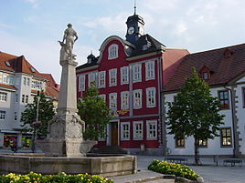


 Suhl
SuhlCoordinates 50°36′38″N 10°41′35″E / 50.61056°N 10.69306°ECoordinates: 50°36′38″N 10°41′35″E / 50.61056°N 10.69306°E Administration Country Germany State Thuringia District Urban district Town subdivisions Town and 4 districts Mayor Jens Triebel (Ind.) Basic statistics Area 102.70 km2 (39.65 sq mi) Elevation 429-676 m Population 38,776 (31 December 2010)[1] - Density 378 /km2 (978 /sq mi) Other information Time zone CET/CEST (UTC+1/+2) Licence plate SHL Postal codes 98501–98530 Area code 03681 Website www.stadtsuhl.de Suhl is a town in Thuringia, Germany. Its population in 2003 was 43,610.
Contents
Geography
Suhl sits on the south edge of the Suhler Scholle, an upthrust granite complex that is streaked by numerous dikes. This is part of the Ruhla-Schleusingen Horst that defines the southwest side of the Thuringian Forest. The southwest side of the Suhler Scholle abuts horizontal sedimentary layers, Buntsandstein (sandstone from the Triassic period) over Zechstein (evaporite deposits from the Permian period). The granite of the Suhler Scholle is capped with Permian sediments and igneous deposits. The higher hills to the northeast are part of the Beerberg Scholle, an irregularly cracked mass of quartz porphyry from the later Permian period.[1][2]
A band of iron ores follows the fault dividing the Suhler Scholle from the sedimentary rocks to the southwest, while the copper and silver deposits are to the northeast in the Permian deposits above the Suhler Scholle. Southeast of town, there is a significant uranium deposit in the Buntsandstein.[3]
According to a local Thuringian joke, "Suhl is so close to the edge of the world you can see Zella-Mehlis".[citation needed] This illustrated the good natured rivalry between Suhl and Zella-Mehlis (another gun-making town). Suhl was located in what was then considered a remote part of Thuringia, with Zella-Mehlis just a short 6 km (3.73 mi) away.
History
First appearing in 1318, the coat of arms from 1365 shows two hammers, indicating the city's most important livelihood: metal processing. City rights were granted (confirmed) in 1527.
Suhl was capital of the southwestern GDR district "Bezirk Suhl" from 1952 to 1990.
Weapon industry
The metal processing of Suhl naturally led, during the Renaissance, to other major local industries, including gunsmithing and armoring. Suhl was a major producer of cannons throughout the seventeenth and subsequent centuries, and Suhl cannons were used by many European powers. A major arms company that was located in Suhl for almost 200 years was J.P. Sauer und Sohn GmbH, producer of hunting rifles, shotguns, and pistols, such as the Sauer 38H, until moving operations to Eckernförde at the end of WWII. Other prominent firearms manufacturers in Suhl included Simson, (also known as BSW and then Gustloff Werke under Nazi rule and Ernst Thälmann Suhl under Communist rule), and C.G. Haenel. The largest manufacturer producing firearms currently in Suhl is Merkel GmbH, who make both rifles and shotguns.
During the Cold War, the East German national shooting arena was located at Suhl, and hosted many top-level competitions, including the 1986 ISSF World Championships. Although surpassed in this respect in the unified Germany by the Olympic shooting centre at Munich, Suhl remains an important place to the sport. It hosts Germany's only school for armorers, and a well equipped museum of weapons.
Suhl became famous after division for building the Schwalbe moped.
Events
From 2007 to 2009, Suhl was the location of the yearly Eurofurence convention, which was held at the city's Hotel Ringberg.
International relations
Suhl is twinned with:
 České Budějovice, Czech Republic
 Bègles, France
 Калу́гa(Kaluga), Russia
 Lahti, Finland
 Leszno, Poland
 Смолян(Smolyan), Bulgaria
 Würzburg, Germany
See also
References
- Notes
- ^ "Bevölkerung nach Gemeinden, erfüllenden Gemeinden und Verwaltungsgemeinschaften" (in German). Thüringer Landesamt für Statistik. 31 December 2010. http://www.statistik.thueringen.de/datenbank/TabAnzeige.asp?tabelle=gg000102%7C%7C.
 Urban and rural districts in the Free State of Thuringia in Germany
Urban districts Rural districts Altenburger Land · Eichsfeld · Gotha · Greiz · Hildburghausen · Ilm-Kreis · Kyffhäuserkreis · Nordhausen · Saale-Holzland-Kreis · Saale-Orla-Kreis · Saalfeld-Rudolstadt · Schmalkalden-Meiningen · Sömmerda · Sonneberg · Unstrut-Hainich-Kreis · Wartburgkreis · Weimarer LandFormer Head Cities of the Bezirke in East Germany East Berlin (independent) · Cottbus · Dresden · Erfurt · Frankfurt (Oder) · Gera · Halle · Karl-Marx-Stadt (Chemnitz) · Leipzig · Magdeburg · Neubrandenburg · Potsdam · Rostock · Schwerin · Suhl Categories:
- Towns in Thuringia


Wikimedia Foundation. 2010.