Csávoly

Csávoly
Csávoly
Csávoly is located in Hungary
Csávoly
Location of Csávoly
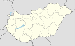
Coordinates: 46°11′28″N 19°08′49″E / 46.191°N 19.147°E / 46.191; 19.147Coordinates: 46°11′28″N 19°08′49″E / 46.191°N 19.147°E / 46.191; 19.147
Country  Hungary
County Bács-Kiskun
Area
 – Total 47.43 km2 (18.3 sq mi)
Population (2001)
 – Total 2,104
 – Density 44.3/km2 (114.7/sq mi)
Time zone CET (UTC+1)
 – Summer (DST) CEST (UTC+2)
Postal code 6448
Area code(s) 79
Website -
Csávoly

Csávoly (Croatian: Čavolj, Serbian: Чавољ) is a village in Bács-Kiskun county, Hungary. It is about 15 km (9 mi) far away from Baja.

Contents

History

Csávoly's history can be traced back to 1198. The village - under the name of Chayol-Thayal - had many proprietors since 1374. According to Turkish tax listings, Csávoly had 22 houses in 1580. After this time, the village was destroyed and founded again several times. The town was reborn in 1734. The first church was constructed in 1740. Between 1782 and 1784, on the suggestion of the bishop of Kalocsa, 424 Germans settled the village from Soroksár and Hajós.

1947 was a major turning point in the village's history. According to the Potsdam Decree, 553 Germans were replaced with Hungarians from Slovakia (the Germans were deported to Germany).

Demographics

Csávoly still remains a multiethnic village (with a Hungarian majority). Existing minorities include:

Csávoly has 2,104 residents.

Buildings and structures

  • 165 metres tall guyed mast used for FM-/TV-broadcasting

Notable persons

Croatian writer from Hungary, a Katymar-born Ivan Petreš Čudomil, was a vicar in Csávoly since 1917, and since 1919, dean.
Although Petreš died in Baja, he was buried in Csávoly.

External links


Wikimedia Foundation. 2010.

Игры ⚽ Поможем написать реферат

Look at other dictionaries:

  • Csávoly — Héraldique Admini …   Wikipédia en Français

  • Csavoly — Original name in latin Csvoly Name in other language Csavoly, Csvoly, Kiscsavoly Baja State code HU Continent/City Europe/Budapest longitude 46.18917 latitude 19.14667 altitude 130 Population 2080 Date 2012 01 18 …   Cities with a population over 1000 database

  • Stanišić — (Станишић) is a village in Serbia. It is situated in the Sombor municipality, in the West Bačka District, Vojvodina province. The village has a Serb ethnic majority and its population numbering 4,808 people (2002 census).NameIn Serbian, the… …   Wikipedia

  • Ladislav Józsa — Pas d image ? Cliquez ici. Biographie Nationalité …   Wikipédia en Français

  • Bunjevci — Infobox Ethnic group group=Bunjevci poptime=unknown (In Serbia some of them declare themselves as members of separate Bunjevac nationality, some as Croats, and few are registered as Yugoslavs or even Hungarians; in Croatia, Bosnia and Herzegovina …   Wikipedia

  • Baja, Hungary — Infobox Settlement image caption = Town hall subdivision type = Country subdivision name = HUN timezone=CET utc offset=+1 timezone DST=CEST utc offset DST=+2 pushpin pushpin label position = pushpin map caption =Location of Baja, Hungary pushpin… …   Wikipedia

  • Bács-Kiskun County — Infobox Hungarian county name =Bács Kiskun region =Southern Great Plain seat = Kecskemét area = 8,445 population = 534,000 density = 63 cities = 119Bács Kiskun is a county ( megye in Hungarian; IPA2|baːtʃ kiʃkun) located in southern Hungary. It… …   Wikipedia

  • Dunavecse — Coat of arms …   Wikipedia

  • Dunapataj — Dunapataj …   Wikipedia

  • Bócsa — Country  Hungary County Bács Kiskun Area  – Total 97.04 km2 (37.5 sq  …   Wikipedia

Share the article and excerpts

Direct link
Do a right-click on the link above
and select “Copy Link”