- Mên-an-Tol
-
 Mên-an-Tol
 A view through the Mên-an-Tol holed stone
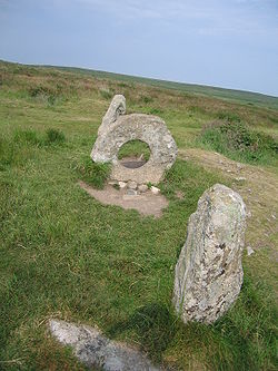
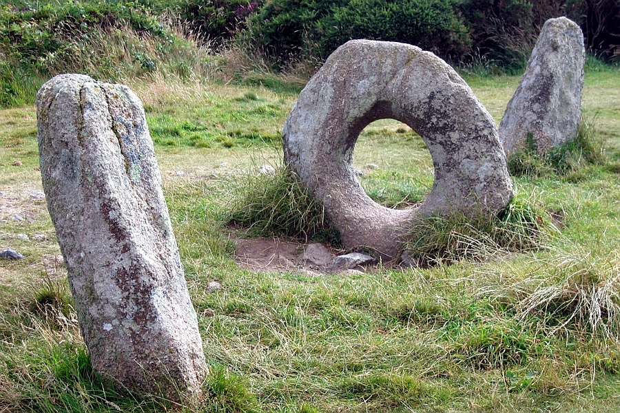
The Mên-an-Tol (also Men an Toll) is a small formation of standing stones near the Madron-Morvah road in Cornwall, United Kingdom (grid reference SW426349). It is about 3 miles north west of Madron. It is also known locally as the "Crick Stone".
The name Mên-an-Tol is Cornish Language, literally meaning "the hole stone".
It consists of three upright granite stones: a round stone with its middle holed out with two small standing stones to each side, in front of and behind the hole. When seen at an angle from one side, the stones form a three-dimensional "101" (see picture).
These stones might have been the entrance to some now vanished tomb. It is possible that they were part of some ancient calendar.
Mên-an-Tol is supposed to have a fairy or piskie guardian who can make miraculous cures. In one case a Changeling baby was put through the stone in order for the mother to get the real child back. Evil piskies had changed her child and the ancient stones were able to reverse their evil spell.[1]
Local legend claims that if at full moon a woman passes through the holed stone seven times backwards, she will soon become pregnant.
Another legend is that passage through the stone will cure a child of rickets (osteomalacia). For centuries, children with rickets were passed naked through the hole in the middle stone nine times. Its curative powers actually are reflected in its name.
The circular stone aligns exactly with the centre stone at Boscawen-Un and the church at nearby St Buryan. While this may conceivably be coincidental, the precision of the alignment suggests an intentional positioning of the structures in relation to each other.
The only other holed stone in Cornwall of this type is known as the 'Tolven Holed Stone' which can seen in a garden near Helston.
References
- ^ Evans-Wentz, W. Y. (1911) The Fairy-Faith in Celtic Countries. London: H. Frowde (Reprinted 1981 by Colin Smythe. ISBN 0-901072-51-8) p. 179
External links
- The Mên-an-Tol at Megalithia.com
- The Mên-an-Tol on Richard's Ancient Site and Curiosity Pages
- Men-An-Tol site page on The Megalithic Portal
- Men-An-Tol site page on The Modern Antiquarian
- Pretanic World - Superstitions about The Mên-an-Tol
- Legends of Cornwall's Stones, Gareth Evans, 2005
- Men-an-Tol at Historic Cornwall
Coordinates: 50°9′30.79″N 5°36′16.03″W / 50.1585528°N 5.6044528°W

This article relating to archaeology in the United Kingdom is a stub. You can help Wikipedia by expanding it.