- Dholpur district
-
This article is about the district. For its eponymous headquarters, see Dholpur.
Dholpur District is a district of Rajasthan state in western India. The town of Dholpur is the district headquarters.
Dholpur District has an area of 3084 km². The Chambal River forms the southern boundary of the district, across which lies the state of Madhya Pradesh. The district is bounded by the state of Uttar Pradesh on the east and northeast, by Bharatpur District of Rajasthan on the northwest, and Karauli District of Rajasthan on the west. All along the bank of the Chambal River the district is deeply intersected by ravines; low ranges of hills in the western portion of the district supply quarries of fine-grained and easily worked red sandstone.
Administratively the district is divided into four subdivisions, Dholpur, Bari, Rajakhera, and Baseri, and five tehsils, Dholpur, Badi, Rajakhera, Basedi, and Saipau.
The economy of the district is primarily agricultural.
Demographics
According to the 2011 census Dholpur district has a population of 1,207,293,[1] roughly equal to the nation of Bahrain[2] or the US state of New Hampshire.[3] This gives it a ranking of 394th in India (out of a total of 640).[1] The district has a population density of 398 inhabitants per square kilometre (1,030 /sq mi) .[1] Its population growth rate over the decade 2001-2011 was 22.78 %.[1] Dhaulpur has a sex ratio of 845 females for every 1000 males,[1] and a literacy rate of 70.14 %.[1]
References
- ^ a b c d e f "District Census 2011". Census2011.co.in. 2011. http://www.census2011.co.in/district.php. Retrieved 2011-09-30.
- ^ US Directorate of Intelligence. "Country Comparison:Population". https://www.cia.gov/library/publications/the-world-factbook/rankorder/2119rank.html. Retrieved 2011-10-01. "Bahrain 1,214,705 July 2011 est."
- ^ "2010 Resident Population Data". U. S. Census Bureau. http://2010.census.gov/2010census/data/apportionment-pop-text.php. Retrieved 2011-09-30. "New Hampshire 1,316,470"
External links

Bharatpur district Agra district, Uttar Pradesh Karauli district 
 Dholpur district

Morena district, Madhya Pradesh Cities and towns
in other districtsAjmer · Alwar · Banswara · Baran · Barmer · Bharatpur · Bhilwara · Bikaner · Bundi · Chittorgarh · Churu · Dausa · Dungarpur · Hanumangarh · Jaipur · Jaisalmer · Jalore · Jhalawar · Jhunjhunu · Jodhpur · Karauli · Kota · Nagaur · Pali · Pratapgarh · Rajsamand · Sawai Madhopur · Sikar · Sirohi · Sri Ganganagar · Tonk · Udaipur
State of Rajasthan (India) Major cities 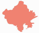
Divisions Districts Ajmer · Alwar · Banswara · Baran · Barmer · Bharatpur · Bhilwara · Bikaner · Bundi · Chittorgarh · Churu · Dausa · Dholpur · Dungarpur · Hanumangarh · Jaipur · Jaisalmer · Jalore · Jhalawar · Jhunjhunu · Jodhpur · Karauli · Kota · Nagaur · Pali · Pratapgarh · Rajsamand · Sawai Madhopur · Sikar · Sirohi · Sri Ganganagar · Tonk · UdaipurCategories:

Wikimedia Foundation. 2010.