- National Register of Historic Places listings in Baldwin County, Alabama
-
 Location of Baldwin County in Alabama
This is a list of the National Register of Historic Places listings in Baldwin County, Alabama.
This is intended to be a complete list of the properties and districts on the National Register of Historic Places in Baldwin County, Alabama, United States. Latitude and longitude coordinates are provided for many National Register properties and districts; these locations may be seen together in a Google map.[1]
There are 57 properties and districts listed on the National Register in the county, including 2 National Historic Landmarks.
-
- This National Park Service list is complete through NPS recent listings posted November 10, 2011.[2]
Current listings
[3] Landmark name Image Date listed Location City or town Summary 1 Allen House December 20, 1988 Off County Road 10 on the northern bank of the Bon Secour River
30°18′09″N 87°44′13″W / 30.3025°N 87.736944°WBon Secour 2 Bank of Fairhope July 1, 1988 396 Fairhope Ave.
30°31′22″N 87°54′12″W / 30.522778°N 87.903333°WFairhope 3 Battles Wharf Historic District April 28, 1988 U.S. Route 98 (Eastern Shore Boulevard) roughly between Woolworth Ave. and Buerger La.
30°29′37″N 87°55′38″W / 30.493611°N 87.927222°WBattles Wharf 4 Beckner House July 1, 1988 63 S. Church St.
30°31′15″N 87°54′17″W / 30.520833°N 87.904722°WFairhope 5 Blakeley June 25, 1974 Along the Tensaw River north of Spanish Fort
30°44′32″N 87°55′27″W / 30.74222°N 87.92417°W[4]Spanish Fort 6 Carl L. Bloxham Building June 30, 1988 327 Fairhope Ave.
30°31′23″N 87°54′15″W / 30.523056°N 87.904167°WFairhope 7 Bottle Creek Indian Mounds 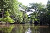
December 2, 1974 Northern end of Mound Island along the eastern side of the Middle River
31°0′32.22″N 87°56′23.748″W / 31.00895°N 87.93993°W[5]Stockton 8 Brodbeck-Zundel Historic District April 28, 1988 Scenic U.S. Route 98 and Old Marlow Rd.
30°28′27″N 87°55′09″W / 30.474167°N 87.919167°WPoint Clear 9 Brunell House August 22, 1995 12113 Jessamine St.
30°24′02″N 87°46′36″W / 30.400556°N 87.776667°WMagnolia Springs 10 Captain Adams House December 20, 1988 907 Captain O'Neal Dr.
30°35′25″N 87°54′51″W / 30.590278°N 87.914167°WDaphne 11 George W. Cullum House June 14, 1990 1915 Old County Rd.
30°36′19″N 87°54′39″W / 30.605278°N 87.910833°WDaphne 12 Fairhope Bayfront District July 1, 1988 Roughly bounded by Blakeney, N. and S. Summit Sts., Fels Ave., and Mobile Bay
30°31′28″N 87°54′32″W / 30.524444°N 87.908889°WFairhope 13 Fairhope Downtown Historic District March 16, 2006 Roughly bounded by Equality St., Fairhope Ave., Morphy Ave., School St., and Summit St.
30°31′21″N 87°54′11″W / 30.5225°N 87.903056°WFairhope 14 First Baptist Church August 25, 1988 Northern side of D'Olive St.
30°53′05″N 87°46′36″W / 30.884722°N 87.776667°WBay Minette 15 Foley Downtown Historic District January 19, 2005 Parts of Alston, N. and S. McZenzie, State Route 98, E. and W. Laurel, Myrtle, Rose, and W. Orange
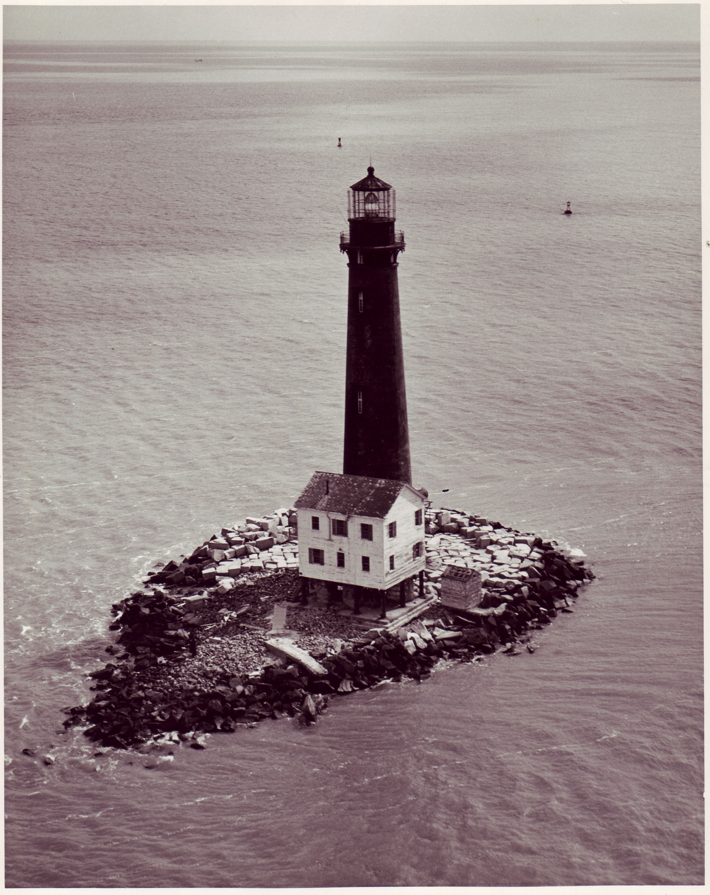
30°24′24″N 87°41′02″W / 30.406667°N 87.683889°WFoley 16 Fort Mims Site September 14, 1972 Address Restricted Tensaw 17 Fort Morgan 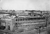
October 15, 1966 Western terminus of State Route 180
30°13′41″N 88°01′23″W / 30.228056°N 88.023056°WGasque 18 Gaston Building July 1, 1988 336 Fairhope Ave.
30°31′22″N 87°54′14″W / 30.522778°N 87.903889°WFairhope 19 Golf, Gun & Country Club July 1, 1988 651 Johnson Ave.
30°31′22″N 87°53′41″W / 30.522778°N 87.894722°WFairhope 20 Governor's Club August 31, 2000 11866 Magnolia St.
30°23′46″N 87°46′34″W / 30.396111°N 87.776111°WMagnolia Springs 21 Hamner House December 20, 1988 Oak Rd. off County Road 6
30°19′07″N 87°42′27″W / 30.318611°N 87.7075°WBon Secour 22 Axil Johnson House July 3, 1997 751 Edwards St.
30°31′39″N 87°53′24″W / 30.5275°N 87.89°WFairhope 23 Killcreas House May 4, 1995 46833 State Route 225
30°54′26″N 87°51′23″W / 30.907222°N 87.856389°WBay Minette 24 Latham United Methodist Church August 25, 1988 Eastern side of State Route 59
31°05′54″N 87°49′51″W / 31.098333°N 87.830833°WLatham 25 Lebanon Chapel AME Church August 25, 1988 Bounded by Young St. on the west and Middle St. on the north
30°30′48″N 87°53′39″W / 30.513333°N 87.894167°WFairhope 26 Malbis Plantation May 10, 2011 10145 US 90
30°39′13″N 87°50′32″W / 30.653611°N 87.842222°WDaphne 27 McMillan House 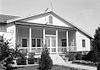
December 20, 1988 1404 Captain O'Neal Ave.
30°35′52″N 87°54′42″W / 30.597778°N 87.911667°WDaphne 28 Methodist Episcopal Church, South September 22, 1980 1608 Old County Rd.
30°36′06″N 87°54′31″W / 30.601667°N 87.908611°WDaphne 29 Montgomery Hill Baptist Church August 25, 1988 Eastern side of State Route 59 on County Road 80
31°09′46″N 87°47′12″W / 31.162778°N 87.786667°WTensaw 30 Montrose Historic District June 3, 1976 Main (State Route 42) and 2nd Sts.
30°34′07″N 87°54′02″W / 30.568611°N 87.900556°WMontrose 31 Moore Store November 30, 2001 14770 Oak St.
30°24′04″N 87°46′15″W / 30.401111°N 87.770833°WMagnolia Springs 32 Nelson House December 20, 1988 State Route 59, North
31°05′08″N 87°49′52″W / 31.085556°N 87.831111°WLatham 33 Nicholson House December 20, 1988 County Road 630°17′33″N 87°44′13″W / 30.2925°N 87.73694°W Oyster Bay 34 Orrell House December 20, 1988 County Road 6
30°18′59″N 87°42′14″W / 30.316389°N 87.703889°WBon Secour 35 People's Supply Company February 21, 1997 21950 Broad St.
30°32′41″N 87°45′03″W / 30.544722°N 87.750833°WSilverhill 36 Point Clear Historic District April 28, 1988 Western side of U.S. Route 98/Eastern Shore Boulevard
30°28′48″N 87°55′40″W / 30.48°N 87.927778°WPoint Clear 37 St. Mark's Lutheran Church August 25, 1988 Western side of County Road 83
30°25′01″N 87°35′55″W / 30.416944°N 87.598611°WElberta 38 St. Patrick's Catholic Church August 25, 1988 Eastern side of U.S. Route 90
30°37′11″N 87°45′10″W / 30.619722°N 87.752778°WLoxley 39 St. Paul's Episcopal Church August 25, 1988 Northern side of Oak Ave.
30°24′05″N 87°46′17″W / 30.401389°N 87.771389°WMagnolia Springs 40 Sand Island Light 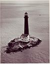
November 12, 1975 Southwest of Fort Morgan off Mobile Point
30°11′15″N 88°03′02″W / 30.1875°N 88.050556°WFort Morgan 41 School of Organic Education July 1, 1988 Bounded by Fairhope and Morphy Aves. and Bancroft and School Sts.
30°31′17″N 87°54′05″W / 30.521389°N 87.901389°WFairhope 42 Lewis Starke House June 14, 1990 2103 Old County Rd.
30°36′26″N 87°54′39″W / 30.607222°N 87.910833°WDaphne 43 State Bank Silverhill December 31, 2001 15950 Silverhill Ave.
30°32′42″N 87°45′05″W / 30.545°N 87.751389°WSilverhill 44 Stockton Methodist Church 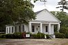
August 25, 1988 Eastern side of State Route 59
31°00′57″N 87°51′11″W / 31.015833°N 87.853056°WStockton 45 Street House December 20, 1988 Wood Acres Rd. off County Road 3
30°27′52″N 87°53′54″W / 30.464444°N 87.898333°WPoint Clear 46 Henry Stuart House October 27, 2006 22787 State Route 98
30°33′23″N 87°53′38″W / 30.556389°N 87.893889°WMontrose 47 Sunnyside Hotel February 20, 1998 14469 Oak St.
30°23′59″N 87°46′36″W / 30.399722°N 87.776667°WMagnolia Springs 48 Svea Land Company Office March 7, 1985 S. 6th St.
30°32′41″N 87°45′14″W / 30.544722°N 87.753889°WSilverhill 49 Swift Presbyterian Church August 25, 1988 Swift Church Rd.
30°22′30″N 87°37′41″W / 30.375°N 87.628056°WMiflin 50 The Texas December 20, 1988 306 Dryer Ave.
30°36′02″N 87°54′37″W / 30.600556°N 87.910278°WDaphne 51 Twin Beach AME Church August 25, 1988 Southern side of County Road 44
30°30′04″N 87°54′34″W / 30.501111°N 87.909444°WFairhope 52 U.S.S. Tecumseh 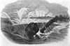
May 14, 1975 Northwest of Fort Morgan in Mobile Bay
30°13′54″N 88°01′33″W / 30.231667°N 88.025833°WFort Morgan 53 U.S. Post Office July 1, 1988 325 Fairhope Ave.
30°31′23″N 87°54′15″W / 30.523056°N 87.904167°WFairhope 54 Walker House December 20, 1988 905 Captain O'Neal Dr.
30°35′23″N 87°54′51″W / 30.589722°N 87.914167°WDaphne 55 White Avenue Historic District July 1, 1988 White Ave.
30°31′10″N 87°54′04″W / 30.519444°N 87.901111°WFairhope 56 Whittier Hall March 7, 1985 201 Magnolia Ave.
30°31′29″N 87°53′45″W / 30.524722°N 87.895833°WFairhope 57 Zurhorst House July 1, 1988 200 Fels Ave.
30°31′16″N 87°54′23″W / 30.521111°N 87.906389°WFairhope See also
- List of National Historic Landmarks in Alabama
- National Register of Historic Places listings in Alabama
References
- ^ The latitude and longitude information provided in this table was derived originally from the National Register Information System, which has been found to be fairly accurate for about 99% of listings. For about 1% of NRIS original coordinates, experience has shown that one or both coordinates are typos or otherwise extremely far off; some corrections may have been made. A more subtle problem causes many locations to be off by up to 150 yards, depending on location in the country: most NRIS coordinates were derived from tracing out latitude and longitudes off of USGS topographical quadrant maps created under the North American Datum of 1927, which differs from the current, highly accurate WGS84 GPS system used by Google maps. Chicago is about right, but NRIS longitudes in Washington are higher by about 4.5 seconds, and are lower by about 2.0 seconds in Maine. Latitudes differ by about 1.0 second in Florida. Some locations in this table may have been corrected to current GPS standards.
- ^ "National Register of Historic Places: Weekly List Actions". National Park Service, United States Department of the Interior. Retrieved on November 10, 2011.
- ^ Numbers represent an ordering by significant words. Various colorings, defined here, differentiate National Historic Landmark sites and National Register of Historic Places Districts from other NRHP buildings, structures, sites or objects.
- ^ Location derived from its GNIS feature record; the NRIS lists the site as "Address Restricted"
- ^ Location derived from its placement on USGS topographical maps; the NRIS lists the site as "Address Restricted"
U.S. National Register of Historic Places in Alabama Lists by county Autauga • Baldwin • Barbour • Bibb • Blount • Bullock • Butler • Calhoun • Chambers • Cherokee • Chilton • Choctaw • Clarke • Clay • Cleburne • Coffee • Colbert • Conecuh • Coosa • Covington • Crenshaw • Cullman • Dale • Dallas • DeKalb • Elmore • Escambia • Etowah • Fayette • Franklin • Geneva • Greene • Hale • Henry • Houston • Jackson • Jefferson • Lamar • Lauderdale • Lawrence • Lee • Limestone • Lowndes • Macon • Madison • Marengo • Marion • Marshall • Mobile • Monroe • Montgomery • Morgan • Perry • Pickens • Pike • Randolph • Russell • St. Clair • Shelby • Sumter • Talladega • Tallapoosa • Tuscaloosa • Walker • Washington • Wilcox • Winston

Lists by city Other lists Municipalities and communities of Baldwin County, Alabama Cities Bay Minette | Daphne | Fairhope | Foley | Gulf Shores | Orange Beach | Robertsdale | Spanish Fort

Towns Elberta | Loxley | Magnolia Springs | Perdido Beach | Silverhill | Summerdale
CDP Unincorporated
communitiesBarnwell | Bayside | Belforest | Blackwater | Bon Secour | Bromly | Clay City | Crossroads | Elsanor | Fort Morgan | Gasque | Houstonville | Josephine | Lillian | Magnolia Beach | Malbis | Marlow | Miflin | Montrose | Oak | Oyster Bay | Perdido | Perdido Key | Pine Grove | Pine Haven | Rabun | River Park | Romar Beach | Seacliff | Seminole | Stapleton | Stockton | Swift | Tensaw | Turkey Branch | Weeks Bay | Whitehouse Fork | Yupon
Ghost town Categories:- National Register of Historic Places in Baldwin County, Alabama
-


Wikimedia Foundation. 2010.