- Crawfordsburn
-
Coordinates: 54°39′00″N 5°43′59″W / 54.65°N 5.733°W
Crawfordsburn Scots: Crawford's burn Irish: Sruth Chráfard[1] 

Crawfordsburn shown within Northern IrelandPopulation 531 (2001 Census) District North Down County County Down Country Northern Ireland Sovereign state United Kingdom Post town BANGOR Postcode district BT19 Dialling code 028 EU Parliament Northern Ireland UK Parliament North Down NI Assembly North Down List of places: UK • Northern Ireland • Down  Crawfordsburn Country Park, 2007
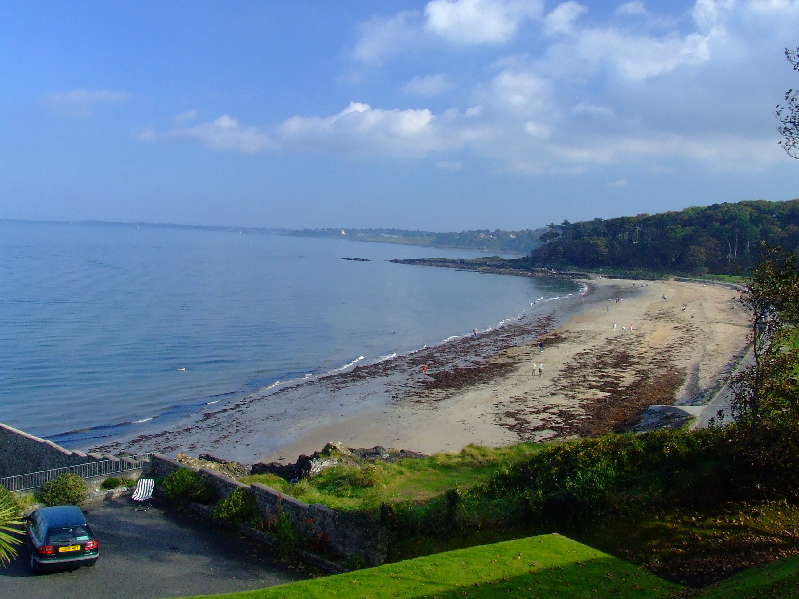
Crawfordsburn (from Ulster Scots: Crawford's burn meaning "Crawford's stream") is a small picturesque village in County Down, Northern Ireland. The village, which is now effectively a commuter suburb, lies between Holywood and Bangor to the north of the A2 road, about 4 km west of Bangor town centre. Bounded to the north and north east by Crawfordsburn Country Park, the village attracts many visitors. It had a population of 531 people in the 2001 Census.
Contents
History
Before the Plantation of Ulster, the area of Crawfordsburn was known as Ballymullan (Irish: Baile Ui Mhaoláin). Crawfordsburn originated in the 17th century as a small settlement on an important routeway along North Down. It was named after a stream which flows through the village. It has retained elements of its 17th century history along its Main Street including the coaching inn. The Sharman-Crawford family developed the village in the 18th and 19th centuries. Crawfordsburn was promoted as a Victorian tourist attraction, particularly for those visitors using the railway to nearby Helens Bay.
Places of interest
- The Old Inn, Crawfordsburn has been in existence since the 17th century. Records show this building to have been standing in its present form since 1614. There is evidence that substantial additions were made in the middle of the 18th century. In the 17th and 18th centuries, Donaghadee was one of the principal cross-channel ports between Ireland and Great Britain. The mail coach making connections with the sailing packet, changed horses at The Old Inn at Crawfordsburn and so it came to be patronised by many notable people including Swift, Tennyson, Thackeray, Dickens and Trollope. It was also frequented by C. S. Lewis.
- Crawfordsburn Country Park, on the southern shores of Belfast Lough, features 3.5 km of coastline and the two best beaches in the Belfast area. The Park also includes Grey Point Fort, a coastal battery and gun emplacement dating from 1904 and updated during World War II. It now houses a military museum.
People
- Samuel Hall-Thompson (1885–1954) was a Unionist politician born in Crawfordsburn.[2]
2001 Census
Crawfordsburn is classified by the NI Statistics and Research Agency (NISRA) as being within Belfast Metropolitan Urban Area (BMUA). On Census day (29 April 2001) there were 531 people living in Crawfordsburn. Of these:
- 13.4% were aged under 16 years and 31.3% were aged 60 and over
- 46.3% of the population were male and 53.7% were female
- 9.6% were from a Catholic background and 84.4% were from a Protestant background
- 1.5% of people aged 16–74 were unemployed
For more details see: NI Neighbourhood Information Service
References
- ^ Placenames Database of Ireland
- ^ "Samuel Hall-Thompson". Biographies of Members of the Northern Ireland House of Commons. http://www.election.demon.co.uk/stormont/biographies.html. Retrieved 6 September 2010.
- The Old Inn, Crawfordsburn
- Crawfordsburn Country Park
- North Down Borough Council
- Draft Belfast Metropolitan Area Plan 2015
- Culture Northern Ireland
See also
Categories:- Villages in County Down
- Seaside resorts in Northern Ireland

Wikimedia Foundation. 2010.