- Departure Bay, British Columbia
-
Coordinates: 49°11′31″N 123°57′16″W / 49.192011°N 123.954556°W
 Departure Bay. To the right of the image is Newcastle Island. A BC Ferries ship can also be seen entering the bay, with two other ships already docked at the terminal.
Departure Bay is a bay in central Nanaimo, British Columbia, on the east coast of Vancouver Island. The surrounding neighbourhood is also referred to as "Departure Bay"—once a settlement of its own, it was amalgamated into the City of Nanaimo in the 1970s (see the history section).
Contents
Geography
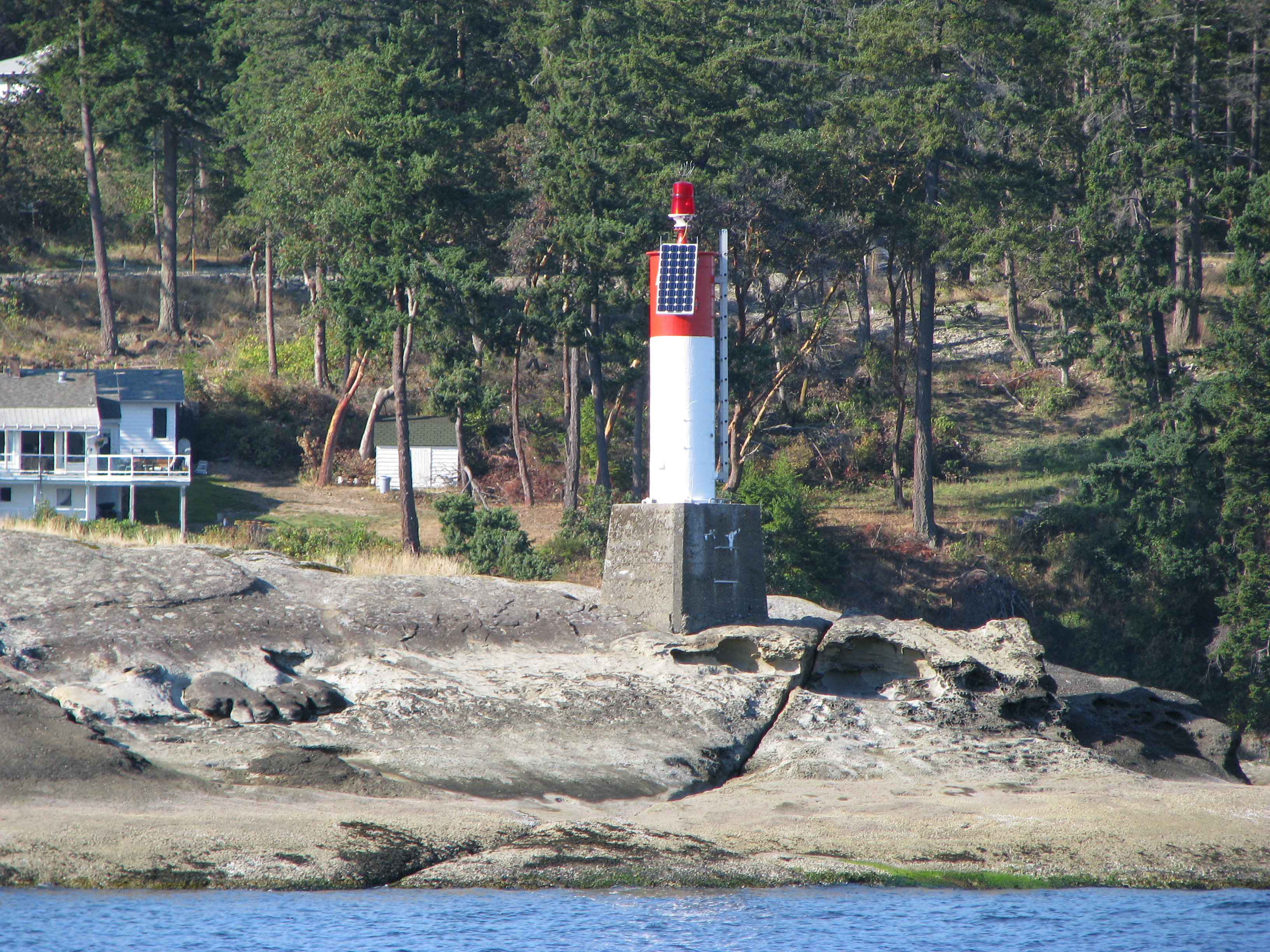
 Jesse Island (with navigational marker).
The bay is framed to the west by Vancouver Island and to the south-east by Newcastle Island, a provincial marine park with a long history of mining, quarrying, herring salteries and tourism. Jesse Island (9 acres or 3.6 hectares) and the smaller Brandon Island are located near the northern shore of the bay. Both islands, though quite small, have varied histories; Brandon Island being notable for a history of Japanese fish canneries and salteries. In 1853 both islands were named after sailors on HMS Virago. Snake Island is a located just outside the mouth of the bay.
The "Departure Bay" neighborhood surrounds most of the bay; though sometimes the northeastern shoreline may be referred to as "Hammond Bay." The BC Ferry terminal (itself referred to simply as "Departure Bay") is on the southern shore of the bay. The image above-right shows a ferry which has just entered the bay turning towards the terminal.
History of the area
The earliest settlers in the region were a first nations group known as the Snuneymuxw. It was reported in 1970 that evidence showed that the area had been inhabited for at least the whole of the last 2000 years relatively consistently.[1]
The area was first explored by the Spanish between the 1770s and 1790s. The whole area, including Northumberland Channel, Nanaimo Harbour, and Departure Bay were named "Bocas de Winthuysen" by a Spanish naval officer, Francisco de Eliza, in 1791. The area was nonetheless referred to by the local native population as "Stil'ilup". The bay and surrounding area received an approximation of its present English moniker in approximately 1852: "Departure Harbour;" responsible for the naming were representatives of the Hudson's Bay Company. Later, in approximately 1855, maps were published showing the modern "Departure Bay."[1][2]
In approximately 1861, the first known settlers of European origin made Departure Bay their home; they were William Joseph Hughes, Samuel Harris, and John and Barbara Christie. To obtain land they used what was known as "pre-emption," a historical method the The Crown used to quickly sell previously un-surveyed land. In the late 1860s, coal was discovered in the Wellington area, and Departure Bay became the terminus of the rail system shipping coal from the mines. Soon, supporting offices and wharves appeared in the area. Later, in the 1870s, coal was discovered closer to the bay itself, and the Vancouver Coal Company set up further operations in the area. As an example of the significance of this area and its commercial operations, the first phone in British Columbia was set up connecting a coal wharf in Departure Bay with the mining operations in nearby Wellington. During the development of Departure Bay, many mining companies were active in the area, including The Departure Bay Mining Company, The Harewood Coal Company, and the aforementioned Vancouver Coal Company. The Hudson's Bay Company also operated mines in the area. Early in the modern history of Departure Bay, in the decades after the first settlements in the 1860s, the area was relatively populous, due in-part to the surrounding mining operations. When the mining operations later ceased (moving further away to Extension), what was once a "booming little port" became "virtually uninhabited."[1] Until as late as the 1940s, the area remained a relatively insignificant neighbor of Nanaimo.[1]
In 1892—after realizing that irrespective of the new plant in the Northfield area, demand was still increasing—the Hamilton Powder Company built an explosives (mainly black powder, dynamite, and stumping powder) manufacturing plant on the shore of Departure Bay. The production of black powder was relatively dangerous, and the death of employees was frequently the result of accidents.
Less than a month later, on the morning of January 14, 1903, the deadliest explosion ever, in terms of loss of life, occurred when two massive explosions rocked the Departure Bay works. The ignition took place in the drying and weighing room where the gun cotton was stored. That concussion then set off the gelignite building 400 feet away, where a large quantity of high explosives was stored. Both buildings were wrecked and twelve men were killed. Their bodies were unidentifiable. ... [This] explosion at the Departure Bay powder works launched a piece of railway track 80 meters through the air with such force that it wrapped itself around a tree ... like a corkscrew.—Carole Davidson[3]Between 1974 and 1975, the community of Departure Bay was amalgamated with the City of Nanaimo, based on a popular vote of only 52 percent in favour. In actuality, 61 percent of Departure Bay residents voted against the change; nonetheless, the greater vote from the populous of Nanaimo (which was to see its personal taxes lowered as a result—while Departure Bay's would be likewise increased) overcame the resistance.
The earliest ferries to use the port were local ships, traveling short routes between locations in the area, including Nanaimo, Departure Bay, and Newcastle Island. The first major ferry operation in the area was that of the Canadian Pacific Navigation Company, which maintained a route between Vancouver Island and the Lower Mainland between 1893 and 1901. In 1901, the Canadian Pacific Navigation Company was purchased by the Canadian Pacific Railway. The route stayed in operation as the sole service until the 1950s, when the Black Ball Ferries of Captain Alexander M. Peabody's Puget Sound Navigation Company began to service the area between Departure Bay and Horseshoe Bay with the ships Kahloke and Chinook. In the late 1950s, during a time of labour unrest in the industry, Premier Bennett started a governmental ferry service, then known as the British Columbia Toll Authority Ferry System.[4] Departure Bay remained being served by the Black Ball Line until it was bought by the government ferry corporation in June 1961.
Present times and ferries
 The BC Ferry "Coastal Celebration" arrives at Departure Bay on June 18, 2008, after completing a 40-day delivery voyage from Flensburg, Germany.
Since the earliest European settlements, the area has been a relatively busy port, for itself and the surrounding communities. The Trans-Canada Highway on Vancouver Island terminates in the north at Departure Bay, where a B.C. Ferry terminal is located. Ferries out of Departure Bay connect the Trans-Canada Highway to the Lower Mainland at Horseshoe Bay. As a major connector to Vancouver, Departure Bay is the most heavily-used Island terminal north of Swartz Bay. Whenever necessary, Departure Bay can act as a backup dock for the ferry to Gabriola Island. Between 1990 and 1997, Departure Bay was also the Island terminus for the "Mid-Island Express" route to Tsawwassen, before being replaced by the newer Duke Point terminal.
Historically, before the BC Ferry Corporation took over services, Departure Bay was served by the Black Ball Ferries Kahloke and Chinook. See the section on the history of the ferries in the area above.
References
- ^ a b c d Davidson, Carole. Historic Departure Bay... Looking Back. 2006. Victoria, BC: Rendezvous Historical Press.
- ^ Pethick, Derek (1980). The Nootka Connection: Europe and the Northwest Coast 1790-1795. Vancouver: Douglas & McIntyre. pp. 54–55. ISBN 0-88894-279-6.
- ^ Davidson, Carole. Historic Departure Bay... Looking Back. 2006. Victoria, BC: Rendezvous Historical Press.
Note: A photograph of this event (the railway tie) from the King Photo—Deno Family Collection is contained within the text; it must be seen to be believed. It is wrapped once wholly around the tree and almost again, for a nearly 720° bend to the railway tie. - ^ BCFerries.com. "Our History (page 2)". BC Ferry Services Inc.. http://www.bcferries.com/about/history/history2.html. Retrieved 03 Oct '09.
Categories:- Neighbourhoods in Nanaimo
- BC Ferries


Wikimedia Foundation. 2010.